Property Record
10009 Westphalia Rd, Upper Marlboro, MD 20774

NEARBY LISTINGS FOR SALE OR LEASE
Property Detail
10009 Westphalia Rd
Washington-Arlington-Alexandria, DC-VA-MD-WV
Prince George's
15-1738137
Maryland
Sfr
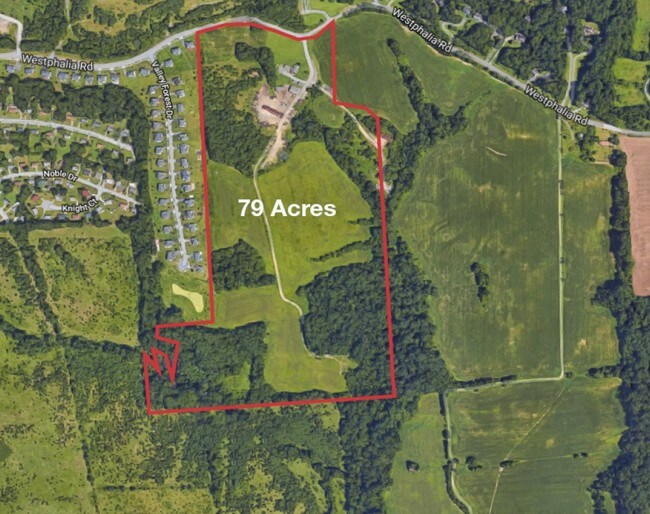
130.04 AC
X
Pennsylvania Ave Corridor
24033C0255E
Washington, DC
4,074 SF
DEMOGRAPHICS near 10009 Westphalia Rd
1 Mile
3 Mile
5 Mile
2024 Total Population
1,965
44,446
177,253
2029 Population
2,017
43,936
173,316
Pop Growth 2024-2029
+ 2.65%
(1.15%)
(2.22%)
Average Age
41
42
41
2024 Total Households
723
16,669
69,029
HH Growth 2024-2029
+ 2.63%
(1.12%)
(2.30%)
Median Household Inc
$116,699
$103,360
$94,389
Avg Household Size
2.70
2.60
2.50
2024 Avg HH Vehicles
2.00
2.00
2.00
Median Home Value
$473,302
$401,591
$362,782
Median Year Built
2007
1985
1985
Nearby Places
Map Layers
Map Styles
 Street
 Aerial
- Restaurants
- Banks
- Shops
- Fitness
- Groceries
PUBLIC TRANSPORTATION
COMMUTER RAIL
DRIVE
WALK
Distance
19 min
9.8 mi
AIRPORT
Ronald Reagan Washington Ntl
DRIVE
WALK
Distance
Ronald Reagan Washington Ntl
33 min
16.1 mi
Baltimore/Washington International Thurgood Marshall
DRIVE
WALK
Distance
Baltimore/Washington International Thurgood Marshall
51 min
32.1 mi
Washington Dulles International
DRIVE
WALK
Distance
Washington Dulles International
70 min
40.4 mi
Freight Ports
Port of Baltimore
DRIVE
WALK
Distance
Port of Baltimore
60 min
38.4 mi
SALE & LEASE HISTORY
LISTING DATE
SALE/LEASE

Apr 10, 2019
For Sale
Nearby Properties
Address
Land Use
TOTAL SIZE
Lot Size
Zoning
Address
Land Use
TOTAL SIZE
Lot Size
Zoning
203.33 AC
IE
Address
Land Use
TOTAL SIZE
Lot Size
Zoning
386,775 SF
45.40 AC
RMF20
Address
Land Use
TOTAL SIZE
Lot Size
Zoning
54.63 AC
RE
Address
Land Use
TOTAL SIZE
Lot Size
Zoning
386,326 SF
62.74 AC
IE
Address
Land Use
TOTAL SIZE
Lot Size
Zoning
9.67 AC
RMF48
Address
Land Use
TOTAL SIZE
Lot Size
Zoning
223,600 SF
13.34 AC
IE
Address
Land Use
TOTAL SIZE
Lot Size
Zoning
219,287 SF
24.46 AC
CGO
Address
Land Use
TOTAL SIZE
Lot Size
Zoning
117.45 AC
IE
Address
Land Use
TOTAL SIZE
Lot Size
Zoning
238,785 SF
12.79 AC
CGO
Address
Land Use
TOTAL SIZE
Lot Size
Zoning
4,059 SF
16.82 AC
IE
Address
Land Use
TOTAL SIZE
Lot Size
Zoning
133,840 SF
33.35 AC
IE
Address
Land Use
TOTAL SIZE
Lot Size
Zoning
159,120 SF
10.25 AC
IE
Address
Land Use
TOTAL SIZE
Lot Size
Zoning
121,240 SF
13.36 AC
CGO
Address
Land Use
TOTAL SIZE
Lot Size
Zoning
117.87 AC
IE
Address
Land Use
TOTAL SIZE
Lot Size
Zoning
156,474 SF
10.86 AC
CGO
Address
Land Use
TOTAL SIZE
Lot Size
Zoning
9.48 AC
RMF20
Address
Land Use
TOTAL SIZE
Lot Size
Zoning
358,700 SF
12.24 AC
TACE
Address
Land Use
TOTAL SIZE
Lot Size
Zoning
45.28 AC
RMH
Address
Land Use
TOTAL SIZE
Lot Size
Zoning
216,875 SF
8.75 AC
IE
Address
Land Use
TOTAL SIZE
Lot Size
Zoning
113,354 SF
31.39 AC
CGO
Address
Land Use
TOTAL SIZE
Lot Size
Zoning
207,504 SF
8.84 AC
I1
Address
Land Use
TOTAL SIZE
Lot Size
Zoning
138,406 SF
7.71 AC
IE
Address
Land Use
TOTAL SIZE
Lot Size
Zoning
116,550 SF
15.60 AC
IE
Address
Land Use
TOTAL SIZE
Lot Size
Zoning
102 AC
IE
Address
Land Use
TOTAL SIZE
Lot Size
Zoning
166,425 SF
10.51 AC
IE
Address
Land Use
TOTAL SIZE
Lot Size
Zoning
7.56 AC
RMF20
Address
Land Use
TOTAL SIZE
Lot Size
Zoning
126,296 SF
34.87 AC
IE
Address
Land Use
TOTAL SIZE
Lot Size
Zoning
115,500 SF
3.10 AC
IE
Address
Land Use
TOTAL SIZE
Lot Size
Zoning
176,978 SF
11 AC
IE
Address
Land Use
TOTAL SIZE
Lot Size
Zoning
135,000 SF
3.89 AC
IE
The World's #1 Commercial Real Estate Marketplace
Connect with us
© 2025 CoStar Group
The information above has been obtained from sources believed reliable. While we do not doubt its accuracy we have not verified it and make no guarantee, warranty or representation about it. It is your responsibility to independently confirm its accuracy and completeness. Any projections, opinions, assumptions, or estimates used are for example only and do not represent the current or future performance of the property. The value of this transaction to you depends on tax and other factors which should be evaluated by your tax, financial, and legal advisors. You and your advisors should conduct a careful, independent investigation of the property to determine to your satisfaction the suitability of the property for your needs.