Property Record
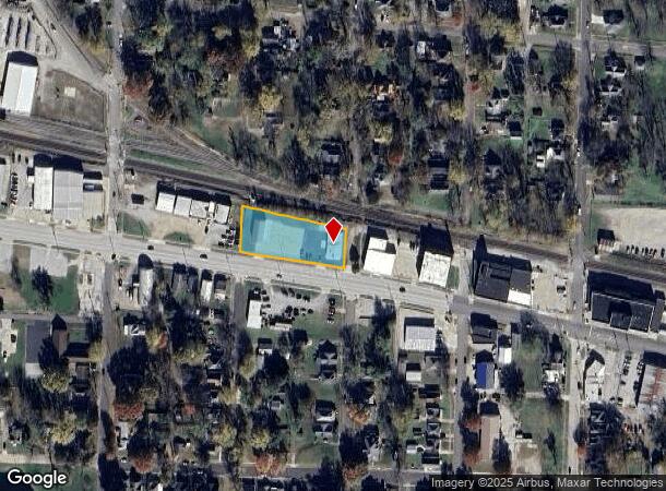
1000A W Main St, Sedalia, MO 65301


NEARBY LISTINGS FOR SALE OR LEASE
Property Detail
1000A W Main St
Other Market Areas
Belle Place Addn
Sedalia, MO
88' X 115' NW COR MAIN & QUINCY ALPHABETICAL & LOTS 1, 2, 3, 4, 5, 6 & 7 BLK 1 BELLE PLACE ADDN & VAC ST 4 45 21
152004203002000
Pettis
Taxexempt
Missouri
2025
1-7
2024
0.80 AC
480600
Missouri North Area
3,000 SF
DEMOGRAPHICS near 1000A W Main St
1 Mile
3 Mile
5 Mile
2024 Total Population
8,078
26,590
31,789
2029 Population
8,339
27,291
32,535
Pop Growth 2024-2029
+ 3.23%
+ 2.64%
+ 2.35%
Average Age
37
39
39
2024 Total Households
3,180
10,757
12,601
HH Growth 2024-2029
+ 3.21%
+ 2.67%
+ 2.40%
Median Household Inc
$50,961
$48,716
$52,113
Avg Household Size
2.40
2.30
2.40
2024 Avg HH Vehicles
2.00
2.00
2.00
Median Home Value
$96,275
$127,406
$143,163
Median Year Built
1951
1966
1970
Nearby Places
Map Layers
Map Styles
 Street
 Aerial
- Restaurants
- Banks
- Shops
- Fitness
- Groceries
Nearby Properties
Address
Land Use
TOTAL SIZE
Lot Size
Zoning
Address
Land Use
TOTAL SIZE
Lot Size
Zoning
202,974 SF
15.87 AC
Address
Land Use
TOTAL SIZE
Lot Size
Zoning
52,605 SF
26.56 AC
Address
Land Use
TOTAL SIZE
Lot Size
Zoning
201,452 SF
15 AC
Address
Land Use
TOTAL SIZE
Lot Size
Zoning
494,190 SF
45.23 AC
Address
Land Use
TOTAL SIZE
Lot Size
Zoning
121,591 SF
15.30 AC
Address
Land Use
TOTAL SIZE
Lot Size
Zoning
69,763 SF
9.96 AC
Address
Land Use
TOTAL SIZE
Lot Size
Zoning
440,184 SF
26 AC
Address
Land Use
TOTAL SIZE
Lot Size
Zoning
49,341 SF
3.37 AC
Address
Land Use
TOTAL SIZE
Lot Size
Zoning
303,444 SF
40.75 AC
Address
Land Use
TOTAL SIZE
Lot Size
Zoning
223,284 SF
38.25 AC
Address
Land Use
TOTAL SIZE
Lot Size
Zoning
13,158 SF
9.20 AC
Address
Land Use
TOTAL SIZE
Lot Size
Zoning
60,173 SF
3.85 AC
Address
Land Use
TOTAL SIZE
Lot Size
Zoning
66,910 SF
44.75 AC
Address
Land Use
TOTAL SIZE
Lot Size
Zoning
11,149 SF
3.81 AC
Address
Land Use
TOTAL SIZE
Lot Size
Zoning
55,464 SF
5.60 AC
Address
Land Use
TOTAL SIZE
Lot Size
Zoning
41,130 SF
2 AC
Address
Land Use
TOTAL SIZE
Lot Size
Zoning
8,699 SF
0.70 AC
Address
Land Use
TOTAL SIZE
Lot Size
Zoning
108,294 SF
12.31 AC
Address
Land Use
TOTAL SIZE
Lot Size
Zoning
8,700 SF
6.62 AC
Address
Land Use
TOTAL SIZE
Lot Size
Zoning
91,564 SF
4.58 AC
Address
Land Use
TOTAL SIZE
Lot Size
Zoning
22,950 SF
3.34 AC
Address
Land Use
TOTAL SIZE
Lot Size
Zoning
52,400 SF
4.74 AC
Address
Land Use
TOTAL SIZE
Lot Size
Zoning
2,800 SF
171.52 AC
Address
Land Use
TOTAL SIZE
Lot Size
Zoning
14,190 SF
1.58 AC
Address
Land Use
TOTAL SIZE
Lot Size
Zoning
41,054 SF
10.74 AC
Address
Land Use
TOTAL SIZE
Lot Size
Zoning
32,640 SF
2.17 AC
Address
Land Use
TOTAL SIZE
Lot Size
Zoning
63,240 SF
6.12 AC
Address
Land Use
TOTAL SIZE
Lot Size
Zoning
24,905 SF
4.13 AC
Address
Land Use
TOTAL SIZE
Lot Size
Zoning
30,000 SF
5.54 AC
Address
Land Use
TOTAL SIZE
Lot Size
Zoning
66,046 SF
2.25 AC
The World's #1 Commercial Real Estate Marketplace
Connect with us
© 2026 CoStar Group
The information above has been obtained from sources believed reliable. While we do not doubt its accuracy we have not verified it and make no guarantee, warranty or representation about it. It is your responsibility to independently confirm its accuracy and completeness. Any projections, opinions, assumptions, or estimates used are for example only and do not represent the current or future performance of the property. The value of this transaction to you depends on tax and other factors which should be evaluated by your tax, financial, and legal advisors. You and your advisors should conduct a careful, independent investigation of the property to determine to your satisfaction the suitability of the property for your needs.