Property Record
1001 Canal Dr, Chesapeake, VA 23323
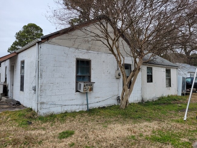
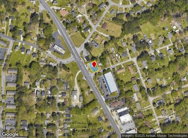
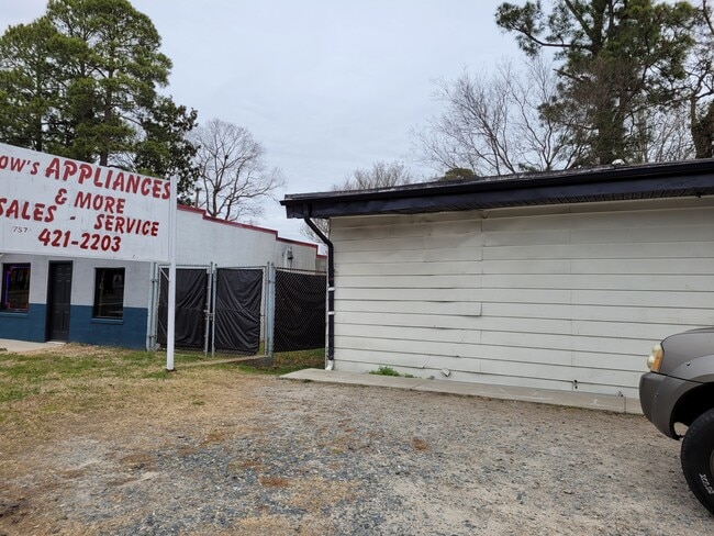
This Property Is For Sale
NEARBY LISTINGS FOR SALE OR LEASE
Property Detail
1001 Canal Dr
0254006000181
South Mil Geo Wash Corridor
Storebuilding
W PT 18 BROADMOOR ANNEX
X
Chesapeake
5100340023D
Virginia
2024
0.23 AC
2025
Victory
021403
Hampton Roads
972 SF
Virginia Beach-Norfolk-Newport News, VA-NC
DEMOGRAPHICS near 1001 Canal Dr
1 Mile
3 Mile
5 Mile
2024 Total Population
9,703
62,554
181,471
2029 Population
10,014
63,981
184,851
Pop Growth 2024-2029
+ 3.21%
+ 2.28%
+ 1.86%
Average Age
37
37
38
2024 Total Households
3,580
22,353
69,988
HH Growth 2024-2029
+ 3.38%
+ 2.29%
+ 1.79%
Median Household Inc
$63,074
$62,384
$61,028
Avg Household Size
2.60
2.70
2.50
2024 Avg HH Vehicles
2.00
2.00
2.00
Median Home Value
$225,565
$222,323
$233,227
Median Year Built
1974
1973
1976
Nearby Places
- Restaurants
- Banks
- Shops
- Fitness
- Groceries
PUBLIC TRANSPORTATION
COMMUTER RAIL
Norfolk (Northeast Regional - Amtrak)
DRIVE
WALK
Distance
Norfolk (Northeast Regional - Amtrak)
12 min
6.7 mi
AIRPORT
Norfolk International
DRIVE
WALK
Distance
Norfolk International
24 min
13.1 mi
Newport News/Williamsburg International
DRIVE
WALK
Distance
Newport News/Williamsburg International
49 min
36.3 mi
Freight Ports
Virginia Port Authority - Portsmouth
DRIVE
WALK
Distance
Virginia Port Authority - Portsmouth
15 min
7.4 mi
Nearby Properties
Address
Land Use
TOTAL SIZE
Lot Size
Zoning
Address
Land Use
TOTAL SIZE
Lot Size
Zoning
250,000 SF
38 AC
MUH
Address
Land Use
TOTAL SIZE
Lot Size
Zoning
482.38 AC
MULTI: MUL
Address
Land Use
TOTAL SIZE
Lot Size
Zoning
92,723 SF
28.83 AC
R6: RESIDE
Address
Land Use
TOTAL SIZE
Lot Size
Zoning
120,471 SF
10.32 AC
M1: LIGHT
Address
Land Use
TOTAL SIZE
Lot Size
Zoning
295,000 SF
27.89 AC
M1: LIGHT
Address
Land Use
TOTAL SIZE
Lot Size
Zoning
178,068 SF
14.72 AC
M1: LIGHT
Address
Land Use
TOTAL SIZE
Lot Size
Zoning
195,637 SF
96.05 AC
RE1: RESID
Address
Land Use
TOTAL SIZE
Lot Size
Zoning
264,975 SF
50.36 AC
R10S: RESI
Address
Land Use
TOTAL SIZE
Lot Size
Zoning
28,253 SF
32.34 AC
M3: WATERF
Address
Land Use
TOTAL SIZE
Lot Size
Zoning
143,220 SF
44.78 AC
M1: LIGHT
Address
Land Use
TOTAL SIZE
Lot Size
Zoning
130,510 SF
33.74 AC
M1: LIGHT
Address
Land Use
TOTAL SIZE
Lot Size
Zoning
2,434 SF
39.25 AC
B2: GENERA
Address
Land Use
TOTAL SIZE
Lot Size
Zoning
1,000 SF
13.68 AC
M2: GENERA
Address
Land Use
TOTAL SIZE
Lot Size
Zoning
85,266 SF
10.10 AC
M1: LIGHT
Address
Land Use
TOTAL SIZE
Lot Size
Zoning
1,352 SF
86 AC
MULTI: MUL
Address
Land Use
TOTAL SIZE
Lot Size
Zoning
387,092 SF
55.92 AC
URM
Address
Land Use
TOTAL SIZE
Lot Size
Zoning
36,525 SF
56.65 AC
M2: GENERA
Address
Land Use
TOTAL SIZE
Lot Size
Zoning
126,250 SF
31.69 AC
R10S: RESI
Address
Land Use
TOTAL SIZE
Lot Size
Zoning
193,534 SF
17.99 AC
M1: LIGHT
Address
Land Use
TOTAL SIZE
Lot Size
Zoning
167,400 SF
10.74 AC
M1: LIGHT
Address
Land Use
TOTAL SIZE
Lot Size
Zoning
197,533 SF
15 AC
M1: LIGHT
Address
Land Use
TOTAL SIZE
Lot Size
Zoning
98,715 SF
20.64 AC
UR
Address
Land Use
TOTAL SIZE
Lot Size
Zoning
155,750 SF
12.01 AC
URM
Address
Land Use
TOTAL SIZE
Lot Size
Zoning
152,906 SF
16.93 AC
M2: GENERA
Address
Land Use
TOTAL SIZE
Lot Size
Zoning
50,486 SF
11.50 AC
M1: LIGHT
Address
Land Use
TOTAL SIZE
Lot Size
Zoning
48,511 SF
20.71 AC
M1: LIGHT
Address
Land Use
TOTAL SIZE
Lot Size
Zoning
187,158 SF
14.50 AC
URM
Address
Land Use
TOTAL SIZE
Lot Size
Zoning
97,632 SF
11.20 AC
RMF1: MULT
Address
Land Use
TOTAL SIZE
Lot Size
Zoning
135,234 SF
14.15 AC
GMU
Address
Land Use
TOTAL SIZE
Lot Size
Zoning
62,936 SF
15 AC
UR
The World's #1 Commercial Real Estate Marketplace
Connect with us
© 2025 CoStar Group
The information above has been obtained from sources believed reliable. While we do not doubt its accuracy we have not verified it and make no guarantee, warranty or representation about it. It is your responsibility to independently confirm its accuracy and completeness. Any projections, opinions, assumptions, or estimates used are for example only and do not represent the current or future performance of the property. The value of this transaction to you depends on tax and other factors which should be evaluated by your tax, financial, and legal advisors. You and your advisors should conduct a careful, independent investigation of the property to determine to your satisfaction the suitability of the property for your needs.