Property Record
1001 E Howell St, Philadelphia, PA 19149


Property Detail
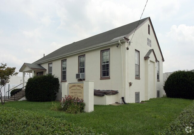
1001 E Howell St
778192000
NEC LANGDON ST
Religious
PHILADELPHIA
CMX2
Pennsylvania
B and X Area of moderate flood hazard, usually the area between the limits of the 100-year and 500-year floods.
64
0
0.13 AC
2026
Northeast Philadelphia
031300
Philadelphia
1,900 SF
Philadelphia-Camden-Wilmington, PA-NJ-DE-MD
NEARBY LISTINGS FOR SALE OR LEASE
DEMOGRAPHICS near 1001 E Howell St
1 mile
3 mile
5 mile
2025 Total Population
52,898
352,595
760,308
2030 Population
51,083
342,398
750,519
Pop Growth 2025-2030
(3.43%)
(2.89%)
(1.29%)
Average Age
36
38
39
2025 Total Households
17,667
123,999
286,989
HH Growth 2025-2030
(3.60%)
(3.03%)
(1.30%)
Median Household Inc
$57,851
$54,911
$55,348
Avg Household Size
2.90
2.70
2.50
2025 Avg HH Vehicles
1.00
1.00
1.00
Median Home Value
$179,982
$198,364
$218,187
Median Year Built
1951
1950
1950
Nearby Places
Map Layers
Map Styles
 Street
 Aerial
Layers
 Traffic
 Biking
Places
Listings with unknown addresses are not visible on the map
- Restaurants
- Banks
- Shops
- Fitness
- Groceries
PUBLIC TRANSPORTATION
COMMUTER RAIL
Cheltenham (R8 - Southeastern Pennsylvania Transportation Authority Regional Rail (SEPTA Regional Rail))
Drive
Walk
Distance
Cheltenham (R8 - Southeastern Pennsylvania Transportation Authority Regional Rail (SEPTA Regional Rail))
4 min
1.5 mi
Lawndale (R8 - Southeastern Pennsylvania Transportation Authority Regional Rail (SEPTA Regional Rail))
Drive
Walk
Distance
Lawndale (R8 - Southeastern Pennsylvania Transportation Authority Regional Rail (SEPTA Regional Rail))
4 min
1.6 mi
AIRPORT
Philadelphia International
Drive
Walk
Distance
Philadelphia International
32 min
19.1 mi
Trenton Mercer
Drive
Walk
Distance
Trenton Mercer
43 min
25.2 mi
Freight Ports
Port of Philadelphia
Drive
Walk
Distance
Port of Philadelphia
9 min
4.8 mi
Nearby Properties
Address
Land Use
TOTAL SIZE
Lot Size
Zoning
Address
Land Use
TOTAL SIZE
Lot Size
Zoning
348,210 SF
51.22 AC
I3
Address
Land Use
TOTAL SIZE
Lot Size
Zoning
212,787 SF
10.14 AC
CA1
Address
Land Use
TOTAL SIZE
Lot Size
Zoning
290,454 SF
58.56 AC
RSA1
Address
Land Use
TOTAL SIZE
Lot Size
Zoning
180,000 SF
23.05 AC
RSA1
Address
Land Use
TOTAL SIZE
Lot Size
Zoning
37.21 AC
SPPOA
Address
Land Use
TOTAL SIZE
Lot Size
Zoning
107,391 SF
13.68 AC
SPINS
Address
Land Use
TOTAL SIZE
Lot Size
Zoning
470,871 SF
41.87 AC
I3
Address
Land Use
TOTAL SIZE
Lot Size
Zoning
410,400 SF
34.14 AC
RSA1
Address
Land Use
TOTAL SIZE
Lot Size
Zoning
425,128 SF
23 AC
RSA5
Address
Land Use
TOTAL SIZE
Lot Size
Zoning
504,972 SF
16.30 AC
RM2
Address
Land Use
TOTAL SIZE
Lot Size
Zoning
126,344 SF
20.87 AC
CA2
Address
Land Use
TOTAL SIZE
Lot Size
Zoning
314,694 SF
96.36 AC
RSA3
Address
Land Use
TOTAL SIZE
Lot Size
Zoning
238,378 SF
18 AC
CA1
Address
Land Use
TOTAL SIZE
Lot Size
Zoning
2,500,000 SF
134.14 AC
I2
Address
Land Use
TOTAL SIZE
Lot Size
Zoning
561,600 SF
11.28 AC
CMX3
Address
Land Use
TOTAL SIZE
Lot Size
Zoning
75,358 SF
24.98 AC
I2
Address
Land Use
TOTAL SIZE
Lot Size
Zoning
1,316,590 SF
48.72 AC
I2
Address
Land Use
TOTAL SIZE
Lot Size
Zoning
1,316,610 SF
46.73 AC
I2
Address
Land Use
TOTAL SIZE
Lot Size
Zoning
208,620 SF
19.71 AC
I2
Address
Land Use
TOTAL SIZE
Lot Size
Zoning
227,844 SF
19.82 AC
I2
Address
Land Use
TOTAL SIZE
Lot Size
Zoning
526,165 SF
12.68 AC
RSA3
Address
Land Use
TOTAL SIZE
Lot Size
Zoning
28,239 SF
1.48 AC
SPINS
Address
Land Use
TOTAL SIZE
Lot Size
Zoning
16,832 SF
65.87 AC
SPPOA
Address
Land Use
TOTAL SIZE
Lot Size
Zoning
223,050 SF
12.31 AC
RSA5
Address
Land Use
TOTAL SIZE
Lot Size
Zoning
233,143 SF
24.24 AC
SPINS
Address
Land Use
TOTAL SIZE
Lot Size
Zoning
5.37 AC
I2
Address
Land Use
TOTAL SIZE
Lot Size
Zoning
329,300 SF
6.98 AC
RSA5
Address
Land Use
TOTAL SIZE
Lot Size
Zoning
281,012 SF
32.58 AC
RSA5
Address
Land Use
TOTAL SIZE
Lot Size
Zoning
182,289 SF
8.16 AC
CA1
Address
Land Use
TOTAL SIZE
Lot Size
Zoning
217,800 SF
0.31 AC
ICMX
The World's #1 Commercial Real Estate Marketplace
Connect with us
© 2026 CoStar Group
The information above has been obtained from sources believed reliable. While we do not doubt its accuracy we have not verified it and make no guarantee, warranty or representation about it. It is your responsibility to independently confirm its accuracy and completeness. Any projections, opinions, assumptions, or estimates used are for example only and do not represent the current or future performance of the property. The value of this transaction to you depends on tax and other factors which should be evaluated by your tax, financial, and legal advisors. You and your advisors should conduct a careful, independent investigation of the property to determine to your satisfaction the suitability of the property for your needs.