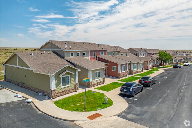
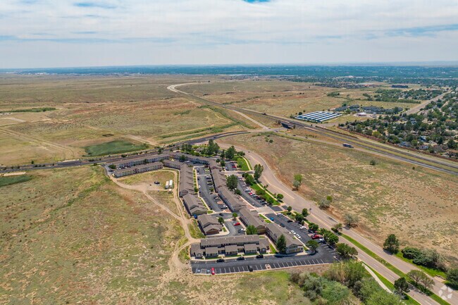
Property Record
1001 Gray Wolf Cir, Pueblo, CO 81001
NEARBY LISTINGS FOR SALE OR LEASE
Property Detail
1001 Gray Wolf Cir
Pueblo, CO
Wolf Village Subdivision Filing No 2
0-4-17-0-03-007
LOT 1 BLK 1 WOLF VILLAGE SUBDIVISION FILING NO 2 A,SPECIAL AREA PLAN FORMERLY #04-170-03-005
Multifamilydwelling
Pueblo
X
Colorado
08101C0512D
1
2024
1.48 AC
2024
Colorado East Area
003004
Other Market Areas
23,028 SF
DEMOGRAPHICS near 1001 Gray Wolf Cir
1 Mile
3 Mile
5 Mile
2024 Total Population
4,589
39,031
78,365
2029 Population
4,675
40,156
80,469
Pop Growth 2024-2029
+ 1.87%
+ 2.88%
+ 2.68%
Average Age
39
39
40
2024 Total Households
1,685
15,959
32,044
HH Growth 2024-2029
+ 1.96%
+ 2.96%
+ 2.85%
Median Household Inc
$62,879
$39,710
$45,231
Avg Household Size
2.50
2.30
2.30
2024 Avg HH Vehicles
2.00
2.00
2.00
Median Home Value
$289,440
$212,493
$216,102
Median Year Built
1971
1967
1965
Nearby Places
Map Layers
Map Styles
 Street
 Aerial
- Restaurants
- Banks
- Shops
- Fitness
- Groceries
Nearby Properties
Address
Land Use
TOTAL SIZE
Lot Size
Zoning
Address
Land Use
TOTAL SIZE
Lot Size
Zoning
486,484 SF
3.75 AC
R5:RES/MUL
Address
Land Use
TOTAL SIZE
Lot Size
Zoning
168,237 SF
3.69 AC
S-1
Address
Land Use
TOTAL SIZE
Lot Size
Zoning
65,508 SF
3.18 AC
Address
Land Use
TOTAL SIZE
Lot Size
Zoning
122,704 SF
2.72 AC
B4:COMM/RE
Address
Land Use
TOTAL SIZE
Lot Size
Zoning
54,250 SF
2.06 AC
B4:COMM/RE
Address
Land Use
TOTAL SIZE
Lot Size
Zoning
71,345 SF
5.17 AC
Address
Land Use
TOTAL SIZE
Lot Size
Zoning
71,936 SF
3.43 AC
R4:RES/MUL
Address
Land Use
TOTAL SIZE
Lot Size
Zoning
61,095 SF
5.58 AC
B3:COMM/H&
Address
Land Use
TOTAL SIZE
Lot Size
Zoning
26,255 SF
2.08 AC
Address
Land Use
TOTAL SIZE
Lot Size
Zoning
44,544 SF
4 AC
R5:RES/MUL
Address
Land Use
TOTAL SIZE
Lot Size
Zoning
200,121 SF
21.03 AC
B4:COMM/RE
Address
Land Use
TOTAL SIZE
Lot Size
Zoning
25,172 SF
1.42 AC
R5:RES/MUL
Address
Land Use
TOTAL SIZE
Lot Size
Zoning
17,906 SF
0.86 AC
PUD
Address
Land Use
TOTAL SIZE
Lot Size
Zoning
23,025 SF
1.21 AC
R5:RES/MUL
Address
Land Use
TOTAL SIZE
Lot Size
Zoning
13,060 SF
11.06 AC
S-1
Address
Land Use
TOTAL SIZE
Lot Size
Zoning
13,178 SF
1.10 AC
R2:RES/1 F
Address
Land Use
TOTAL SIZE
Lot Size
Zoning
15,741 SF
24.16 AC
R5:RES/MUL
Address
Land Use
TOTAL SIZE
Lot Size
Zoning
35,530 SF
0.54 AC
S1:SPC/PUB
Address
Land Use
TOTAL SIZE
Lot Size
Zoning
25,983 SF
0.97 AC
B4:COMM/RE
Address
Land Use
TOTAL SIZE
Lot Size
Zoning
50,464 SF
9.34 AC
B4:COMM/RE
Address
Land Use
TOTAL SIZE
Lot Size
Zoning
25,180 SF
1.83 AC
B4:COMM/RE
Address
Land Use
TOTAL SIZE
Lot Size
Zoning
141,902 SF
5.08 AC
R5:RES/MUL
Address
Land Use
TOTAL SIZE
Lot Size
Zoning
20,507 SF
2.93 AC
B3:COMM/H&
Address
Land Use
TOTAL SIZE
Lot Size
Zoning
16,700 SF
1.63 AC
R-4
Address
Land Use
TOTAL SIZE
Lot Size
Zoning
202,847 SF
22.04 AC
B4:COMM/RE
Address
Land Use
TOTAL SIZE
Lot Size
Zoning
26,550 SF
3.52 AC
S1:SPC/PUB
Address
Land Use
TOTAL SIZE
Lot Size
Zoning
13,204 SF
1.31 AC
B4:COMM/RE
Address
Land Use
TOTAL SIZE
Lot Size
Zoning
12,950 SF
0.32 AC
B4:COMM/RE
Address
Land Use
TOTAL SIZE
Lot Size
Zoning
181,050 SF
12.97 AC
B3:COMM/H&
Address
Land Use
TOTAL SIZE
Lot Size
Zoning
146,292 SF
17.81 AC
B3:COMM/H&
The World's #1 Commercial Real Estate Marketplace
Connect with us
© 2026 CoStar Group
The information above has been obtained from sources believed reliable. While we do not doubt its accuracy we have not verified it and make no guarantee, warranty or representation about it. It is your responsibility to independently confirm its accuracy and completeness. Any projections, opinions, assumptions, or estimates used are for example only and do not represent the current or future performance of the property. The value of this transaction to you depends on tax and other factors which should be evaluated by your tax, financial, and legal advisors. You and your advisors should conduct a careful, independent investigation of the property to determine to your satisfaction the suitability of the property for your needs.