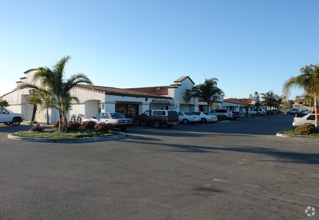
Property Record
1001 Harbor Blvd, Oxnard, CA 93035


Current Lease Availabilities
Property Detail
1001 Harbor Blvd
191-0-075-015
TRACT: 127701 LOT: 115 REF: 029MR 061
Storebuilding
Ventura
CNC
California
C and X Area of minimal flood hazard, usually depicted on FIRMs as above the 500-year flood level.
115
2024
2.39 AC
2025
Oxnard/Port Hueneme
003615
Los Angeles
988 SF
Oxnard-Thousand Oaks-Ventura, CA
NEARBY LISTINGS FOR SALE OR LEASE
DEMOGRAPHICS near 1001 Harbor Blvd
1 mile
3 mile
5 mile
2024 Total Population
6,287
55,273
202,486
2029 Population
6,591
55,434
201,531
Pop Growth 2024-2029
+ 4.84%
+ 0.29%
(0.47%)
Average Age
53
42
38
2024 Total Households
3,057
18,628
57,592
HH Growth 2024-2029
+ 4.71%
+ 0.85%
(0.16%)
Median Household Inc
$126,686
$99,238
$91,470
Avg Household Size
2.10
2.90
3.30
2024 Avg HH Vehicles
2.00
2.00
2.00
Median Home Value
$992,655
$785,714
$726,171
Median Year Built
1983
1977
1974
Nearby Places
Map Layers
Map Styles
 Street
 Aerial
Transit
 Traffic
 Biking
Places
Listings with unknown addresses are not visible on the map
- Restaurants
- Banks
- Shops
- Fitness
- Groceries
PUBLIC TRANSPORTATION
COMMUTER RAIL
Oxnard (Ventura County Line - Southern California Regional Rail Authority (Metrolink))
Drive
Walk
Distance
Oxnard (Ventura County Line - Southern California Regional Rail Authority (Metrolink))
9 min
4.4 mi
Drive
Walk
Distance
10 min
6.0 mi
AIRPORT
Santa Barbara Municipal
Drive
Walk
Distance
Santa Barbara Municipal
70 min
46.9 mi
Nearby Properties
Address
Land Use
TOTAL SIZE
Lot Size
Zoning
Address
Land Use
TOTAL SIZE
Lot Size
Zoning
241,298 SF
8 AC
R3C
Address
Land Use
TOTAL SIZE
Lot Size
Zoning
166,920 SF
7.15 AC
R3PD
Address
Land Use
TOTAL SIZE
Lot Size
Zoning
129,018 SF
5.09 AC
R3PD
Address
Land Use
TOTAL SIZE
Lot Size
Zoning
Address
Land Use
TOTAL SIZE
Lot Size
Zoning
94,375 SF
7.94 AC
Address
Land Use
TOTAL SIZE
Lot Size
Zoning
70,600 SF
3.75 AC
R3PD
Address
Land Use
TOTAL SIZE
Lot Size
Zoning
98,276 SF
14 AC
R3
Address
Land Use
TOTAL SIZE
Lot Size
Zoning
56,230 SF
1.19 AC
Address
Land Use
TOTAL SIZE
Lot Size
Zoning
71,845 SF
3.01 AC
COPD
Address
Land Use
TOTAL SIZE
Lot Size
Zoning
52,060 SF
4.61 AC
C2PD
Address
Land Use
TOTAL SIZE
Lot Size
Zoning
86,627 SF
6.59 AC
CMPD
Address
Land Use
TOTAL SIZE
Lot Size
Zoning
57,224 SF
3.17 AC
R1
Address
Land Use
TOTAL SIZE
Lot Size
Zoning
1,316 SF
3.86 AC
Address
Land Use
TOTAL SIZE
Lot Size
Zoning
75,685 SF
3.09 AC
Address
Land Use
TOTAL SIZE
Lot Size
Zoning
11,072 SF
12.16 AC
C2PD
Address
Land Use
TOTAL SIZE
Lot Size
Zoning
31,631 SF
2.45 AC
Address
Land Use
TOTAL SIZE
Lot Size
Zoning
40,179 SF
5.83 AC
Address
Land Use
TOTAL SIZE
Lot Size
Zoning
122,040 SF
7.52 AC
R2PD
Address
Land Use
TOTAL SIZE
Lot Size
Zoning
37,500 SF
1.37 AC
Address
Land Use
TOTAL SIZE
Lot Size
Zoning
33,609 SF
2.60 AC
Address
Land Use
TOTAL SIZE
Lot Size
Zoning
40,977 SF
4.14 AC
R1PD
Address
Land Use
TOTAL SIZE
Lot Size
Zoning
32,016 SF
2.28 AC
Address
Land Use
TOTAL SIZE
Lot Size
Zoning
36,894 SF
2.89 AC
Address
Land Use
TOTAL SIZE
Lot Size
Zoning
20,925 SF
2.64 AC
Address
Land Use
TOTAL SIZE
Lot Size
Zoning
40,980 SF
3.51 AC
Address
Land Use
TOTAL SIZE
Lot Size
Zoning
5.11 AC
Address
Land Use
TOTAL SIZE
Lot Size
Zoning
2.88 AC
C2PD
Address
Land Use
TOTAL SIZE
Lot Size
Zoning
57.91 AC
AEC-A
Address
Land Use
TOTAL SIZE
Lot Size
Zoning
25,116 SF
0.58 AC
Address
Land Use
TOTAL SIZE
Lot Size
Zoning
8,098 SF
1.08 AC
The World's #1 Commercial Real Estate Marketplace
Connect with us
© 2026 CoStar Group
The information above has been obtained from sources believed reliable. While we do not doubt its accuracy we have not verified it and make no guarantee, warranty or representation about it. It is your responsibility to independently confirm its accuracy and completeness. Any projections, opinions, assumptions, or estimates used are for example only and do not represent the current or future performance of the property. The value of this transaction to you depends on tax and other factors which should be evaluated by your tax, financial, and legal advisors. You and your advisors should conduct a careful, independent investigation of the property to determine to your satisfaction the suitability of the property for your needs.