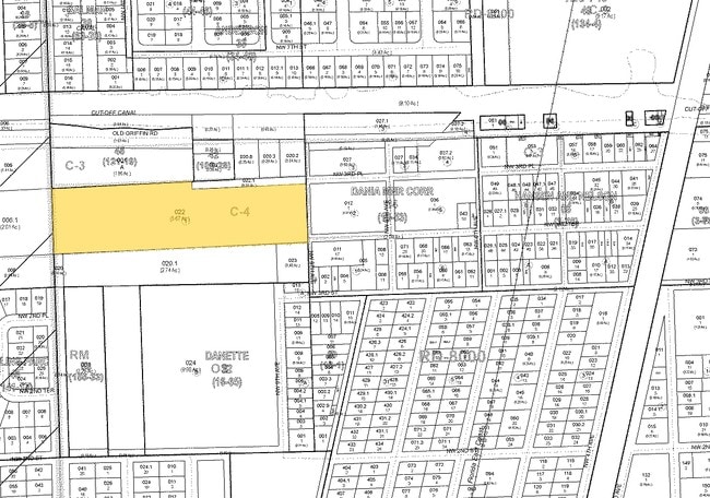
Property Record
1001 Old Griffin Rd, Dania Beach, FL 33004
NEARBY LISTINGS FOR SALE OR LEASE
Property Detail
1001 Old Griffin Rd
Fort Lauderdale-Pompano Beach-Deerfield Beach, FL
34-50-42
50-42-34-00-0206
34-50-42 THAT PT OF W3/4 OF N1/2 OF SW1/4 OF NW1/4 DESC AS FOL,COMM AT NE COR,SLY 246.25,WLY 183.2 TO POB, W 98,NLY 149.9,ELY 98.1 SLY 144.3 TO POB AS IN OR 4740/702
Parkinglot
Broward
AE
Florida
12011C0567J
0.35 AC
2024
Fort Lauderdale
2025
South Florida
080105
DEMOGRAPHICS near 1001 Old Griffin Rd
1 Mile
3 Mile
5 Mile
2024 Total Population
8,224
85,059
301,633
2029 Population
8,502
85,602
303,475
Pop Growth 2024-2029
+ 3.38%
+ 0.64%
+ 0.61%
Average Age
42
42
42
2024 Total Households
3,338
35,865
128,328
HH Growth 2024-2029
+ 3.42%
+ 0.20%
+ 0.56%
Median Household Inc
$41,844
$60,985
$62,509
Avg Household Size
2.40
2.30
2.20
2024 Avg HH Vehicles
1.00
2.00
2.00
Median Home Value
$337,116
$377,565
$375,209
Median Year Built
1972
1974
1973
Nearby Places
Map Layers
Map Styles
 Street
 Aerial
- Restaurants
- Banks
- Shops
- Fitness
- Groceries
PUBLIC TRANSPORTATION
COMMUTER RAIL
Fort Lauderdale/Hollywood International Airport (Mangonia Park - Miami Airport - Tri-Rail, Tri-County Commuter - Tri-Rail, West Palm Beach - MiamiCentral - Tri-Rail)
DRIVE
WALK
Distance
Fort Lauderdale/Hollywood International Airport (Mangonia Park - Miami Airport - Tri-Rail, Tri-County Commuter - Tri-Rail, West Palm Beach - MiamiCentral - Tri-Rail)
5 min
1.9 mi
Sheridan Street (Tri-County Commuter - South Florida Regional Transportation Authority (Tri-Rail))
DRIVE
WALK
Distance
Sheridan Street (Tri-County Commuter - South Florida Regional Transportation Authority (Tri-Rail))
9 min
4.0 mi
AIRPORT
Fort Lauderdale/Hollywood International
DRIVE
WALK
Distance
Fort Lauderdale/Hollywood International
7 min
2.7 mi
Miami International
DRIVE
WALK
Distance
Miami International
44 min
27.9 mi
Freight Ports
Port Everglades
DRIVE
WALK
Distance
Port Everglades
6 min
3.3 mi
Nearby Properties
Address
Land Use
TOTAL SIZE
Lot Size
Zoning
Address
Land Use
TOTAL SIZE
Lot Size
Zoning
4,515,106 SF
887.02 AC
AT
Address
Land Use
TOTAL SIZE
Lot Size
Zoning
3,629,204 SF
159.43 AC
AT
Address
Land Use
TOTAL SIZE
Lot Size
Zoning
964,376 SF
258.71 AC
AT
Address
Land Use
TOTAL SIZE
Lot Size
Zoning
631,381 SF
3.26 AC
B-1
Address
Land Use
TOTAL SIZE
Lot Size
Zoning
654,212 SF
3.59 AC
Address
Land Use
TOTAL SIZE
Lot Size
Zoning
311,472 SF
136.47 AC
PEDD
Address
Land Use
TOTAL SIZE
Lot Size
Zoning
596,640 SF
3.08 AC
B-2
Address
Land Use
TOTAL SIZE
Lot Size
Zoning
91,897 SF
175.58 AC
PEDD
Address
Land Use
TOTAL SIZE
Lot Size
Zoning
272,634 SF
32.39 AC
PMUD
Address
Land Use
TOTAL SIZE
Lot Size
Zoning
376,559 SF
14.53 AC
PD
Address
Land Use
TOTAL SIZE
Lot Size
Zoning
615,846 SF
2.06 AC
CC
Address
Land Use
TOTAL SIZE
Lot Size
Zoning
828,208 SF
44.48 AC
PMUD
Address
Land Use
TOTAL SIZE
Lot Size
Zoning
296,691 SF
1.86 AC
PMUD
Address
Land Use
TOTAL SIZE
Lot Size
Zoning
218,137 SF
7.13 AC
RM-2
Address
Land Use
TOTAL SIZE
Lot Size
Zoning
161,298 SF
31.25 AC
B-3
Address
Land Use
TOTAL SIZE
Lot Size
Zoning
271,598 SF
74.62 AC
PEDD
Address
Land Use
TOTAL SIZE
Lot Size
Zoning
287,160 SF
16.39 AC
RM-18
Address
Land Use
TOTAL SIZE
Lot Size
Zoning
313,850 SF
0.80 AC
Address
Land Use
TOTAL SIZE
Lot Size
Zoning
703,415 SF
36.04 AC
PEDD
Address
Land Use
TOTAL SIZE
Lot Size
Zoning
247,174 SF
9.03 AC
RM-2
Address
Land Use
TOTAL SIZE
Lot Size
Zoning
552,737 SF
11.76 AC
C-4
Address
Land Use
TOTAL SIZE
Lot Size
Zoning
370,172 SF
24.52 AC
GU
Address
Land Use
TOTAL SIZE
Lot Size
Zoning
217,019 SF
10.62 AC
B-2
Address
Land Use
TOTAL SIZE
Lot Size
Zoning
221,179 SF
25.86 AC
EDBB-MU
Address
Land Use
TOTAL SIZE
Lot Size
Zoning
289,524 SF
39.20 AC
GU
Address
Land Use
TOTAL SIZE
Lot Size
Zoning
480 SF
2.43 AC
PMUD-SL
Address
Land Use
TOTAL SIZE
Lot Size
Zoning
87,029 SF
18.33 AC
I
Address
Land Use
TOTAL SIZE
Lot Size
Zoning
151,839 SF
9.66 AC
RM-2
Address
Land Use
TOTAL SIZE
Lot Size
Zoning
257,137 SF
2.80 AC
B-2
Address
Land Use
TOTAL SIZE
Lot Size
Zoning
199,956 SF
5.54 AC
B-2
The World's #1 Commercial Real Estate Marketplace
Connect with us
© 2026 CoStar Group
The information above has been obtained from sources believed reliable. While we do not doubt its accuracy we have not verified it and make no guarantee, warranty or representation about it. It is your responsibility to independently confirm its accuracy and completeness. Any projections, opinions, assumptions, or estimates used are for example only and do not represent the current or future performance of the property. The value of this transaction to you depends on tax and other factors which should be evaluated by your tax, financial, and legal advisors. You and your advisors should conduct a careful, independent investigation of the property to determine to your satisfaction the suitability of the property for your needs.