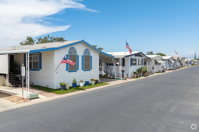
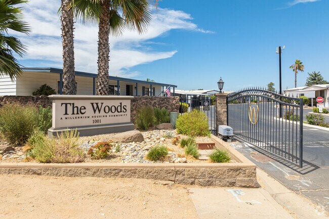
Property Record
1001 Sylmar Ave, Clovis, CA 93612

NEARBY LISTINGS FOR SALE OR LEASE
Property Detail
1001 Sylmar Ave
Fresno, CA
Shepherd & Teague Alluvial #3
420-030-10
33.78 AC IN SHEPHERD TEAGUE #3 & IN SEC 7 T13R21
Mobilemanufacturedhomeregardlessoflandownership
Fresno
X
California
06019C1580H
26
2025
33.78 AC
2025
East Fresno
005607
Fresno
6,288 SF
DEMOGRAPHICS near 1001 Sylmar Ave
1 mile
3 mile
5 mile
2024 Total Population
20,636
136,996
349,258
2029 Population
21,083
139,908
357,416
Pop Growth 2024-2029
+ 2.17%
+ 2.13%
+ 2.34%
Average Age
37
37
37
2024 Total Households
8,274
50,321
121,171
HH Growth 2024-2029
+ 2.32%
+ 2.18%
+ 2.32%
Median Household Inc
$50,406
$65,992
$72,023
Avg Household Size
2.30
2.60
2.80
2024 Avg HH Vehicles
2.00
2.00
2.00
Median Home Value
$276,458
$336,348
$362,567
Median Year Built
1977
1978
1981
Nearby Places
Map Layers
Map Styles
 Street
 Aerial
Transit
 Traffic
 Biking
Places
Listings with unknown addresses are not visible on the map
- Restaurants
- Banks
- Shops
- Fitness
- Groceries
PUBLIC TRANSPORTATION
COMMUTER RAIL
Fresno (San Joaquins - Amtrak)
Drive
Walk
Distance
Fresno (San Joaquins - Amtrak)
12 min
8.3 mi
AIRPORT
Fresno Yosemite International
Drive
Walk
Distance
Fresno Yosemite International
10 min
4.9 mi
Freight Ports
Port of Stockton
Drive
Walk
Distance
Port of Stockton
158 min
129.7 mi
Nearby Properties
Address
Land Use
TOTAL SIZE
Lot Size
Zoning
Address
Land Use
TOTAL SIZE
Lot Size
Zoning
1,081,456 SF
113.56 AC
M1
Address
Land Use
TOTAL SIZE
Lot Size
Zoning
794,471 SF
73.71 AC
Address
Land Use
TOTAL SIZE
Lot Size
Zoning
693,292 SF
29.86 AC
CP
Address
Land Use
TOTAL SIZE
Lot Size
Zoning
180,770 SF
19.03 AC
PCC
Address
Land Use
TOTAL SIZE
Lot Size
Zoning
239,000 SF
20.34 AC
R2
Address
Land Use
TOTAL SIZE
Lot Size
Zoning
239,437 SF
31.16 AC
RA
Address
Land Use
TOTAL SIZE
Lot Size
Zoning
192,062 SF
11.50 AC
RS5
Address
Land Use
TOTAL SIZE
Lot Size
Zoning
184,694 SF
9.99 AC
SPLIT
Address
Land Use
TOTAL SIZE
Lot Size
Zoning
268,956 SF
13.25 AC
R3
Address
Land Use
TOTAL SIZE
Lot Size
Zoning
249,818 SF
12.24 AC
PCC
Address
Land Use
TOTAL SIZE
Lot Size
Zoning
174,577 SF
8.40 AC
RM1
Address
Land Use
TOTAL SIZE
Lot Size
Zoning
182,606 SF
6.51 AC
RA
Address
Land Use
TOTAL SIZE
Lot Size
Zoning
121,491 SF
4.52 AC
R3
Address
Land Use
TOTAL SIZE
Lot Size
Zoning
175,117 SF
10 AC
C1
Address
Land Use
TOTAL SIZE
Lot Size
Zoning
191,177 SF
19.19 AC
C2
Address
Land Use
TOTAL SIZE
Lot Size
Zoning
91,715 SF
4.50 AC
R3
Address
Land Use
TOTAL SIZE
Lot Size
Zoning
152,918 SF
15.85 AC
C2
Address
Land Use
TOTAL SIZE
Lot Size
Zoning
157,702 SF
4.61 AC
R2A
Address
Land Use
TOTAL SIZE
Lot Size
Zoning
132,084 SF
9.68 AC
RM1
Address
Land Use
TOTAL SIZE
Lot Size
Zoning
86,678 SF
4.16 AC
CP
Address
Land Use
TOTAL SIZE
Lot Size
Zoning
32,151 SF
14.84 AC
Address
Land Use
TOTAL SIZE
Lot Size
Zoning
67,465 SF
12.60 AC
C
Address
Land Use
TOTAL SIZE
Lot Size
Zoning
69,399 SF
7.31 AC
CP
Address
Land Use
TOTAL SIZE
Lot Size
Zoning
73,821 SF
6.52 AC
CP
Address
Land Use
TOTAL SIZE
Lot Size
Zoning
156,738 SF
12.05 AC
R3A
Address
Land Use
TOTAL SIZE
Lot Size
Zoning
86,136 SF
5.50 AC
M2
Address
Land Use
TOTAL SIZE
Lot Size
Zoning
83,458 SF
2.66 AC
PCC
Address
Land Use
TOTAL SIZE
Lot Size
Zoning
250,412 SF
16.09 AC
RM3
Address
Land Use
TOTAL SIZE
Lot Size
Zoning
140,608 SF
11.15 AC
PCC
Address
Land Use
TOTAL SIZE
Lot Size
Zoning
151,980 SF
4.94 AC
CM
The World's #1 Commercial Real Estate Marketplace
Connect with us
© 2026 CoStar Group
The information above has been obtained from sources believed reliable. While we do not doubt its accuracy we have not verified it and make no guarantee, warranty or representation about it. It is your responsibility to independently confirm its accuracy and completeness. Any projections, opinions, assumptions, or estimates used are for example only and do not represent the current or future performance of the property. The value of this transaction to you depends on tax and other factors which should be evaluated by your tax, financial, and legal advisors. You and your advisors should conduct a careful, independent investigation of the property to determine to your satisfaction the suitability of the property for your needs.