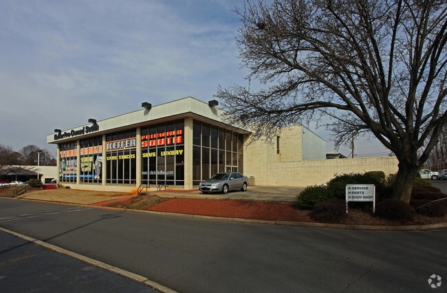
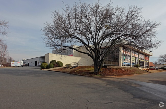
Property Record
1001 Tyvola Rd, Charlotte, NC 28217


NEARBY LISTINGS FOR SALE OR LEASE
Property Detail
1001 Tyvola Rd
Charlotte-Concord-Gastonia, NC-SC
Richard W Keffer, Jr & Constan
169-084-02
M71-251
Multifamilydwelling
Mecklenburg
X
North Carolina
3710453200K
2
2024
6.60 AC
2025
Inner Southeast
003802
Charlotte
302,196 SF
DEMOGRAPHICS near 1001 Tyvola Rd
1 Mile
3 Mile
5 Mile
2024 Total Population
7,261
95,928
227,127
2029 Population
7,629
102,093
241,783
Pop Growth 2024-2029
+ 5.07%
+ 6.43%
+ 6.45%
Average Age
36
36
37
2024 Total Households
3,128
42,844
105,648
HH Growth 2024-2029
+ 5.02%
+ 6.50%
+ 6.61%
Median Household Inc
$60,041
$74,770
$82,847
Avg Household Size
2.20
2.20
2.10
2024 Avg HH Vehicles
2.00
2.00
2.00
Median Home Value
$332,894
$404,465
$470,641
Median Year Built
1967
1988
1993
Nearby Places
Map Layers
Map Styles
 Street
 Aerial
- Restaurants
- Banks
- Shops
- Fitness
- Groceries
PUBLIC TRANSPORTATION
TRANSIT/SUBWAY
Tyvola (LYNX Blue Line - Charlotte Area Transit System (CATS))
DRIVE
WALK
Distance
Tyvola (LYNX Blue Line - Charlotte Area Transit System (CATS))
1 min
6 min
0.3 mi
Woodlawn (LYNX Blue Line - Charlotte Area Transit System (CATS))
DRIVE
WALK
Distance
Woodlawn (LYNX Blue Line - Charlotte Area Transit System (CATS))
3 min
16 min
0.9 mi
Archdale (LYNX Blue Line - Charlotte Area Transit System (CATS))
DRIVE
WALK
Distance
Archdale (LYNX Blue Line - Charlotte Area Transit System (CATS))
3 min
20 min
1.0 mi
COMMUTER RAIL
Charlotte Amtrak Station (Carolinian - Amtrak, Crescent - Amtrak, Piedmont - Amtrak)
DRIVE
WALK
Distance
Charlotte Amtrak Station (Carolinian - Amtrak, Crescent - Amtrak, Piedmont - Amtrak)
14 min
8.6 mi
AIRPORT
Charlotte/Douglas International
DRIVE
WALK
Distance
Charlotte/Douglas International
14 min
6.2 mi
Concord-Padgett Regional
DRIVE
WALK
Distance
Concord-Padgett Regional
32 min
22.3 mi
Freight Ports
North Charleston Terminal
DRIVE
WALK
Distance
North Charleston Terminal
220 min
194.4 mi
Nearby Properties
Address
Land Use
TOTAL SIZE
Lot Size
Zoning
Address
Land Use
TOTAL SIZE
Lot Size
Zoning
875,672 SF
41.66 AC
CC
Address
Land Use
TOTAL SIZE
Lot Size
Zoning
965,867 SF
5.81 AC
O1
Address
Land Use
TOTAL SIZE
Lot Size
Zoning
709,410 SF
22.24 AC
INSTCD
Address
Land Use
TOTAL SIZE
Lot Size
Zoning
743,550 SF
4.69 AC
I2
Address
Land Use
TOTAL SIZE
Lot Size
Zoning
505,747 SF
3.87 AC
Address
Land Use
TOTAL SIZE
Lot Size
Zoning
639,406 SF
2.76 AC
TOD-UC
Address
Land Use
TOTAL SIZE
Lot Size
Zoning
187,366 SF
4.06 AC
TOD-UC
Address
Land Use
TOTAL SIZE
Lot Size
Zoning
573,667 SF
5.81 AC
MUDDO
Address
Land Use
TOTAL SIZE
Lot Size
Zoning
831,732 SF
24.50 AC
R3
Address
Land Use
TOTAL SIZE
Lot Size
Zoning
546,111 SF
4.85 AC
MUDDCD
Address
Land Use
TOTAL SIZE
Lot Size
Zoning
409,916 SF
2.90 AC
I2
Address
Land Use
TOTAL SIZE
Lot Size
Zoning
572,979 SF
5.60 AC
O3
Address
Land Use
TOTAL SIZE
Lot Size
Zoning
460,937 SF
2.67 AC
O1
Address
Land Use
TOTAL SIZE
Lot Size
Zoning
399,398 SF
35.02 AC
Address
Land Use
TOTAL SIZE
Lot Size
Zoning
544,973 SF
3.42 AC
Address
Land Use
TOTAL SIZE
Lot Size
Zoning
266,073 SF
4.36 AC
I2
Address
Land Use
TOTAL SIZE
Lot Size
Zoning
434,803 SF
4.58 AC
I2
Address
Land Use
TOTAL SIZE
Lot Size
Zoning
419,445 SF
2 AC
TOD-UC
Address
Land Use
TOTAL SIZE
Lot Size
Zoning
554,176 SF
3.88 AC
I-2
Address
Land Use
TOTAL SIZE
Lot Size
Zoning
500,799 SF
4.48 AC
I2
Address
Land Use
TOTAL SIZE
Lot Size
Zoning
447,816 SF
3.42 AC
I2
Address
Land Use
TOTAL SIZE
Lot Size
Zoning
473,582 SF
3.41 AC
TOD-TR
Address
Land Use
TOTAL SIZE
Lot Size
Zoning
493,745 SF
4.25 AC
I2
Address
Land Use
TOTAL SIZE
Lot Size
Zoning
356,838 SF
27.63 AC
B1
Address
Land Use
TOTAL SIZE
Lot Size
Zoning
427,305 SF
3.21 AC
O2CD
Address
Land Use
TOTAL SIZE
Lot Size
Zoning
262,862 SF
3.01 AC
I2
Address
Land Use
TOTAL SIZE
Lot Size
Zoning
328,090 SF
70.27 AC
R3
Address
Land Use
TOTAL SIZE
Lot Size
Zoning
24.40 AC
UR-2(CD)
Address
Land Use
TOTAL SIZE
Lot Size
Zoning
471,303 SF
4.30 AC
O3
Address
Land Use
TOTAL SIZE
Lot Size
Zoning
23,502 SF
3.31 AC
TOD-CC
The World's #1 Commercial Real Estate Marketplace
Connect with us
© 2025 CoStar Group
The information above has been obtained from sources believed reliable. While we do not doubt its accuracy we have not verified it and make no guarantee, warranty or representation about it. It is your responsibility to independently confirm its accuracy and completeness. Any projections, opinions, assumptions, or estimates used are for example only and do not represent the current or future performance of the property. The value of this transaction to you depends on tax and other factors which should be evaluated by your tax, financial, and legal advisors. You and your advisors should conduct a careful, independent investigation of the property to determine to your satisfaction the suitability of the property for your needs.