Property Record
1001 Villa Grande Way, Boulder City, NV 89005


NEARBY LISTINGS FOR SALE OR LEASE
-
-
View all Boulder City listings for sale on LoopNet.com
Property Detail
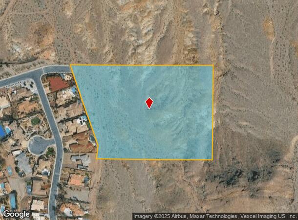
1001 Villa Grande Way
181-34-303-001
PT S2 SEC 34 22 64 (TRACT 112)
Vacantlandnec
Clark
X
Nevada
32003C2980E
11.65 AC
2025
Outlying S Clark County
2025
Las Vegas
005503
Las Vegas-Henderson-North Las Vegas, NV
DEMOGRAPHICS near 1001 Villa Grande Way
1 Mile
3 Mile
5 Mile
2024 Total Population
1,004
13,416
15,639
2029 Population
1,099
14,468
16,873
Pop Growth 2024-2029
+ 9.46%
+ 7.84%
+ 7.89%
Average Age
56
49
49
2024 Total Households
482
6,012
6,982
HH Growth 2024-2029
+ 9.34%
+ 7.80%
+ 7.86%
Median Household Inc
$82,143
$69,020
$68,731
Avg Household Size
2.10
2.20
2.20
2024 Avg HH Vehicles
2.00
2.00
2.00
Median Home Value
$591,160
$408,904
$425,524
Median Year Built
1988
1979
1980
Nearby Places
Map Layers
Map Styles
 Street
 Aerial
- Restaurants
- Banks
- Shops
- Fitness
- Groceries
PUBLIC TRANSPORTATION
AIRPORT
Boulder City Municipal
DRIVE
WALK
Distance
Boulder City Municipal
12 min
5.5 mi
Harry Reid International
DRIVE
WALK
Distance
Harry Reid International
35 min
25.6 mi
Freight Ports
Port of Long Beach
DRIVE
WALK
Distance
Port of Long Beach
333 min
294.2 mi
SALE & LEASE HISTORY
LISTING DATE
SALE/LEASE

Sep 24, 2016
For Sale
Oct 10, 2016
For Sale
Jul 31, 2017
For Sale
Apr 11, 2019
For Sale
Nearby Properties
Address
Land Use
TOTAL SIZE
Lot Size
Zoning
Address
Land Use
TOTAL SIZE
Lot Size
Zoning
36.90 AC
GM
Address
Land Use
TOTAL SIZE
Lot Size
Zoning
73,468 SF
11.34 AC
H
Address
Land Use
TOTAL SIZE
Lot Size
Zoning
640 SF
10.96 AC
H1
Address
Land Use
TOTAL SIZE
Lot Size
Zoning
22.31 AC
GM
Address
Land Use
TOTAL SIZE
Lot Size
Zoning
89,666 SF
38.65 AC
R18
Address
Land Use
TOTAL SIZE
Lot Size
Zoning
61,720 SF
6.39 AC
H
Address
Land Use
TOTAL SIZE
Lot Size
Zoning
51,423 SF
4.01 AC
Address
Land Use
TOTAL SIZE
Lot Size
Zoning
150.88 AC
S
Address
Land Use
TOTAL SIZE
Lot Size
Zoning
53,578 SF
1.35 AC
C2
Address
Land Use
TOTAL SIZE
Lot Size
Zoning
48,033 SF
4.89 AC
C2
Address
Land Use
TOTAL SIZE
Lot Size
Zoning
5,238 SF
5.97 AC
C2
Address
Land Use
TOTAL SIZE
Lot Size
Zoning
61,972 SF
3.85 AC
C2
Address
Land Use
TOTAL SIZE
Lot Size
Zoning
Address
Land Use
TOTAL SIZE
Lot Size
Zoning
9.93 AC
GP
Address
Land Use
TOTAL SIZE
Lot Size
Zoning
3,268 SF
0.65 AC
C2
Address
Land Use
TOTAL SIZE
Lot Size
Zoning
13.88 AC
CM
Address
Land Use
TOTAL SIZE
Lot Size
Zoning
4,806 SF
11.86 AC
RV
Address
Land Use
TOTAL SIZE
Lot Size
Zoning
12.90 AC
CM
Address
Land Use
TOTAL SIZE
Lot Size
Zoning
9,600 SF
4.37 AC
GM
Address
Land Use
TOTAL SIZE
Lot Size
Zoning
46,668 SF
2.96 AC
C2
Address
Land Use
TOTAL SIZE
Lot Size
Zoning
23,589 SF
5.46 AC
R17
Address
Land Use
TOTAL SIZE
Lot Size
Zoning
16,846 SF
2.06 AC
C2
Address
Land Use
TOTAL SIZE
Lot Size
Zoning
10.88 AC
C1
Address
Land Use
TOTAL SIZE
Lot Size
Zoning
25,843 SF
0.06 AC
Address
Land Use
TOTAL SIZE
Lot Size
Zoning
49,200 SF
4.15 AC
CM
Address
Land Use
TOTAL SIZE
Lot Size
Zoning
17,960 SF
7.31 AC
R17
Address
Land Use
TOTAL SIZE
Lot Size
Zoning
5.38 AC
GP
Address
Land Use
TOTAL SIZE
Lot Size
Zoning
7,035 SF
20.82 AC
H1
Address
Land Use
TOTAL SIZE
Lot Size
Zoning
112 SF
94.22 AC
S
Address
Land Use
TOTAL SIZE
Lot Size
Zoning
5.51 AC
GM
The World's #1 Commercial Real Estate Marketplace
Connect with us
© 2026 CoStar Group
The information above has been obtained from sources believed reliable. While we do not doubt its accuracy we have not verified it and make no guarantee, warranty or representation about it. It is your responsibility to independently confirm its accuracy and completeness. Any projections, opinions, assumptions, or estimates used are for example only and do not represent the current or future performance of the property. The value of this transaction to you depends on tax and other factors which should be evaluated by your tax, financial, and legal advisors. You and your advisors should conduct a careful, independent investigation of the property to determine to your satisfaction the suitability of the property for your needs.