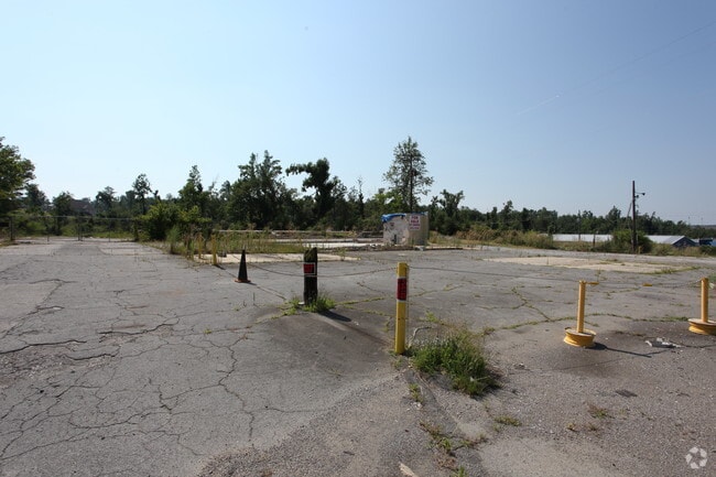
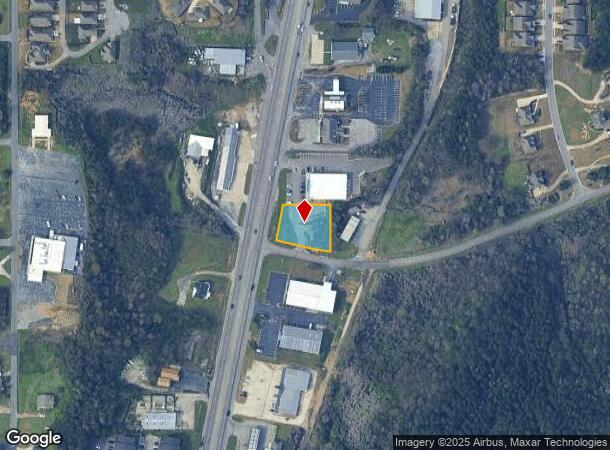
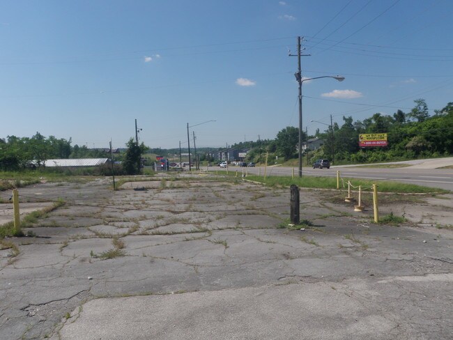
Property Record
1201 Decatur Hwy, Fultondale, AL 35068

NEARBY LISTINGS FOR SALE OR LEASE
Property Detail
1201 Decatur Hwy
Birmingham-Hoover, AL
Delaney Fultondale Subdivision
14-00-36-1-001-007.000
LOT 2 DELANEY FULTONDALE SUBDIVISION 253/11
Vacantlandnec
Jefferson
X
Alabama
01073C0381H
2
2023
0.47 AC
2024
Fultondale
0120021014
Birmingham
DEMOGRAPHICS near 1201 Decatur Hwy
1 Mile
3 Mile
5 Mile
2024 Total Population
3,187
22,501
60,000
2029 Population
3,101
22,147
59,615
Pop Growth 2024-2029
(2.70%)
(1.57%)
(0.64%)
Average Age
36
38
40
2024 Total Households
1,438
9,055
24,195
HH Growth 2024-2029
(2.78%)
(1.70%)
(0.67%)
Median Household Inc
$69,973
$54,023
$45,408
Avg Household Size
2.20
2.40
2.40
2024 Avg HH Vehicles
2.00
2.00
2.00
Median Home Value
$206,410
$152,027
$138,696
Median Year Built
2001
1974
1971
Nearby Places
- Restaurants
- Banks
- Shops
- Fitness
- Groceries
PUBLIC TRANSPORTATION
COMMUTER RAIL
Birmingham (Crescent - Amtrak)
DRIVE
WALK
Distance
Birmingham (Crescent - Amtrak)
12 min
8.0 mi
AIRPORT
Birmingham-Shuttlesworth International
DRIVE
WALK
Distance
Birmingham-Shuttlesworth International
17 min
9.1 mi
Freight Ports
Port of Mobile
DRIVE
WALK
Distance
Port of Mobile
288 min
262.6 mi
SALE & LEASE HISTORY
LISTING DATE
SALE/LEASE

Sep 24, 2016
For Sale
Aug 07, 2017
For Sale
Nearby Properties
Address
Land Use
TOTAL SIZE
Lot Size
Zoning
Address
Land Use
TOTAL SIZE
Lot Size
Zoning
216,610 SF
20 AC
R3
Address
Land Use
TOTAL SIZE
Lot Size
Zoning
189,049 SF
12.05 AC
R3&B
Address
Land Use
TOTAL SIZE
Lot Size
Zoning
196,498 SF
11.71 AC
R-4
Address
Land Use
TOTAL SIZE
Lot Size
Zoning
124,896 SF
11 AC
R1-B
Address
Land Use
TOTAL SIZE
Lot Size
Zoning
20,965 SF
1.35 AC
I3
Address
Land Use
TOTAL SIZE
Lot Size
Zoning
134,840 SF
7.80 AC
C1
Address
Land Use
TOTAL SIZE
Lot Size
Zoning
78,939 SF
10.30 AC
B2
Address
Land Use
TOTAL SIZE
Lot Size
Zoning
83,381 SF
6.28 AC
R3&B
Address
Land Use
TOTAL SIZE
Lot Size
Zoning
224,072 SF
16 AC
I2
Address
Land Use
TOTAL SIZE
Lot Size
Zoning
29,614 SF
1.63 AC
B2
Address
Land Use
TOTAL SIZE
Lot Size
Zoning
83,432 SF
5.50 AC
R1-B
Address
Land Use
TOTAL SIZE
Lot Size
Zoning
33,956 SF
2.54 AC
R1
Address
Land Use
TOTAL SIZE
Lot Size
Zoning
66,043 SF
13.08 AC
B2
Address
Land Use
TOTAL SIZE
Lot Size
Zoning
116,982 SF
10.44 AC
B2
Address
Land Use
TOTAL SIZE
Lot Size
Zoning
70,794 SF
4.89 AC
B2
Address
Land Use
TOTAL SIZE
Lot Size
Zoning
104,900 SF
18 AC
B2
Address
Land Use
TOTAL SIZE
Lot Size
Zoning
193,788 SF
78.50 AC
M2
Address
Land Use
TOTAL SIZE
Lot Size
Zoning
121,440 SF
11.60 AC
M-2
Address
Land Use
TOTAL SIZE
Lot Size
Zoning
24,004 SF
2.49 AC
I3
Address
Land Use
TOTAL SIZE
Lot Size
Zoning
32,043 SF
2.15 AC
B2
Address
Land Use
TOTAL SIZE
Lot Size
Zoning
70,590 SF
9.90 AC
M1
Address
Land Use
TOTAL SIZE
Lot Size
Zoning
2,336 SF
10.80 AC
M2
Address
Land Use
TOTAL SIZE
Lot Size
Zoning
44,012 SF
15.10 AC
M-1
Address
Land Use
TOTAL SIZE
Lot Size
Zoning
28,414 SF
0.95 AC
B2
Address
Land Use
TOTAL SIZE
Lot Size
Zoning
56,650 SF
20 AC
I-2
Address
Land Use
TOTAL SIZE
Lot Size
Zoning
24,558 SF
1.77 AC
B-2
Address
Land Use
TOTAL SIZE
Lot Size
Zoning
57,364 SF
4.58 AC
B-2
Address
Land Use
TOTAL SIZE
Lot Size
Zoning
40,401 SF
1.90 AC
R1
Address
Land Use
TOTAL SIZE
Lot Size
Zoning
107,697 SF
34.50 AC
M2
Address
Land Use
TOTAL SIZE
Lot Size
Zoning
85,208 SF
4 AC
I4
The World's #1 Commercial Real Estate Marketplace
Connect with us
© 2025 CoStar Group
The information above has been obtained from sources believed reliable. While we do not doubt its accuracy we have not verified it and make no guarantee, warranty or representation about it. It is your responsibility to independently confirm its accuracy and completeness. Any projections, opinions, assumptions, or estimates used are for example only and do not represent the current or future performance of the property. The value of this transaction to you depends on tax and other factors which should be evaluated by your tax, financial, and legal advisors. You and your advisors should conduct a careful, independent investigation of the property to determine to your satisfaction the suitability of the property for your needs.