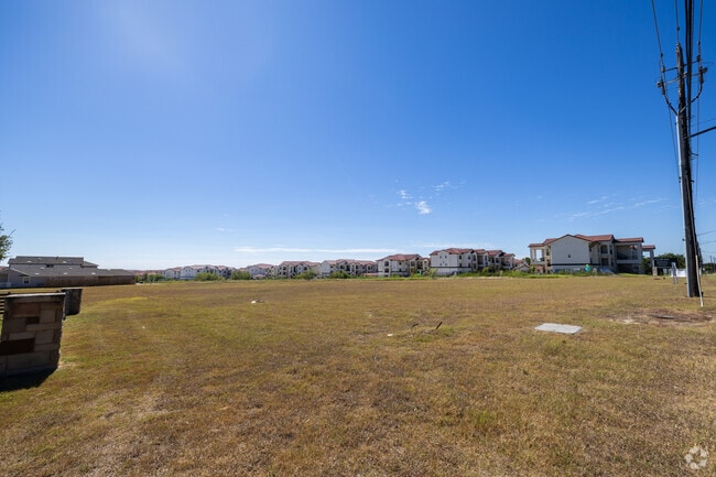
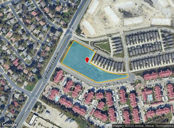
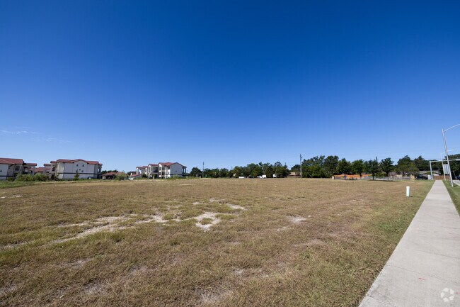
Property Record
Dessau Rd, Austin, TX 78754
NEARBY LISTINGS FOR SALE OR LEASE
Property Detail
Dessau Rd
Austin-Round Rock-San Marcos, TX
Rice J O
846014
ABS 675 SUR 31 RICE J O ACR 3.3721
Farms
Travis
X
Texas
48453C0460K
3.37 AC
2024
Northeast
2025
Austin
043500
DEMOGRAPHICS near Dessau Rd
1 Mile
3 Mile
5 Mile
2024 Total Population
13,072
125,212
306,364
2029 Population
14,190
135,978
333,810
Pop Growth 2024-2029
+ 8.55%
+ 8.60%
+ 8.96%
Average Age
38
36
36
2024 Total Households
4,443
47,777
129,423
HH Growth 2024-2029
+ 9.16%
+ 9.36%
+ 9.66%
Median Household Inc
$59,294
$55,186
$68,123
Avg Household Size
2.70
2.50
2.30
2024 Avg HH Vehicles
2.00
2.00
2.00
Median Home Value
$274,572
$316,939
$380,332
Median Year Built
1990
1985
1991
Nearby Places
Map Layers
Map Styles
 Street
 Aerial
- Restaurants
- Banks
- Shops
- Fitness
- Groceries
PUBLIC TRANSPORTATION
AIRPORT
Austin-Bergstrom International
DRIVE
WALK
Distance
Austin-Bergstrom International
29 min
17.3 mi
Freight Ports
Calhoun Port
DRIVE
WALK
Distance
Calhoun Port
195 min
160.8 mi
SALE & LEASE HISTORY
LISTING DATE
SALE/LEASE

Sep 16, 2024
For Sale
May 08, 2023
For Sale
Nearby Properties
Address
Land Use
TOTAL SIZE
Lot Size
Zoning
Address
Land Use
TOTAL SIZE
Lot Size
Zoning
287,272 SF
17.68 AC
Address
Land Use
TOTAL SIZE
Lot Size
Zoning
348,496 SF
17.59 AC
Address
Land Use
TOTAL SIZE
Lot Size
Zoning
398,475 SF
35.14 AC
Address
Land Use
TOTAL SIZE
Lot Size
Zoning
379,500 SF
17.99 AC
Address
Land Use
TOTAL SIZE
Lot Size
Zoning
299,957 SF
22.02 AC
Address
Land Use
TOTAL SIZE
Lot Size
Zoning
459,304 SF
28.36 AC
Address
Land Use
TOTAL SIZE
Lot Size
Zoning
752,804 SF
180.91 AC
Address
Land Use
TOTAL SIZE
Lot Size
Zoning
270,780 SF
18.17 AC
Address
Land Use
TOTAL SIZE
Lot Size
Zoning
376,385 SF
26.47 AC
Address
Land Use
TOTAL SIZE
Lot Size
Zoning
323,425 SF
14.20 AC
Address
Land Use
TOTAL SIZE
Lot Size
Zoning
384,776 SF
22.88 AC
Address
Land Use
TOTAL SIZE
Lot Size
Zoning
264,401 SF
10.48 AC
Address
Land Use
TOTAL SIZE
Lot Size
Zoning
374,432 SF
14.28 AC
Address
Land Use
TOTAL SIZE
Lot Size
Zoning
439,312 SF
30.08 AC
Address
Land Use
TOTAL SIZE
Lot Size
Zoning
254,796 SF
11.29 AC
Address
Land Use
TOTAL SIZE
Lot Size
Zoning
277,987 SF
11.01 AC
Address
Land Use
TOTAL SIZE
Lot Size
Zoning
242,484 SF
15.50 AC
Address
Land Use
TOTAL SIZE
Lot Size
Zoning
330,841 SF
16.48 AC
Address
Land Use
TOTAL SIZE
Lot Size
Zoning
400,630 SF
15.30 AC
Address
Land Use
TOTAL SIZE
Lot Size
Zoning
379,200 SF
19.79 AC
Address
Land Use
TOTAL SIZE
Lot Size
Zoning
266,728 SF
14.87 AC
Address
Land Use
TOTAL SIZE
Lot Size
Zoning
241,800 SF
13.27 AC
Address
Land Use
TOTAL SIZE
Lot Size
Zoning
261,594 SF
6.66 AC
Address
Land Use
TOTAL SIZE
Lot Size
Zoning
331,943 SF
22.87 AC
Address
Land Use
TOTAL SIZE
Lot Size
Zoning
326,138 SF
15.95 AC
Address
Land Use
TOTAL SIZE
Lot Size
Zoning
316,064 SF
18.98 AC
Address
Land Use
TOTAL SIZE
Lot Size
Zoning
336,658 SF
22.91 AC
Address
Land Use
TOTAL SIZE
Lot Size
Zoning
350,341 SF
30.34 AC
Address
Land Use
TOTAL SIZE
Lot Size
Zoning
297,000 SF
16.85 AC
Address
Land Use
TOTAL SIZE
Lot Size
Zoning
261,162 SF
16.64 AC
The World's #1 Commercial Real Estate Marketplace
Connect with us
© 2026 CoStar Group
The information above has been obtained from sources believed reliable. While we do not doubt its accuracy we have not verified it and make no guarantee, warranty or representation about it. It is your responsibility to independently confirm its accuracy and completeness. Any projections, opinions, assumptions, or estimates used are for example only and do not represent the current or future performance of the property. The value of this transaction to you depends on tax and other factors which should be evaluated by your tax, financial, and legal advisors. You and your advisors should conduct a careful, independent investigation of the property to determine to your satisfaction the suitability of the property for your needs.