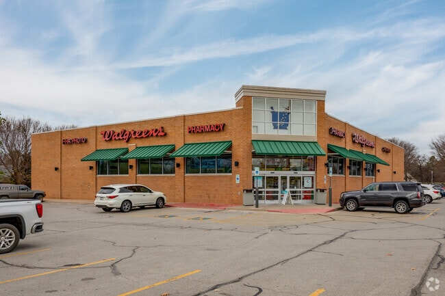
Property Record
10018 S Yale Ave, Tulsa, OK 74137


NEARBY LISTINGS FOR SALE OR LEASE
Property Detail
10018 S Yale Ave
Tulsa, OK
Yale 101 Addn
74252-83-21-47010
LT 1 BLK 1
Storebuilding
Tulsa
X
Oklahoma
40143C0368L
1
2025
1.74 AC
2025
South Tulsa
007634
Tulsa
13,552 SF
DEMOGRAPHICS near 10018 S Yale Ave
1 Mile
3 Mile
5 Mile
2024 Total Population
7,688
68,880
178,210
2029 Population
7,872
71,144
184,404
Pop Growth 2024-2029
+ 2.39%
+ 3.29%
+ 3.48%
Average Age
42
40
39
2024 Total Households
2,759
27,895
72,409
HH Growth 2024-2029
+ 2.50%
+ 3.24%
+ 3.47%
Median Household Inc
$140,388
$85,425
$74,039
Avg Household Size
2.70
2.40
2.40
2024 Avg HH Vehicles
2.00
2.00
2.00
Median Home Value
$371,882
$303,449
$267,047
Median Year Built
1986
1988
1987
Nearby Places
Map Layers
Map Styles
 Street
 Aerial
- Restaurants
- Banks
- Shops
- Fitness
- Groceries
PUBLIC TRANSPORTATION
AIRPORT
Tulsa International
DRIVE
WALK
Distance
Tulsa International
28 min
19.9 mi
Freight Ports
Tulsa Port Of Catoosa
DRIVE
WALK
Distance
Tulsa Port Of Catoosa
31 min
23.7 mi
Nearby Properties
Address
Land Use
TOTAL SIZE
Lot Size
Zoning
Address
Land Use
TOTAL SIZE
Lot Size
Zoning
1,584,609 SF
84.41 AC
AG
Address
Land Use
TOTAL SIZE
Lot Size
Zoning
790,247 SF
149.86 AC
RS3
Address
Land Use
TOTAL SIZE
Lot Size
Zoning
206,760 SF
78.45 AC
AG
Address
Land Use
TOTAL SIZE
Lot Size
Zoning
163,472 SF
29.92 AC
AG
Address
Land Use
TOTAL SIZE
Lot Size
Zoning
6,338 SF
104.15 AC
AG
Address
Land Use
TOTAL SIZE
Lot Size
Zoning
55,384 SF
14.81 AC
AG
Address
Land Use
TOTAL SIZE
Lot Size
Zoning
107,538 SF
19.74 AC
OM
Address
Land Use
TOTAL SIZE
Lot Size
Zoning
58,977 SF
15.85 AC
CS
Address
Land Use
TOTAL SIZE
Lot Size
Zoning
8,388 SF
63.49 AC
AG
Address
Land Use
TOTAL SIZE
Lot Size
Zoning
176,243 SF
5.77 AC
CS
Address
Land Use
TOTAL SIZE
Lot Size
Zoning
65,385 SF
16.59 AC
AG
Address
Land Use
TOTAL SIZE
Lot Size
Zoning
65,812 SF
14.12 AC
RS1
Address
Land Use
TOTAL SIZE
Lot Size
Zoning
33,668 SF
8.04 AC
CO
Address
Land Use
TOTAL SIZE
Lot Size
Zoning
27,278 SF
2.49 AC
CS
Address
Land Use
TOTAL SIZE
Lot Size
Zoning
98,290 SF
19.62 AC
RS3
Address
Land Use
TOTAL SIZE
Lot Size
Zoning
86,747 SF
19.01 AC
RS3
Address
Land Use
TOTAL SIZE
Lot Size
Zoning
56,526 SF
25.18 AC
AG
Address
Land Use
TOTAL SIZE
Lot Size
Zoning
365,433 SF
18.39 AC
CO
Address
Land Use
TOTAL SIZE
Lot Size
Zoning
1 SF
11.34 AC
CS
Address
Land Use
TOTAL SIZE
Lot Size
Zoning
2,178,542 SF
46.63 AC
OM
Address
Land Use
TOTAL SIZE
Lot Size
Zoning
35,904 SF
4.08 AC
RM1
Address
Land Use
TOTAL SIZE
Lot Size
Zoning
355,931 SF
29.06 AC
RM1
Address
Land Use
TOTAL SIZE
Lot Size
Zoning
59,175 SF
8.28 AC
RS3
Address
Land Use
TOTAL SIZE
Lot Size
Zoning
49,090 SF
12.91 AC
OL
Address
Land Use
TOTAL SIZE
Lot Size
Zoning
240 SF
17.07 AC
OM
Address
Land Use
TOTAL SIZE
Lot Size
Zoning
37,075 SF
21.33 AC
AG
Address
Land Use
TOTAL SIZE
Lot Size
Zoning
72,746 SF
3.93 AC
AG
Address
Land Use
TOTAL SIZE
Lot Size
Zoning
30,000 SF
5.06 AC
Address
Land Use
TOTAL SIZE
Lot Size
Zoning
31,798 SF
4.42 AC
AG
Address
Land Use
TOTAL SIZE
Lot Size
Zoning
34,071 SF
9.29 AC
AG
The World's #1 Commercial Real Estate Marketplace
Connect with us
© 2025 CoStar Group
The information above has been obtained from sources believed reliable. While we do not doubt its accuracy we have not verified it and make no guarantee, warranty or representation about it. It is your responsibility to independently confirm its accuracy and completeness. Any projections, opinions, assumptions, or estimates used are for example only and do not represent the current or future performance of the property. The value of this transaction to you depends on tax and other factors which should be evaluated by your tax, financial, and legal advisors. You and your advisors should conduct a careful, independent investigation of the property to determine to your satisfaction the suitability of the property for your needs.