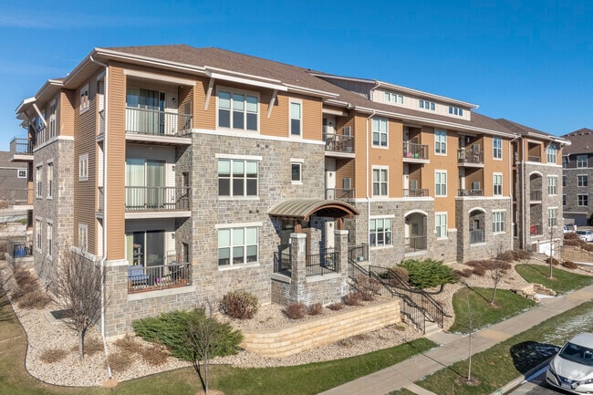
Property Record
1002 Cherry Blossom Dr, Verona, WI 53593


NEARBY LISTINGS FOR SALE OR LEASE
Property Detail
1002 Cherry Blossom Dr
Madison, WI
Sugar Maple
0708-332-0710-7
SUGAR MAPLE, LOT 46.
Commercialnec
Dane
X
Wisconsin
55025C0395G
46
2024
3.11 AC
2024
Outer Verona
010903
Milwaukee/Madison
37,851 SF
DEMOGRAPHICS near 1002 Cherry Blossom Dr
1 Mile
3 Mile
5 Mile
2024 Total Population
5,837
45,093
118,843
2029 Population
6,099
47,219
123,826
Pop Growth 2024-2029
+ 4.49%
+ 4.71%
+ 4.19%
Average Age
36
38
39
2024 Total Households
2,582
20,572
52,280
HH Growth 2024-2029
+ 4.61%
+ 4.76%
+ 4.32%
Median Household Inc
$134,157
$96,554
$93,564
Avg Household Size
2.20
2.10
2.20
2024 Avg HH Vehicles
2.00
2.00
2.00
Median Home Value
$449,923
$421,095
$372,063
Median Year Built
2010
2001
1992
Nearby Places
Map Layers
Map Styles
 Street
 Aerial
- Restaurants
- Banks
- Shops
- Fitness
- Groceries
PUBLIC TRANSPORTATION
AIRPORT
Dane County Regional/Truax Field
DRIVE
WALK
Distance
Dane County Regional/Truax Field
32 min
19.0 mi
Freight Ports
Port Milwaukee
DRIVE
WALK
Distance
Port Milwaukee
114 min
93.3 mi
Nearby Properties
Address
Land Use
TOTAL SIZE
Lot Size
Zoning
Address
Land Use
TOTAL SIZE
Lot Size
Zoning
354,461 SF
37.40 AC
RMX
Address
Land Use
TOTAL SIZE
Lot Size
Zoning
700,496 SF
23.94 AC
SR-V2
Address
Land Use
TOTAL SIZE
Lot Size
Zoning
37,909 SF
10.27 AC
SEC
Address
Land Use
TOTAL SIZE
Lot Size
Zoning
203,672 SF
7.34 AC
PD
Address
Land Use
TOTAL SIZE
Lot Size
Zoning
169,563 SF
19.82 AC
SEC
Address
Land Use
TOTAL SIZE
Lot Size
Zoning
27,201 SF
7.65 AC
TR-U2
Address
Land Use
TOTAL SIZE
Lot Size
Zoning
27,201 SF
10.08 AC
TR-U2
Address
Land Use
TOTAL SIZE
Lot Size
Zoning
161,767 SF
4.58 AC
CC-T
Address
Land Use
TOTAL SIZE
Lot Size
Zoning
2.91 AC
SE
Address
Land Use
TOTAL SIZE
Lot Size
Zoning
290,535 SF
11.25 AC
PD
Address
Land Use
TOTAL SIZE
Lot Size
Zoning
4.05 AC
CC-T
Address
Land Use
TOTAL SIZE
Lot Size
Zoning
326,724 SF
4.23 AC
PD
Address
Land Use
TOTAL SIZE
Lot Size
Zoning
311,672 SF
4.59 AC
PD
Address
Land Use
TOTAL SIZE
Lot Size
Zoning
254,922 SF
11.97 AC
PD
Address
Land Use
TOTAL SIZE
Lot Size
Zoning
324,920 SF
8.47 AC
PD
Address
Land Use
TOTAL SIZE
Lot Size
Zoning
320,074 SF
9.28 AC
SR-V2
Address
Land Use
TOTAL SIZE
Lot Size
Zoning
229,381 SF
7.35 AC
PD
Address
Land Use
TOTAL SIZE
Lot Size
Zoning
37,909 SF
10.27 AC
SEC
Address
Land Use
TOTAL SIZE
Lot Size
Zoning
6.57 AC
SR-V2
Address
Land Use
TOTAL SIZE
Lot Size
Zoning
2.98 AC
TR-U2
Address
Land Use
TOTAL SIZE
Lot Size
Zoning
34,457 SF
9.04 AC
PD
Address
Land Use
TOTAL SIZE
Lot Size
Zoning
125,786 SF
5.62 AC
A
Address
Land Use
TOTAL SIZE
Lot Size
Zoning
264,603 SF
10.32 AC
PD
Address
Land Use
TOTAL SIZE
Lot Size
Zoning
70,258 SF
14.37 AC
PD
Address
Land Use
TOTAL SIZE
Lot Size
Zoning
119,297 SF
4.19 AC
TR-P
Address
Land Use
TOTAL SIZE
Lot Size
Zoning
231,107 SF
4.59 AC
PD
Address
Land Use
TOTAL SIZE
Lot Size
Zoning
2.03 AC
TR-P
Address
Land Use
TOTAL SIZE
Lot Size
Zoning
162,786 SF
17.48 AC
PD
Address
Land Use
TOTAL SIZE
Lot Size
Zoning
82,489 SF
3.97 AC
TR-U1
Address
Land Use
TOTAL SIZE
Lot Size
Zoning
80,328 SF
5.31 AC
SE
The World's #1 Commercial Real Estate Marketplace
Connect with us
© 2025 CoStar Group
The information above has been obtained from sources believed reliable. While we do not doubt its accuracy we have not verified it and make no guarantee, warranty or representation about it. It is your responsibility to independently confirm its accuracy and completeness. Any projections, opinions, assumptions, or estimates used are for example only and do not represent the current or future performance of the property. The value of this transaction to you depends on tax and other factors which should be evaluated by your tax, financial, and legal advisors. You and your advisors should conduct a careful, independent investigation of the property to determine to your satisfaction the suitability of the property for your needs.