Property Record
1002 Front St S, La Crosse, WI 54601
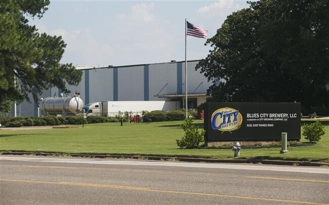
Property Detail
1002 Front St S
La Crosse-Onalaska, WI-MN
STODDARD & LEVYS ADDITION ALL BLOCK 14 (LOTS 1-10) INC VAC N/S ALLEY & VAC S 1/2 WINNEBAGO ST ADJ ON N SUB TO ESMTS
017-030108-060
LA CROSSE
Industrialgeneral
Wisconsin
MZA
1-10
B and X Area of moderate flood hazard, usually the area between the limits of the 100-year and 500-year floods.
0.87 AC
2025
Downtown La Crosse
2025
Other Market Areas
000700
NEARBY LISTINGS FOR SALE OR LEASE
DEMOGRAPHICS near 1002 Front St S
1 mile
3 mile
5 mile
2025 Total Population
12,058
47,605
68,308
2030 Population
12,198
48,403
68,879
Pop Growth 2025-2030
+ 1.16%
+ 1.68%
+ 0.84%
Average Age
35
37
39
2025 Total Households
5,542
20,449
29,706
HH Growth 2025-2030
+ 1.17%
+ 2.02%
+ 1.00%
Median Household Inc
$42,286
$52,450
$57,648
Avg Household Size
1.90
2.00
2.10
2025 Avg HH Vehicles
2.00
2.00
2.00
Median Home Value
$197,131
$214,930
$234,721
Median Year Built
1972
1967
1970
Nearby Places
Map Layers
Map Styles
 Street
 Aerial
Layers
 Traffic
 Biking
Places
Listings with unknown addresses are not visible on the map
- Restaurants
- Banks
- Shops
- Fitness
- Groceries
PUBLIC TRANSPORTATION
COMMUTER RAIL
La Crosse (Empire Builder - Amtrak)
Drive
Walk
Distance
La Crosse (Empire Builder - Amtrak)
9 min
3.2 mi
AIRPORT
La Crosse Regional
Drive
Walk
Distance
La Crosse Regional
18 min
10.1 mi
Freight Ports
Port Milwaukee
Drive
Walk
Distance
Port Milwaukee
240 min
212.9 mi
Nearby Properties
Address
Land Use
TOTAL SIZE
Lot Size
Zoning
Address
Land Use
TOTAL SIZE
Lot Size
Zoning
38,407 SF
3.12 AC
MZA
Address
Land Use
TOTAL SIZE
Lot Size
Zoning
4.65 AC
Address
Land Use
TOTAL SIZE
Lot Size
Zoning
158,050 SF
44.85 AC
Address
Land Use
TOTAL SIZE
Lot Size
Zoning
54.26 AC
MZA
Address
Land Use
TOTAL SIZE
Lot Size
Zoning
131,552 SF
0.89 AC
Address
Land Use
TOTAL SIZE
Lot Size
Zoning
3.91 AC
Address
Land Use
TOTAL SIZE
Lot Size
Zoning
0.75 AC
MZA
Address
Land Use
TOTAL SIZE
Lot Size
Zoning
59,405 SF
5.64 AC
Address
Land Use
TOTAL SIZE
Lot Size
Zoning
0.12 AC
Address
Land Use
TOTAL SIZE
Lot Size
Zoning
11.56 AC
Address
Land Use
TOTAL SIZE
Lot Size
Zoning
0.56 AC
MZA
Address
Land Use
TOTAL SIZE
Lot Size
Zoning
10.21 AC
MZA
Address
Land Use
TOTAL SIZE
Lot Size
Zoning
5.79 AC
MZA
Address
Land Use
TOTAL SIZE
Lot Size
Zoning
2.43 AC
Address
Land Use
TOTAL SIZE
Lot Size
Zoning
73,056 SF
0.62 AC
Address
Land Use
TOTAL SIZE
Lot Size
Zoning
15.48 AC
MZA
Address
Land Use
TOTAL SIZE
Lot Size
Zoning
81,664 SF
1.06 AC
MZA
Address
Land Use
TOTAL SIZE
Lot Size
Zoning
162,355 SF
13.90 AC
MZA
Address
Land Use
TOTAL SIZE
Lot Size
Zoning
2.10 AC
MZA
Address
Land Use
TOTAL SIZE
Lot Size
Zoning
8.98 AC
MZA
Address
Land Use
TOTAL SIZE
Lot Size
Zoning
7.88 AC
IND
Address
Land Use
TOTAL SIZE
Lot Size
Zoning
32,153 SF
3.16 AC
MZA
Address
Land Use
TOTAL SIZE
Lot Size
Zoning
64,480 SF
0.69 AC
MZA
Address
Land Use
TOTAL SIZE
Lot Size
Zoning
1.20 AC
MZA
Address
Land Use
TOTAL SIZE
Lot Size
Zoning
1.19 AC
Address
Land Use
TOTAL SIZE
Lot Size
Zoning
0.50 AC
Address
Land Use
TOTAL SIZE
Lot Size
Zoning
2.12 AC
MZA
Address
Land Use
TOTAL SIZE
Lot Size
Zoning
5.01 AC
MZA
Address
Land Use
TOTAL SIZE
Lot Size
Zoning
0.96 AC
MZA
Address
Land Use
TOTAL SIZE
Lot Size
Zoning
0.78 AC
MZA
The World's #1 Commercial Real Estate Marketplace
Connect with us
© 2026 CoStar Group
The information above has been obtained from sources believed reliable. While we do not doubt its accuracy we have not verified it and make no guarantee, warranty or representation about it. It is your responsibility to independently confirm its accuracy and completeness. Any projections, opinions, assumptions, or estimates used are for example only and do not represent the current or future performance of the property. The value of this transaction to you depends on tax and other factors which should be evaluated by your tax, financial, and legal advisors. You and your advisors should conduct a careful, independent investigation of the property to determine to your satisfaction the suitability of the property for your needs.