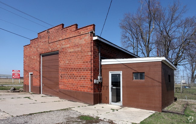
Property Record
N Hurricane Rd, Franklin, IN 46131
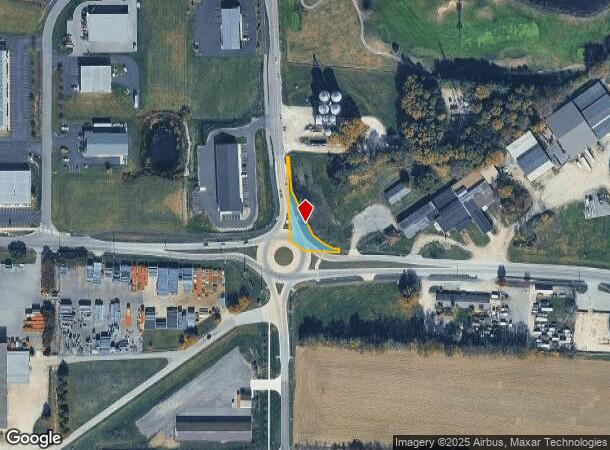
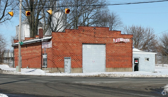
NEARBY LISTINGS FOR SALE OR LEASE
Property Detail
N Hurricane Rd
41-08-12-033-009.002-017
PT SW 1/4 S12 T12 R4 TRACT A MP FRANKLIN COMMUNI
Municipalproperty
Johnson
X
Indiana
18081C0231E
0.37 AC
0
Johnson County
2024
Indianapolis
610900
Indianapolis-Carmel-Anderson, IN
2,656 SF
DEMOGRAPHICS near N Hurricane Rd
1 Mile
3 Mile
5 Mile
2024 Total Population
7,081
26,877
36,923
2029 Population
7,597
28,753
39,557
Pop Growth 2024-2029
+ 7.29%
+ 6.98%
+ 7.13%
Average Age
40
40
39
2024 Total Households
2,692
9,954
13,540
HH Growth 2024-2029
+ 7.50%
+ 7.14%
+ 7.28%
Median Household Inc
$70,164
$69,525
$73,175
Avg Household Size
2.50
2.50
2.60
2024 Avg HH Vehicles
2.00
2.00
2.00
Median Home Value
$204,365
$194,547
$189,725
Median Year Built
1982
1991
1991
Nearby Places
Map Layers
Map Styles
 Street
 Aerial
- Restaurants
- Banks
- Shops
- Fitness
- Groceries
PUBLIC TRANSPORTATION
AIRPORT
Indianapolis International
DRIVE
WALK
Distance
Indianapolis International
40 min
32.3 mi
SALE & LEASE HISTORY
LISTING DATE
SALE/LEASE

May 25, 2017
For Lease
Nearby Properties
Address
Land Use
TOTAL SIZE
Lot Size
Zoning
Address
Land Use
TOTAL SIZE
Lot Size
Zoning
2,908 SF
216.91 AC
Address
Land Use
TOTAL SIZE
Lot Size
Zoning
954,880 SF
42.36 AC
Address
Land Use
TOTAL SIZE
Lot Size
Zoning
35,382 SF
42.11 AC
Address
Land Use
TOTAL SIZE
Lot Size
Zoning
153,589 SF
160.27 AC
Address
Land Use
TOTAL SIZE
Lot Size
Zoning
933,504 SF
42.07 AC
Address
Land Use
TOTAL SIZE
Lot Size
Zoning
806,916 SF
42.56 AC
Address
Land Use
TOTAL SIZE
Lot Size
Zoning
519,376 SF
53.98 AC
Address
Land Use
TOTAL SIZE
Lot Size
Zoning
553,152 SF
35.86 AC
Address
Land Use
TOTAL SIZE
Lot Size
Zoning
160.96 AC
PUD
Address
Land Use
TOTAL SIZE
Lot Size
Zoning
18.95 AC
Address
Land Use
TOTAL SIZE
Lot Size
Zoning
8,504 SF
31.42 AC
Address
Land Use
TOTAL SIZE
Lot Size
Zoning
1,792 SF
66.50 AC
Address
Land Use
TOTAL SIZE
Lot Size
Zoning
146,505 SF
30.71 AC
Address
Land Use
TOTAL SIZE
Lot Size
Zoning
232,709 SF
51.30 AC
Address
Land Use
TOTAL SIZE
Lot Size
Zoning
193,378 SF
20.55 AC
Address
Land Use
TOTAL SIZE
Lot Size
Zoning
7,304 SF
15.32 AC
Address
Land Use
TOTAL SIZE
Lot Size
Zoning
136,760 SF
31.47 AC
Address
Land Use
TOTAL SIZE
Lot Size
Zoning
119,499 SF
11.54 AC
Address
Land Use
TOTAL SIZE
Lot Size
Zoning
54,436 SF
18.83 AC
Address
Land Use
TOTAL SIZE
Lot Size
Zoning
207,310 SF
17.20 AC
Address
Land Use
TOTAL SIZE
Lot Size
Zoning
20.19 AC
Address
Land Use
TOTAL SIZE
Lot Size
Zoning
86,082 SF
8.14 AC
Address
Land Use
TOTAL SIZE
Lot Size
Zoning
193,690 SF
47 AC
Address
Land Use
TOTAL SIZE
Lot Size
Zoning
2,516 SF
7.87 AC
Address
Land Use
TOTAL SIZE
Lot Size
Zoning
2,304 SF
14.05 AC
Address
Land Use
TOTAL SIZE
Lot Size
Zoning
66,906 SF
2.92 AC
Address
Land Use
TOTAL SIZE
Lot Size
Zoning
119,416 SF
11.51 AC
Address
Land Use
TOTAL SIZE
Lot Size
Zoning
26,208 SF
3.74 AC
PUD
Address
Land Use
TOTAL SIZE
Lot Size
Zoning
539,190 SF
33.27 AC
Address
Land Use
TOTAL SIZE
Lot Size
Zoning
39.94 AC
PUD
The World's #1 Commercial Real Estate Marketplace
Connect with us
© 2025 CoStar Group
The information above has been obtained from sources believed reliable. While we do not doubt its accuracy we have not verified it and make no guarantee, warranty or representation about it. It is your responsibility to independently confirm its accuracy and completeness. Any projections, opinions, assumptions, or estimates used are for example only and do not represent the current or future performance of the property. The value of this transaction to you depends on tax and other factors which should be evaluated by your tax, financial, and legal advisors. You and your advisors should conduct a careful, independent investigation of the property to determine to your satisfaction the suitability of the property for your needs.