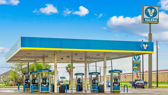
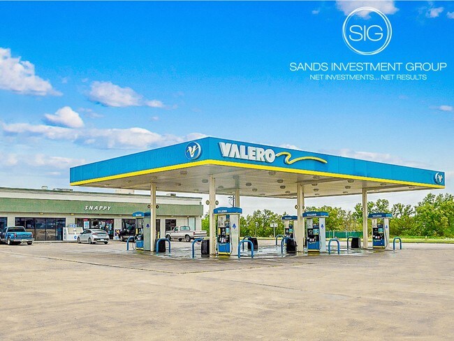
Property Record
1002 Us Highway 77, Bishop, TX 78343

Property Detail
1002 Us Highway 77
Corpus Christi, TX
BISHOP F Z 4.51 ACS OUT TR B-1 SEC 102
200093884
NUECES
Commercialnec
Texas
B and X Area of moderate flood hazard, usually the area between the limits of the 100-year and 500-year floods.
b-1
2024
4.51 AC
2025
Southwest
006000
Corpus Christi
6,000 SF
NEARBY LISTINGS FOR SALE OR LEASE
-
-
View all Bishop listings for sale on LoopNet.com
DEMOGRAPHICS near 1002 Us Highway 77
1 mile
3 mile
5 mile
2025 Total Population
1,093
4,210
4,514
2030 Population
1,114
4,261
4,560
Pop Growth 2025-2030
+ 1.92%
+ 1.21%
+ 1.02%
Average Age
39
39
39
2025 Total Households
380
1,457
1,516
HH Growth 2025-2030
+ 1.84%
+ 1.24%
+ 1.06%
Median Household Inc
$56,764
$62,454
$62,021
Avg Household Size
2.80
2.80
2.80
2025 Avg HH Vehicles
2.00
2.00
2.00
Median Home Value
$78,797
$95,421
$97,534
Median Year Built
1982
1977
1978
Nearby Places
Map Layers
Map Styles
 Street
 Aerial
Transit
 Traffic
 Biking
Places
Listings with unknown addresses are not visible on the map
- Restaurants
- Banks
- Shops
- Fitness
- Groceries
PUBLIC TRANSPORTATION
AIRPORT
Corpus Christi International
Drive
Walk
Distance
Corpus Christi International
51 min
27.0 mi
Freight Ports
Port of Corpus Christi
Drive
Walk
Distance
Port of Corpus Christi
58 min
34.5 mi
SALE & LEASE HISTORY
LISTING DATE
SALE/LEASE

Sep 25, 2019
For Sale
Nearby Properties
Address
Land Use
TOTAL SIZE
Lot Size
Zoning
Address
Land Use
TOTAL SIZE
Lot Size
Zoning
528,818 SF
12.14 AC
Address
Land Use
TOTAL SIZE
Lot Size
Zoning
175 SF
1.41 AC
Address
Land Use
TOTAL SIZE
Lot Size
Zoning
1,450 SF
18.93 AC
Address
Land Use
TOTAL SIZE
Lot Size
Zoning
7,112 SF
4.88 AC
Address
Land Use
TOTAL SIZE
Lot Size
Zoning
24,000 SF
250 AC
Address
Land Use
TOTAL SIZE
Lot Size
Zoning
3.44 AC
Address
Land Use
TOTAL SIZE
Lot Size
Zoning
6,335,800 SF
29.09 AC
Address
Land Use
TOTAL SIZE
Lot Size
Zoning
1,620 SF
7.42 AC
Address
Land Use
TOTAL SIZE
Lot Size
Zoning
1,600 SF
10 AC
Address
Land Use
TOTAL SIZE
Lot Size
Zoning
19,024 SF
2 AC
Address
Land Use
TOTAL SIZE
Lot Size
Zoning
9,010 SF
0.97 AC
Address
Land Use
TOTAL SIZE
Lot Size
Zoning
5,000 SF
10.09 AC
OCL
Address
Land Use
TOTAL SIZE
Lot Size
Zoning
553,734 SF
6.36 AC
Address
Land Use
TOTAL SIZE
Lot Size
Zoning
5,612 SF
4.66 AC
Address
Land Use
TOTAL SIZE
Lot Size
Zoning
564 SF
2.72 AC
Address
Land Use
TOTAL SIZE
Lot Size
Zoning
8,400 SF
9.26 AC
Address
Land Use
TOTAL SIZE
Lot Size
Zoning
6,140 SF
1.62 AC
Address
Land Use
TOTAL SIZE
Lot Size
Zoning
2,782 SF
2.84 AC
Address
Land Use
TOTAL SIZE
Lot Size
Zoning
4,846 SF
1.02 AC
Address
Land Use
TOTAL SIZE
Lot Size
Zoning
115.45 AC
Address
Land Use
TOTAL SIZE
Lot Size
Zoning
3,874 SF
1 AC
Address
Land Use
TOTAL SIZE
Lot Size
Zoning
0.46 AC
Address
Land Use
TOTAL SIZE
Lot Size
Zoning
10,396 SF
1.17 AC
Address
Land Use
TOTAL SIZE
Lot Size
Zoning
26,968 SF
2.79 AC
Address
Land Use
TOTAL SIZE
Lot Size
Zoning
3,192 SF
0.72 AC
Address
Land Use
TOTAL SIZE
Lot Size
Zoning
2.42 AC
Address
Land Use
TOTAL SIZE
Lot Size
Zoning
Address
Land Use
TOTAL SIZE
Lot Size
Zoning
3,004 SF
0.55 AC
BUS
Address
Land Use
TOTAL SIZE
Lot Size
Zoning
7,000 SF
1.61 AC
The World's #1 Commercial Real Estate Marketplace
Connect with us
© 2026 CoStar Group
The information above has been obtained from sources believed reliable. While we do not doubt its accuracy we have not verified it and make no guarantee, warranty or representation about it. It is your responsibility to independently confirm its accuracy and completeness. Any projections, opinions, assumptions, or estimates used are for example only and do not represent the current or future performance of the property. The value of this transaction to you depends on tax and other factors which should be evaluated by your tax, financial, and legal advisors. You and your advisors should conduct a careful, independent investigation of the property to determine to your satisfaction the suitability of the property for your needs.