Property Record
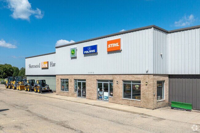
1002 W Jefferson St, Shorewood, IL 60404


NEARBY LISTINGS FOR SALE OR LEASE
Property Detail
1002 W Jefferson St
Chicago-Naperville-Elgin, IL-IN
Robin Hill
05-06-09-300-017
THE E1/2 OF THE SW1/4 OF SEC 9, T35N-R9E, (EX THRFM THOSE PRTS DESC AS ROBIN HILL SUB UNITS 1, 2 3) (EX THAT PRT PER DOC NO
Commercialnec
Will
AE
Illinois
17197C0139G
3.60 AC
2024
Joliet/Central Will
2024
Chicago
883216
DEMOGRAPHICS near 1002 W Jefferson St
1 Mile
3 Mile
5 Mile
2024 Total Population
8,222
55,849
131,812
2029 Population
8,190
55,927
133,134
Pop Growth 2024-2029
(0.39%)
+ 0.14%
+ 1.00%
Average Age
43
39
38
2024 Total Households
3,049
18,731
45,485
HH Growth 2024-2029
(0.43%)
+ 0.09%
+ 0.78%
Median Household Inc
$107,307
$107,658
$93,570
Avg Household Size
2.70
2.90
2.80
2024 Avg HH Vehicles
2.00
2.00
2.00
Median Home Value
$268,902
$265,219
$250,973
Median Year Built
1987
1999
1995
Nearby Places
Map Layers
Map Styles
 Street
 Aerial
- Restaurants
- Banks
- Shops
- Fitness
- Groceries
PUBLIC TRANSPORTATION
COMMUTER RAIL
Joliet Station (Heritage Corridor Line - Northeast Illinois Regional Commuter Railroad (Metra), Rock Island District Line - Northeast Illinois Regional Commuter Railroad (Metra))
DRIVE
WALK
Distance
Joliet Station (Heritage Corridor Line - Northeast Illinois Regional Commuter Railroad (Metra), Rock Island District Line - Northeast Illinois Regional Commuter Railroad (Metra))
17 min
7.0 mi
AIRPORT
Chicago Midway International
DRIVE
WALK
Distance
Chicago Midway International
46 min
34.3 mi
Chicago O'Hare International
DRIVE
WALK
Distance
Chicago O'Hare International
63 min
45.7 mi
Nearby Properties
Address
Land Use
TOTAL SIZE
Lot Size
Zoning
Address
Land Use
TOTAL SIZE
Lot Size
Zoning
50.58 AC
Address
Land Use
TOTAL SIZE
Lot Size
Zoning
48.10 AC
Address
Land Use
TOTAL SIZE
Lot Size
Zoning
51.97 AC
Address
Land Use
TOTAL SIZE
Lot Size
Zoning
502,836 SF
24.99 AC
Address
Land Use
TOTAL SIZE
Lot Size
Zoning
445,236 SF
20.40 AC
Address
Land Use
TOTAL SIZE
Lot Size
Zoning
459,070 SF
22.35 AC
Address
Land Use
TOTAL SIZE
Lot Size
Zoning
20.37 AC
Address
Land Use
TOTAL SIZE
Lot Size
Zoning
16.91 AC
Address
Land Use
TOTAL SIZE
Lot Size
Zoning
408,850 SF
18.27 AC
Address
Land Use
TOTAL SIZE
Lot Size
Zoning
322,874 SF
13.71 AC
Address
Land Use
TOTAL SIZE
Lot Size
Zoning
22.74 AC
Address
Land Use
TOTAL SIZE
Lot Size
Zoning
15.31 AC
Address
Land Use
TOTAL SIZE
Lot Size
Zoning
309,840 SF
13.24 AC
Address
Land Use
TOTAL SIZE
Lot Size
Zoning
277,776 SF
14.17 AC
Address
Land Use
TOTAL SIZE
Lot Size
Zoning
5.12 AC
Address
Land Use
TOTAL SIZE
Lot Size
Zoning
Address
Land Use
TOTAL SIZE
Lot Size
Zoning
17.58 AC
Address
Land Use
TOTAL SIZE
Lot Size
Zoning
250,560 SF
11.18 AC
Address
Land Use
TOTAL SIZE
Lot Size
Zoning
259,200 SF
17.87 AC
Address
Land Use
TOTAL SIZE
Lot Size
Zoning
240,468 SF
10.31 AC
Address
Land Use
TOTAL SIZE
Lot Size
Zoning
Address
Land Use
TOTAL SIZE
Lot Size
Zoning
205,200 SF
5.66 AC
Address
Land Use
TOTAL SIZE
Lot Size
Zoning
84,899 SF
3.98 AC
Address
Land Use
TOTAL SIZE
Lot Size
Zoning
5.39 AC
Address
Land Use
TOTAL SIZE
Lot Size
Zoning
8.46 AC
Address
Land Use
TOTAL SIZE
Lot Size
Zoning
140,000 SF
7.16 AC
Address
Land Use
TOTAL SIZE
Lot Size
Zoning
64,046 SF
5.41 AC
Address
Land Use
TOTAL SIZE
Lot Size
Zoning
123,698 SF
10.88 AC
Address
Land Use
TOTAL SIZE
Lot Size
Zoning
105,825 SF
2.62 AC
Address
Land Use
TOTAL SIZE
Lot Size
Zoning
15.05 AC
The World's #1 Commercial Real Estate Marketplace
Connect with us
© 2026 CoStar Group
The information above has been obtained from sources believed reliable. While we do not doubt its accuracy we have not verified it and make no guarantee, warranty or representation about it. It is your responsibility to independently confirm its accuracy and completeness. Any projections, opinions, assumptions, or estimates used are for example only and do not represent the current or future performance of the property. The value of this transaction to you depends on tax and other factors which should be evaluated by your tax, financial, and legal advisors. You and your advisors should conduct a careful, independent investigation of the property to determine to your satisfaction the suitability of the property for your needs.