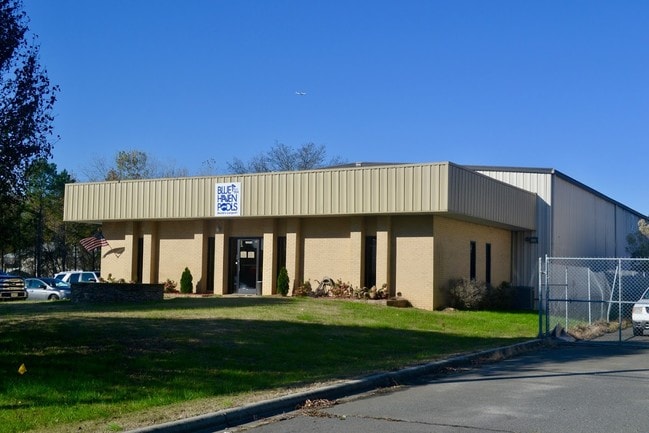
Property Record
10020 Industrial Dr, Pineville, NC 28134


Current Lease Availabilities
NEARBY LISTINGS FOR SALE OR LEASE
Property Detail
10020 Industrial Dr
Charlotte-Concord-Gastonia, NC-SC
Southland Indl Park Inc Surv
205-094-16
N/A
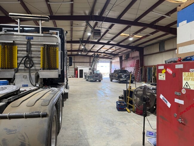
Industrialgeneral
Mecklenburg
X
North Carolina
3710443900L
16
2024
1.53 AC
2025
State Line
005824
Charlotte
9,900 SF
DEMOGRAPHICS near 10020 Industrial Dr
1 Mile
3 Mile
5 Mile
2024 Total Population
1,635
60,901
187,031
2029 Population
1,782
65,340
199,730
Pop Growth 2024-2029
+ 8.99%
+ 7.29%
+ 6.79%
Average Age
35
37
38
2024 Total Households
612
25,015
77,281
HH Growth 2024-2029
+ 8.82%
+ 7.03%
+ 6.69%
Median Household Inc
$81,713
$64,015
$82,321
Avg Household Size
2.60
2.40
2.40
2024 Avg HH Vehicles
2.00
2.00
2.00
Median Home Value
$375,509
$321,015
$366,940
Median Year Built
2010
1988
1993
Nearby Places
Map Layers
Map Styles
 Street
 Aerial
- Restaurants
- Banks
- Shops
- Fitness
- Groceries
PUBLIC TRANSPORTATION
AIRPORT
Charlotte/Douglas International
DRIVE
WALK
Distance
Charlotte/Douglas International
22 min
11.4 mi
Concord-Padgett Regional
DRIVE
WALK
Distance
Concord-Padgett Regional
43 min
34.4 mi
Nearby Properties
Address
Land Use
TOTAL SIZE
Lot Size
Zoning
Address
Land Use
TOTAL SIZE
Lot Size
Zoning
922,476 SF
49.91 AC
BP
Address
Land Use
TOTAL SIZE
Lot Size
Zoning
605,976 SF
46.31 AC
R17MF
Address
Land Use
TOTAL SIZE
Lot Size
Zoning
244,692 SF
264.29 AC
I2
Address
Land Use
TOTAL SIZE
Lot Size
Zoning
654,693 SF
51.50 AC
O1
Address
Land Use
TOTAL SIZE
Lot Size
Zoning
646,209 SF
72.24 AC
CC
Address
Land Use
TOTAL SIZE
Lot Size
Zoning
326,013 SF
25.59 AC
RMF
Address
Land Use
TOTAL SIZE
Lot Size
Zoning
381,729 SF
22.37 AC
R17MF
Address
Land Use
TOTAL SIZE
Lot Size
Zoning
1,007,888 SF
55.04 AC
G-I
Address
Land Use
TOTAL SIZE
Lot Size
Zoning
452,964 SF
9.19 AC
OCCD
Address
Land Use
TOTAL SIZE
Lot Size
Zoning
324,998 SF
16.60 AC
OICD
Address
Land Use
TOTAL SIZE
Lot Size
Zoning
238,604 SF
25.85 AC
R12MF
Address
Land Use
TOTAL SIZE
Lot Size
Zoning
1,396,936 SF
68.78 AC
I2
Address
Land Use
TOTAL SIZE
Lot Size
Zoning
429,918 SF
13.50 AC
O1
Address
Land Use
TOTAL SIZE
Lot Size
Zoning
212,904 SF
58.09 AC
INST
Address
Land Use
TOTAL SIZE
Lot Size
Zoning
226,768 SF
19.59 AC
RMF
Address
Land Use
TOTAL SIZE
Lot Size
Zoning
294,045 SF
24.31 AC
B4
Address
Land Use
TOTAL SIZE
Lot Size
Zoning
262,246 SF
51.99 AC
R3
Address
Land Use
TOTAL SIZE
Lot Size
Zoning
301,671 SF
14.81 AC
Address
Land Use
TOTAL SIZE
Lot Size
Zoning
873,356 SF
52.31 AC
I2
Address
Land Use
TOTAL SIZE
Lot Size
Zoning
190,262 SF
15.94 AC
RMF
Address
Land Use
TOTAL SIZE
Lot Size
Zoning
174,381 SF
31.15 AC
R17MF
Address
Land Use
TOTAL SIZE
Lot Size
Zoning
216,222 SF
21.81 AC
RMF
Address
Land Use
TOTAL SIZE
Lot Size
Zoning
227,264 SF
21.77 AC
RMF
Address
Land Use
TOTAL SIZE
Lot Size
Zoning
196,886 SF
18.60 AC
R17MF
Address
Land Use
TOTAL SIZE
Lot Size
Zoning
141,117 SF
21.75 AC
B1SCD
Address
Land Use
TOTAL SIZE
Lot Size
Zoning
241,548 SF
29.87 AC
R12MFCD
Address
Land Use
TOTAL SIZE
Lot Size
Zoning
524,365 SF
33.52 AC
G-I
Address
Land Use
TOTAL SIZE
Lot Size
Zoning
205,029 SF
25.80 AC
R12MFCD
Address
Land Use
TOTAL SIZE
Lot Size
Zoning
156,008 SF
16.03 AC
R17MF
Address
Land Use
TOTAL SIZE
Lot Size
Zoning
175,326 SF
14.66 AC
RMF
The World's #1 Commercial Real Estate Marketplace
Connect with us
© 2025 CoStar Group
The information above has been obtained from sources believed reliable. While we do not doubt its accuracy we have not verified it and make no guarantee, warranty or representation about it. It is your responsibility to independently confirm its accuracy and completeness. Any projections, opinions, assumptions, or estimates used are for example only and do not represent the current or future performance of the property. The value of this transaction to you depends on tax and other factors which should be evaluated by your tax, financial, and legal advisors. You and your advisors should conduct a careful, independent investigation of the property to determine to your satisfaction the suitability of the property for your needs.