Property Record
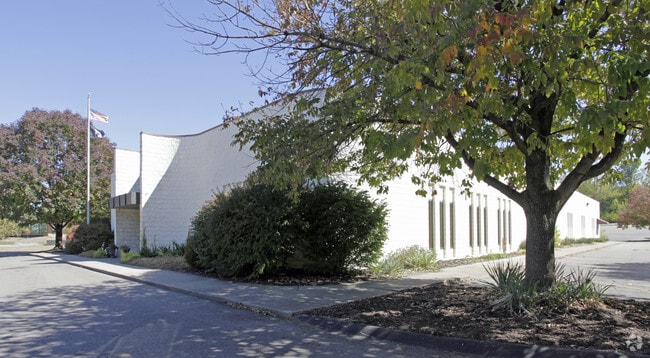
10020 Reading Rd, Cincinnati, OH 45241


Property Detail
10020 Reading Rd
611-0020-0272
ES READING RD 4.5734 ACS28 T4 ER1
Charitableorganization
Hamilton
B and X Area of moderate flood hazard, usually the area between the limits of the 100-year and 500-year floods.
Ohio
0
4.57 AC
2025
Blue Ash
023100
Cincinnati/Dayton
16,000 SF
Cincinnati, OH-KY-IN
NEARBY LISTINGS FOR SALE OR LEASE
-
-
View all Cincinnati listings for sale on LoopNet.com
DEMOGRAPHICS near 10020 Reading Rd
1 mile
3 mile
5 mile
2025 Total Population
2,929
57,511
171,760
2030 Population
2,953
58,015
173,227
Pop Growth 2025-2030
+ 0.82%
+ 0.88%
+ 0.85%
Average Age
45
41
41
2025 Total Households
1,211
24,371
72,187
HH Growth 2025-2030
+ 0.91%
+ 0.85%
+ 0.87%
Median Household Inc
$119,086
$77,348
$77,781
Avg Household Size
2.40
2.30
2.30
2025 Avg HH Vehicles
2.00
2.00
2.00
Median Home Value
$359,090
$261,453
$272,205
Median Year Built
1977
1960
1961
Nearby Places
Map Layers
Map Styles
 Street
 Aerial
Layers
 Traffic
 Biking
Places
Listings with unknown addresses are not visible on the map
- Restaurants
- Banks
- Shops
- Fitness
- Groceries
PUBLIC TRANSPORTATION
AIRPORT
Cincinnati/Northern Kentucky International
Drive
Walk
Distance
Cincinnati/Northern Kentucky International
43 min
25.9 mi
Nearby Properties
Address
Land Use
TOTAL SIZE
Lot Size
Zoning
Address
Land Use
TOTAL SIZE
Lot Size
Zoning
47.52 AC
Address
Land Use
TOTAL SIZE
Lot Size
Zoning
6.03 AC
Address
Land Use
TOTAL SIZE
Lot Size
Zoning
119.08 AC
R1
Address
Land Use
TOTAL SIZE
Lot Size
Zoning
5.78 AC
Address
Land Use
TOTAL SIZE
Lot Size
Zoning
1,238 SF
14.03 AC
Address
Land Use
TOTAL SIZE
Lot Size
Zoning
15.33 AC
Address
Land Use
TOTAL SIZE
Lot Size
Zoning
29.79 AC
M1
Address
Land Use
TOTAL SIZE
Lot Size
Zoning
124.81 AC
Address
Land Use
TOTAL SIZE
Lot Size
Zoning
68.49 AC
Address
Land Use
TOTAL SIZE
Lot Size
Zoning
Address
Land Use
TOTAL SIZE
Lot Size
Zoning
23.45 AC
Address
Land Use
TOTAL SIZE
Lot Size
Zoning
Address
Land Use
TOTAL SIZE
Lot Size
Zoning
Address
Land Use
TOTAL SIZE
Lot Size
Zoning
15.61 AC
Address
Land Use
TOTAL SIZE
Lot Size
Zoning
4,599 SF
29.03 AC
R4
Address
Land Use
TOTAL SIZE
Lot Size
Zoning
8,964 SF
11.61 AC
Address
Land Use
TOTAL SIZE
Lot Size
Zoning
25,098 SF
21.31 AC
Address
Land Use
TOTAL SIZE
Lot Size
Zoning
555 SF
7.20 AC
M1
Address
Land Use
TOTAL SIZE
Lot Size
Zoning
5,085 SF
15.17 AC
Address
Land Use
TOTAL SIZE
Lot Size
Zoning
8.06 AC
Address
Land Use
TOTAL SIZE
Lot Size
Zoning
Address
Land Use
TOTAL SIZE
Lot Size
Zoning
Address
Land Use
TOTAL SIZE
Lot Size
Zoning
3,608 SF
8.05 AC
M1
Address
Land Use
TOTAL SIZE
Lot Size
Zoning
1,788 SF
9.55 AC
M1
Address
Land Use
TOTAL SIZE
Lot Size
Zoning
5.33 AC
Address
Land Use
TOTAL SIZE
Lot Size
Zoning
2.22 AC
Address
Land Use
TOTAL SIZE
Lot Size
Zoning
6,652 SF
15.45 AC
R1
Address
Land Use
TOTAL SIZE
Lot Size
Zoning
8.75 AC
M1
Address
Land Use
TOTAL SIZE
Lot Size
Zoning
16.46 AC
M1
Address
Land Use
TOTAL SIZE
Lot Size
Zoning
12.48 AC
R1
The World's #1 Commercial Real Estate Marketplace
Connect with us
© 2026 CoStar Group
The information above has been obtained from sources believed reliable. While we do not doubt its accuracy we have not verified it and make no guarantee, warranty or representation about it. It is your responsibility to independently confirm its accuracy and completeness. Any projections, opinions, assumptions, or estimates used are for example only and do not represent the current or future performance of the property. The value of this transaction to you depends on tax and other factors which should be evaluated by your tax, financial, and legal advisors. You and your advisors should conduct a careful, independent investigation of the property to determine to your satisfaction the suitability of the property for your needs.