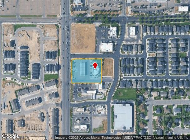
Property Record
10022 N 4800 W, Pleasant Grove, UT 84062

NEARBY LISTINGS FOR SALE OR LEASE
Property Detail
10022 N 4800 W
Provo-Orem, UT
LOT 1, PLAT B, RHINEHART LAND SUB AREA 1.500 AC.
51-696-0001
Utah
Storebuilding
Utah
2024
1
2025
1.50 AC
010210
Utah County
4,929 SF
Salt Lake City
DEMOGRAPHICS near 10022 N 4800 W
1 Mile
3 Mile
5 Mile
2024 Total Population
9,688
70,571
152,827
2029 Population
11,326
82,236
178,443
Pop Growth 2024-2029
+ 16.91%
+ 16.53%
+ 16.76%
Average Age
35
34
33
2024 Total Households
2,447
18,274
42,513
HH Growth 2024-2029
+ 17.37%
+ 16.94%
+ 17.19%
Median Household Inc
$131,649
$121,924
$106,871
Avg Household Size
3.90
3.80
3.60
2024 Avg HH Vehicles
3.00
3.00
3.00
Median Home Value
$610,265
$619,552
$543,002
Median Year Built
2000
2000
2001
Nearby Places
Map Layers
Map Styles
 Street
 Aerial
- Restaurants
- Banks
- Shops
- Fitness
- Groceries
PUBLIC TRANSPORTATION
COMMUTER RAIL
American Fork Station (FrontRunner - Utah Transit Authority (UTA))
DRIVE
WALK
Distance
American Fork Station (FrontRunner - Utah Transit Authority (UTA))
12 min
5.1 mi
Lehi Station (FrontRunner - Utah Transit Authority (UTA))
DRIVE
WALK
Distance
Lehi Station (FrontRunner - Utah Transit Authority (UTA))
14 min
8.5 mi
AIRPORT
Provo Municipal
DRIVE
WALK
Distance
Provo Municipal
26 min
17.5 mi
Salt Lake City International
DRIVE
WALK
Distance
Salt Lake City International
45 min
36.5 mi
Freight Ports
Port of Stockton
DRIVE
WALK
Distance
Port of Stockton
746 min
726.9 mi
Nearby Properties
Address
Land Use
TOTAL SIZE
Lot Size
Zoning
Address
Land Use
TOTAL SIZE
Lot Size
Zoning
165,821 SF
12.29 AC
Address
Land Use
TOTAL SIZE
Lot Size
Zoning
153,790 SF
12.07 AC
Address
Land Use
TOTAL SIZE
Lot Size
Zoning
409,362 SF
29.53 AC
Address
Land Use
TOTAL SIZE
Lot Size
Zoning
134,728 SF
13.07 AC
Address
Land Use
TOTAL SIZE
Lot Size
Zoning
70,213 SF
2.14 AC
Address
Land Use
TOTAL SIZE
Lot Size
Zoning
70,678 SF
4.03 AC
Address
Land Use
TOTAL SIZE
Lot Size
Zoning
41,134 SF
2.05 AC
RR5
Address
Land Use
TOTAL SIZE
Lot Size
Zoning
46,203 SF
4.61 AC
Address
Land Use
TOTAL SIZE
Lot Size
Zoning
47,661 SF
3.62 AC
Address
Land Use
TOTAL SIZE
Lot Size
Zoning
43,345 SF
4.06 AC
Address
Land Use
TOTAL SIZE
Lot Size
Zoning
81,136 SF
1.85 AC
Address
Land Use
TOTAL SIZE
Lot Size
Zoning
32,740 SF
153.49 AC
Address
Land Use
TOTAL SIZE
Lot Size
Zoning
90,581 SF
3.87 AC
Address
Land Use
TOTAL SIZE
Lot Size
Zoning
33,163 SF
1.64 AC
Address
Land Use
TOTAL SIZE
Lot Size
Zoning
37,588 SF
2.38 AC
Address
Land Use
TOTAL SIZE
Lot Size
Zoning
24,070 SF
1.76 AC
Address
Land Use
TOTAL SIZE
Lot Size
Zoning
52,429 SF
2.05 AC
Address
Land Use
TOTAL SIZE
Lot Size
Zoning
47,873 SF
2.24 AC
Address
Land Use
TOTAL SIZE
Lot Size
Zoning
15,094 SF
1.73 AC
Address
Land Use
TOTAL SIZE
Lot Size
Zoning
18,918 SF
1.75 AC
Address
Land Use
TOTAL SIZE
Lot Size
Zoning
44,597 SF
4.26 AC
Address
Land Use
TOTAL SIZE
Lot Size
Zoning
15,319 SF
2.04 AC
Address
Land Use
TOTAL SIZE
Lot Size
Zoning
28,331 SF
5 AC
Address
Land Use
TOTAL SIZE
Lot Size
Zoning
10,251 SF
1.06 AC
Address
Land Use
TOTAL SIZE
Lot Size
Zoning
14,656 SF
1.73 AC
Address
Land Use
TOTAL SIZE
Lot Size
Zoning
27,169 SF
0.52 AC
Address
Land Use
TOTAL SIZE
Lot Size
Zoning
62,013 SF
4.87 AC
Address
Land Use
TOTAL SIZE
Lot Size
Zoning
32,324 SF
2.31 AC
Address
Land Use
TOTAL SIZE
Lot Size
Zoning
21,994 SF
2.04 AC
RR5
Address
Land Use
TOTAL SIZE
Lot Size
Zoning
14,453 SF
1.13 AC
The World's #1 Commercial Real Estate Marketplace
Connect with us
© 2025 CoStar Group
The information above has been obtained from sources believed reliable. While we do not doubt its accuracy we have not verified it and make no guarantee, warranty or representation about it. It is your responsibility to independently confirm its accuracy and completeness. Any projections, opinions, assumptions, or estimates used are for example only and do not represent the current or future performance of the property. The value of this transaction to you depends on tax and other factors which should be evaluated by your tax, financial, and legal advisors. You and your advisors should conduct a careful, independent investigation of the property to determine to your satisfaction the suitability of the property for your needs.