Property Record
State Route 339 S, Fancy Farm, KY 42039
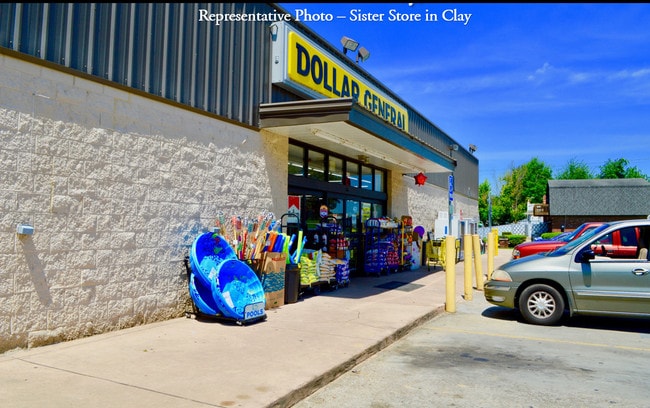


This Property Is For Sale
NEARBY LISTINGS FOR SALE OR LEASE
-
-
View all Fancy Farm listings for sale on LoopNet.com
Property Detail
State Route 339 S
Mayfield, KY
Graves
022.00.00.076.00
Kentucky
Sfr
81 AC
X
Kentucky West Area
21105C0100C
Other Market Areas
3,210 SF
DEMOGRAPHICS near State Route 339 S
1 Mile
3 Mile
5 Mile
2024 Total Population
649
1,349
3,104
2029 Population
640
1,330
3,065
Pop Growth 2024-2029
(1.39%)
(1.41%)
(1.26%)
Average Age
41
41
41
2024 Total Households
256
523
1,188
HH Growth 2024-2029
(1.17%)
(1.34%)
(1.18%)
Median Household Inc
$65,869
$64,200
$60,259
Avg Household Size
2.50
2.60
2.60
2024 Avg HH Vehicles
2.00
2.00
2.00
Median Home Value
$213,265
$197,618
$179,469
Median Year Built
1983
1977
1976
Nearby Places
Map Layers
Map Styles
 Street
 Aerial
- Restaurants
- Banks
- Shops
- Fitness
- Groceries
Nearby Properties
Address
Land Use
TOTAL SIZE
Lot Size
Zoning
Address
Land Use
TOTAL SIZE
Lot Size
Zoning
Address
Land Use
TOTAL SIZE
Lot Size
Zoning
Address
Land Use
TOTAL SIZE
Lot Size
Zoning
Address
Land Use
TOTAL SIZE
Lot Size
Zoning
Address
Land Use
TOTAL SIZE
Lot Size
Zoning
9,100 SF
1.61 AC
Address
Land Use
TOTAL SIZE
Lot Size
Zoning
5,021 SF
19.61 AC
R
Address
Land Use
TOTAL SIZE
Lot Size
Zoning
127 AC
R
Address
Land Use
TOTAL SIZE
Lot Size
Zoning
105 AC
R
Address
Land Use
TOTAL SIZE
Lot Size
Zoning
127 AC
R
Address
Land Use
TOTAL SIZE
Lot Size
Zoning
521 AC
R
Address
Land Use
TOTAL SIZE
Lot Size
Zoning
5.70 AC
RESIDENTIA
Address
Land Use
TOTAL SIZE
Lot Size
Zoning
0.32 AC
R
Address
Land Use
TOTAL SIZE
Lot Size
Zoning
2,518 SF
0.65 AC
RESIDENTIA
Address
Land Use
TOTAL SIZE
Lot Size
Zoning
3,840 SF
1.50 AC
R
Address
Land Use
TOTAL SIZE
Lot Size
Zoning
0.42 AC
R
Address
Land Use
TOTAL SIZE
Lot Size
Zoning
Address
Land Use
TOTAL SIZE
Lot Size
Zoning
116 AC
R
Address
Land Use
TOTAL SIZE
Lot Size
Zoning
50 AC
R
Address
Land Use
TOTAL SIZE
Lot Size
Zoning
52 AC
R
Address
Land Use
TOTAL SIZE
Lot Size
Zoning
Address
Land Use
TOTAL SIZE
Lot Size
Zoning
48 AC
R
Address
Land Use
TOTAL SIZE
Lot Size
Zoning
1,944 SF
0.56 AC
RESIDENTIA
Address
Land Use
TOTAL SIZE
Lot Size
Zoning
11 AC
R
Address
Land Use
TOTAL SIZE
Lot Size
Zoning
Address
Land Use
TOTAL SIZE
Lot Size
Zoning
2,700 SF
7.76 AC
R
Address
Land Use
TOTAL SIZE
Lot Size
Zoning
52 AC
R
Address
Land Use
TOTAL SIZE
Lot Size
Zoning
1,808 SF
2 AC
Address
Land Use
TOTAL SIZE
Lot Size
Zoning
0.57 AC
RESIDENTIA
Address
Land Use
TOTAL SIZE
Lot Size
Zoning
Address
Land Use
TOTAL SIZE
Lot Size
Zoning
40 AC
R
The World's #1 Commercial Real Estate Marketplace
Connect with us
© 2026 CoStar Group
The information above has been obtained from sources believed reliable. While we do not doubt its accuracy we have not verified it and make no guarantee, warranty or representation about it. It is your responsibility to independently confirm its accuracy and completeness. Any projections, opinions, assumptions, or estimates used are for example only and do not represent the current or future performance of the property. The value of this transaction to you depends on tax and other factors which should be evaluated by your tax, financial, and legal advisors. You and your advisors should conduct a careful, independent investigation of the property to determine to your satisfaction the suitability of the property for your needs.