Property Record
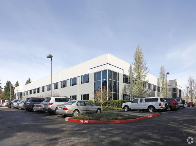
10025 Sw Freeman Dr, Wilsonville, OR 97070


NEARBY LISTINGS FOR SALE OR LEASE
Property Detail
10025 Sw Freeman Dr
Portland-Vancouver-Hillsboro, OR-WA
Charlottes Country Estates 03
00805454
TOWNSHIP 3S RANGE 1W SECTION 11 TAX LOT 03002 SEE RELATED PROPERTIES 03002A1, 03002MA1, 03002MA2
Industrialgeneral
Clackamas
X
Oregon
41067C0609E
3002
2025
20.84 AC
2025
Wilsonville
022707
Portland
DEMOGRAPHICS near 10025 Sw Freeman Dr
1 Mile
3 Mile
5 Mile
2024 Total Population
892
38,692
87,613
2029 Population
909
39,296
88,428
Pop Growth 2024-2029
+ 1.91%
+ 1.56%
+ 0.93%
Average Age
38
40
40
2024 Total Households
337
14,616
33,151
HH Growth 2024-2029
+ 2.08%
+ 1.68%
+ 1.02%
Median Household Inc
$102,439
$105,861
$100,920
Avg Household Size
2.40
2.50
2.60
2024 Avg HH Vehicles
2.00
2.00
2.00
Median Home Value
$578,767
$609,323
$590,266
Median Year Built
2010
1995
1993
Nearby Places
Map Layers
Map Styles
 Street
 Aerial
- Restaurants
- Banks
- Shops
- Fitness
- Groceries
PUBLIC TRANSPORTATION
COMMUTER RAIL
Wilsonville (Westside Express Service - Tri-County Metropolitan Transportation District of Oregon Rail (TriMet Rail))
DRIVE
WALK
Distance
Wilsonville (Westside Express Service - Tri-County Metropolitan Transportation District of Oregon Rail (TriMet Rail))
6 min
2.1 mi
Tualatin (Westside Express Service - Tri-County Metropolitan Transportation District of Oregon Rail (TriMet Rail))
DRIVE
WALK
Distance
Tualatin (Westside Express Service - Tri-County Metropolitan Transportation District of Oregon Rail (TriMet Rail))
9 min
4.5 mi
AIRPORT
Portland International
DRIVE
WALK
Distance
Portland International
43 min
28.3 mi
Freight Ports
Port of Portland
DRIVE
WALK
Distance
Port of Portland
30 min
19.5 mi
Nearby Properties
Address
Land Use
TOTAL SIZE
Lot Size
Zoning
Address
Land Use
TOTAL SIZE
Lot Size
Zoning
23.98 AC
EI
Address
Land Use
TOTAL SIZE
Lot Size
Zoning
508,000 SF
69.72 AC
PFC
Address
Land Use
TOTAL SIZE
Lot Size
Zoning
20.21 AC
FDAHI
Address
Land Use
TOTAL SIZE
Lot Size
Zoning
9.76 AC
PDI
Address
Land Use
TOTAL SIZE
Lot Size
Zoning
54.36 AC
PDI
Address
Land Use
TOTAL SIZE
Lot Size
Zoning
16.18 AC
PDR4
Address
Land Use
TOTAL SIZE
Lot Size
Zoning
21.25 AC
PDR5
Address
Land Use
TOTAL SIZE
Lot Size
Zoning
216,000 SF
64.68 AC
RL
Address
Land Use
TOTAL SIZE
Lot Size
Zoning
Address
Land Use
TOTAL SIZE
Lot Size
Zoning
26.06 AC
PDI
Address
Land Use
TOTAL SIZE
Lot Size
Zoning
24.75 AC
PDI
Address
Land Use
TOTAL SIZE
Lot Size
Zoning
Address
Land Use
TOTAL SIZE
Lot Size
Zoning
18.49 AC
TC
Address
Land Use
TOTAL SIZE
Lot Size
Zoning
24.67 AC
PDR6
Address
Land Use
TOTAL SIZE
Lot Size
Zoning
20.20 AC
PDR6
Address
Land Use
TOTAL SIZE
Lot Size
Zoning
14.44 AC
PDI
Address
Land Use
TOTAL SIZE
Lot Size
Zoning
1,232 SF
27.77 AC
EI
Address
Land Use
TOTAL SIZE
Lot Size
Zoning
26.18 AC
PDI
Address
Land Use
TOTAL SIZE
Lot Size
Zoning
87.02 AC
PDI
Address
Land Use
TOTAL SIZE
Lot Size
Zoning
Address
Land Use
TOTAL SIZE
Lot Size
Zoning
14.05 AC
PDR5
Address
Land Use
TOTAL SIZE
Lot Size
Zoning
3,474 SF
23.31 AC
PDI
Address
Land Use
TOTAL SIZE
Lot Size
Zoning
Address
Land Use
TOTAL SIZE
Lot Size
Zoning
18.55 AC
EI
Address
Land Use
TOTAL SIZE
Lot Size
Zoning
9,918 SF
25.16 AC
PDR5
Address
Land Use
TOTAL SIZE
Lot Size
Zoning
20.89 AC
PDR5
Address
Land Use
TOTAL SIZE
Lot Size
Zoning
12.32 AC
PDR5
Address
Land Use
TOTAL SIZE
Lot Size
Zoning
3.41 AC
PDR4
Address
Land Use
TOTAL SIZE
Lot Size
Zoning
The World's #1 Commercial Real Estate Marketplace
Connect with us
© 2025 CoStar Group
The information above has been obtained from sources believed reliable. While we do not doubt its accuracy we have not verified it and make no guarantee, warranty or representation about it. It is your responsibility to independently confirm its accuracy and completeness. Any projections, opinions, assumptions, or estimates used are for example only and do not represent the current or future performance of the property. The value of this transaction to you depends on tax and other factors which should be evaluated by your tax, financial, and legal advisors. You and your advisors should conduct a careful, independent investigation of the property to determine to your satisfaction the suitability of the property for your needs.