Property Record
1003 Holman Dr, Monroe, OH 45050


Save to a Folder
{{folder.Name}}
{{folder.ListingIds.length}} Properties
{{folder.ListingIds.length}} Property
Create a New Folder
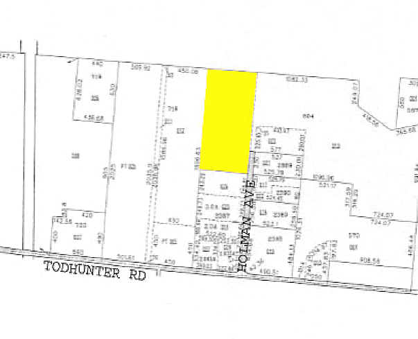
Property Detail
1003 Holman Dr
Cincinnati, OH-KY-IN
804 W 549 OF 804
C1800-001-000-018
BUTLER
Industrialgeneral
Ohio
B and X Area of moderate flood hazard, usually the area between the limits of the 100-year and 500-year floods.
804
2024
12.36 AC
2025
Monroe/Middletown
011200
Cincinnati/Dayton
17,264 SF
NEARBY LISTINGS FOR SALE OR LEASE
DEMOGRAPHICS near 1003 Holman Dr
1 mile
3 mile
5 mile
2025 Total Population
967
38,071
105,032
2030 Population
1,000
39,259
108,328
Pop Growth 2025-2030
+ 3.41%
+ 3.12%
+ 3.14%
Average Age
43
38
39
2025 Total Households
367
14,586
38,777
HH Growth 2025-2030
+ 3.54%
+ 3.20%
+ 3.24%
Median Household Inc
$92,452
$67,332
$75,692
Avg Household Size
2.50
2.50
2.60
2025 Avg HH Vehicles
2.00
2.00
2.00
Median Home Value
$273,683
$224,085
$255,126
Median Year Built
1977
1973
1974
Nearby Places
Map Layers
Map Styles
 Street
 Aerial
Layers
 Traffic
 Biking
Places
Listings with unknown addresses are not visible on the map
- Restaurants
- Banks
- Shops
- Fitness
- Groceries
PUBLIC TRANSPORTATION
AIRPORT
James M Cox Dayton International
Drive
Walk
Distance
James M Cox Dayton International
57 min
39.5 mi
Cincinnati/Northern Kentucky International
Drive
Walk
Distance
Cincinnati/Northern Kentucky International
70 min
46.1 mi
Nearby Properties
Address
Land Use
TOTAL SIZE
Lot Size
Zoning
Address
Land Use
TOTAL SIZE
Lot Size
Zoning
40.03 AC
Address
Land Use
TOTAL SIZE
Lot Size
Zoning
14,558 SF
26.81 AC
Address
Land Use
TOTAL SIZE
Lot Size
Zoning
34.66 AC
Address
Land Use
TOTAL SIZE
Lot Size
Zoning
369,922 SF
28.10 AC
Address
Land Use
TOTAL SIZE
Lot Size
Zoning
746,883 SF
40.03 AC
Address
Land Use
TOTAL SIZE
Lot Size
Zoning
1,380,095 SF
47.11 AC
Address
Land Use
TOTAL SIZE
Lot Size
Zoning
833,210 SF
57.88 AC
Address
Land Use
TOTAL SIZE
Lot Size
Zoning
57.88 AC
Address
Land Use
TOTAL SIZE
Lot Size
Zoning
3,956 SF
186.57 AC
Address
Land Use
TOTAL SIZE
Lot Size
Zoning
99.22 AC
Address
Land Use
TOTAL SIZE
Lot Size
Zoning
334,640 SF
41.28 AC
Address
Land Use
TOTAL SIZE
Lot Size
Zoning
542,679 SF
24.92 AC
Address
Land Use
TOTAL SIZE
Lot Size
Zoning
369,922 SF
28.10 AC
Address
Land Use
TOTAL SIZE
Lot Size
Zoning
189,571 SF
10.79 AC
ADV
Address
Land Use
TOTAL SIZE
Lot Size
Zoning
478,217 SF
61.13 AC
Address
Land Use
TOTAL SIZE
Lot Size
Zoning
612,886 SF
30.51 AC
Address
Land Use
TOTAL SIZE
Lot Size
Zoning
148,762 SF
5.01 AC
Address
Land Use
TOTAL SIZE
Lot Size
Zoning
402,440 SF
25.46 AC
Address
Land Use
TOTAL SIZE
Lot Size
Zoning
93,289 SF
11.43 AC
Address
Land Use
TOTAL SIZE
Lot Size
Zoning
41.28 AC
Address
Land Use
TOTAL SIZE
Lot Size
Zoning
86.47 AC
ADV
Address
Land Use
TOTAL SIZE
Lot Size
Zoning
57,248 SF
224.87 AC
Address
Land Use
TOTAL SIZE
Lot Size
Zoning
235,831 SF
15.01 AC
Address
Land Use
TOTAL SIZE
Lot Size
Zoning
485,080 SF
15.10 AC
Address
Land Use
TOTAL SIZE
Lot Size
Zoning
33,362 SF
0.73 AC
Address
Land Use
TOTAL SIZE
Lot Size
Zoning
371,743 SF
24.58 AC
ADV
Address
Land Use
TOTAL SIZE
Lot Size
Zoning
9,069 SF
115.70 AC
Address
Land Use
TOTAL SIZE
Lot Size
Zoning
142,005 SF
12.06 AC
Address
Land Use
TOTAL SIZE
Lot Size
Zoning
97,550 SF
44 AC
Address
Land Use
TOTAL SIZE
Lot Size
Zoning
166 AC
ADV
The World's #1 Commercial Real Estate Marketplace
Connect with us
© 2026 CoStar Group
The information above has been obtained from sources believed reliable. While we do not doubt its accuracy we have not verified it and make no guarantee, warranty or representation about it. It is your responsibility to independently confirm its accuracy and completeness. Any projections, opinions, assumptions, or estimates used are for example only and do not represent the current or future performance of the property. The value of this transaction to you depends on tax and other factors which should be evaluated by your tax, financial, and legal advisors. You and your advisors should conduct a careful, independent investigation of the property to determine to your satisfaction the suitability of the property for your needs.