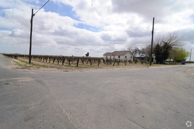
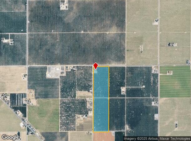
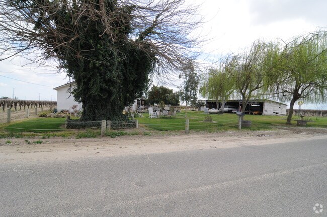
Property Record
10030 S Blythe Ave, Fresno, CA 93706

NEARBY LISTINGS FOR SALE OR LEASE
-
-
View all Fresno listings for sale on LoopNet.com
Property Detail
10030 S Blythe Ave
035-163-01
40 AC W1/2 OF W1/2 OF NE1/4 SEC 35 T15R19
Orchard
Fresno
X
California
06019C2625H
40 AC
2025
W Outlying Fresno County
2025
Fresno
007600
Fresno, CA
2,000 SF
DEMOGRAPHICS near 10030 S Blythe Ave
1 Mile
3 Mile
5 Mile
2024 Total Population
168
2,079
6,039
2029 Population
162
1,994
5,813
Pop Growth 2024-2029
(3.57%)
(4.09%)
(3.74%)
Average Age
34
34
35
2024 Total Households
45
562
1,636
HH Growth 2024-2029
(4.44%)
(4.27%)
(3.85%)
Median Household Inc
$36,875
$46,900
$57,078
Avg Household Size
3.40
3.40
3.50
2024 Avg HH Vehicles
2.00
2.00
2.00
Median Home Value
$221,428
$281,883
$278,546
Median Year Built
1973
1970
1969
Nearby Places
Map Layers
Map Styles
 Street
 Aerial
- Restaurants
- Banks
- Shops
- Fitness
- Groceries
PUBLIC TRANSPORTATION
AIRPORT
Fresno Yosemite International
DRIVE
WALK
Distance
Fresno Yosemite International
34 min
20.6 mi
Freight Ports
Port of Stockton
DRIVE
WALK
Distance
Port of Stockton
174 min
141.9 mi
Nearby Properties
Address
Land Use
TOTAL SIZE
Lot Size
Zoning
Address
Land Use
TOTAL SIZE
Lot Size
Zoning
3,868 SF
39.50 AC
AE20
Address
Land Use
TOTAL SIZE
Lot Size
Zoning
150,670 SF
13.86 AC
AE20
Address
Land Use
TOTAL SIZE
Lot Size
Zoning
1,438 SF
19.32 AC
AE20
Address
Land Use
TOTAL SIZE
Lot Size
Zoning
1,000 SF
19.69 AC
AE20
Address
Land Use
TOTAL SIZE
Lot Size
Zoning
80 AC
AE20
Address
Land Use
TOTAL SIZE
Lot Size
Zoning
672 SF
96.35 AC
AE20
Address
Land Use
TOTAL SIZE
Lot Size
Zoning
26.22 AC
Address
Land Use
TOTAL SIZE
Lot Size
Zoning
1,232 SF
79.40 AC
AE20
Address
Land Use
TOTAL SIZE
Lot Size
Zoning
3,696 SF
37.57 AC
AE20
Address
Land Use
TOTAL SIZE
Lot Size
Zoning
1,348 SF
79.40 AC
AE20
Address
Land Use
TOTAL SIZE
Lot Size
Zoning
39.49 AC
AE20
Address
Land Use
TOTAL SIZE
Lot Size
Zoning
1,908 SF
114.75 AC
Address
Land Use
TOTAL SIZE
Lot Size
Zoning
1,344 SF
38.57 AC
AE20
Address
Land Use
TOTAL SIZE
Lot Size
Zoning
57.96 AC
AE20
Address
Land Use
TOTAL SIZE
Lot Size
Zoning
912 SF
71.37 AC
AE20
Address
Land Use
TOTAL SIZE
Lot Size
Zoning
2,903 SF
28.95 AC
AE20
Address
Land Use
TOTAL SIZE
Lot Size
Zoning
1,118 SF
79.37 AC
AE20
Address
Land Use
TOTAL SIZE
Lot Size
Zoning
1,920 SF
116.58 AC
AE20
Address
Land Use
TOTAL SIZE
Lot Size
Zoning
2,976 SF
4 AC
AE20
Address
Land Use
TOTAL SIZE
Lot Size
Zoning
1,866 SF
39.40 AC
AE20
Address
Land Use
TOTAL SIZE
Lot Size
Zoning
2,360 SF
60 AC
AE20
Address
Land Use
TOTAL SIZE
Lot Size
Zoning
40 AC
AE20
Address
Land Use
TOTAL SIZE
Lot Size
Zoning
968 SF
40 AC
AE20
Address
Land Use
TOTAL SIZE
Lot Size
Zoning
1,760 SF
45 AC
AE20
Address
Land Use
TOTAL SIZE
Lot Size
Zoning
1,178 SF
156.30 AC
AE20
Address
Land Use
TOTAL SIZE
Lot Size
Zoning
3,499 SF
104.45 AC
AE20
Address
Land Use
TOTAL SIZE
Lot Size
Zoning
33.64 AC
AE20
Address
Land Use
TOTAL SIZE
Lot Size
Zoning
5,334 SF
100 AC
AE20
Address
Land Use
TOTAL SIZE
Lot Size
Zoning
1,156 SF
19.62 AC
AE20
The World's #1 Commercial Real Estate Marketplace
Connect with us
© 2026 CoStar Group
The information above has been obtained from sources believed reliable. While we do not doubt its accuracy we have not verified it and make no guarantee, warranty or representation about it. It is your responsibility to independently confirm its accuracy and completeness. Any projections, opinions, assumptions, or estimates used are for example only and do not represent the current or future performance of the property. The value of this transaction to you depends on tax and other factors which should be evaluated by your tax, financial, and legal advisors. You and your advisors should conduct a careful, independent investigation of the property to determine to your satisfaction the suitability of the property for your needs.