Property Record
1004 76Th St, North Bergen, NJ 07047


Save to a Folder
{{folder.Name}}
{{folder.ListingIds.length}} Properties
{{folder.ListingIds.length}} Property
Create a New Folder
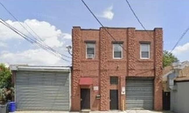
Property Detail
1004 76Th St
08-00320-0000-00010
Hudson
Warehouse
New Jersey
R1
10
B and X Area of moderate flood hazard, usually the area between the limits of the 100-year and 500-year floods.
0.12 AC
2025
Secaucus/North Bergen
2026
Northern New Jersey
014300
New York-Jersey City-White Plains, NY-NJ
7,380 SF
NEARBY LISTINGS FOR SALE OR LEASE
DEMOGRAPHICS near 1004 76Th St
1 mile
3 mile
5 mile
2025 Total Population
75,004
591,772
1,920,956
2030 Population
78,007
618,353
2,008,076
Pop Growth 2025-2030
+ 4.00%
+ 4.49%
+ 4.54%
Average Age
41
42
41
2025 Total Households
27,802
258,594
874,020
HH Growth 2025-2030
+ 4.38%
+ 4.83%
+ 4.93%
Median Household Inc
$68,349
$102,703
$100,221
Avg Household Size
2.60
2.10
2.10
2025 Avg HH Vehicles
1.00
1.00
.00
Median Home Value
$466,493
$832,555
$849,584
Median Year Built
1959
1955
1959
Nearby Places
Map Layers
Map Styles
 Street
 Aerial
Layers
 Traffic
 Biking
Places
Listings with unknown addresses are not visible on the map
- Restaurants
- Banks
- Shops
- Fitness
- Groceries
PUBLIC TRANSPORTATION
COMMUTER RAIL
New York Penn Station (Njt) (Babylon Branch - Long Island Rail Road, Far Rockaway Branch - Long Island Rail Road, Hempstead Branch - Long Island Rail Road, Long Beach Branch - Long Island Rail Road, Montauk Branch - Long Island Rail Road, Montclair-Boonton Line - Long Island Rail Road, Morris & Essex Gladstone Branch - Long Island Rail Road, Morris & Essex Morristown Line - Long Island Rail Road, North Jersey Coast Line - Long Island Rail Road, Northeast Corridor Line - Long Island Rail Road, Port Jefferson Branch - Long Island Rail Road, Port Washington Branch - Long Island Rail Road, Ronkonkoma Branch - Long Island Rail Road, West Hempstead Branch - Long Island Rail Road)
Drive
Walk
Distance
New York Penn Station (Njt) (Babylon Branch - Long Island Rail Road, Far Rockaway Branch - Long Island Rail Road, Hempstead Branch - Long Island Rail Road, Long Beach Branch - Long Island Rail Road, Montauk Branch - Long Island Rail Road, Montclair-Boonton Line - Long Island Rail Road, Morris & Essex Gladstone Branch - Long Island Rail Road, Morris & Essex Morristown Line - Long Island Rail Road, North Jersey Coast Line - Long Island Rail Road, Northeast Corridor Line - Long Island Rail Road, Port Jefferson Branch - Long Island Rail Road, Port Washington Branch - Long Island Rail Road, Ronkonkoma Branch - Long Island Rail Road, West Hempstead Branch - Long Island Rail Road)
16 min
6.5 mi
Ny Moynihan Train Hall At Penn Station (Crescent - Amtrak, Ethan Allen Express - Amtrak, Keystone Service - Amtrak, Lake Shore Limited - Amtrak, Northeast Regional - Amtrak)
Drive
Walk
Distance
Ny Moynihan Train Hall At Penn Station (Crescent - Amtrak, Ethan Allen Express - Amtrak, Keystone Service - Amtrak, Lake Shore Limited - Amtrak, Northeast Regional - Amtrak)
17 min
6.7 mi
AIRPORT
Newark Liberty International
Drive
Walk
Distance
Newark Liberty International
16 min
13.0 mi
LaGuardia
Drive
Walk
Distance
LaGuardia
28 min
16.3 mi
John F Kennedy International
Drive
Walk
Distance
John F Kennedy International
39 min
27.4 mi
Freight Ports
NY - Red Hook Container Terminal
Drive
Walk
Distance
NY - Red Hook Container Terminal
26 min
13.0 mi
SALE & LEASE HISTORY
LISTING DATE
SALE/LEASE

Jul 27, 2025
For Sale
Nearby Properties
Address
Land Use
TOTAL SIZE
Lot Size
Zoning
Address
Land Use
TOTAL SIZE
Lot Size
Zoning
1,233,684 SF
16.94 AC
PARK
Address
Land Use
TOTAL SIZE
Lot Size
Zoning
Address
Land Use
TOTAL SIZE
Lot Size
Zoning
264,420 SF
7.26 AC
C4-7
Address
Land Use
TOTAL SIZE
Lot Size
Zoning
637,863 SF
C6-6
Address
Land Use
TOTAL SIZE
Lot Size
Zoning
366,455 SF
3.23 AC
R
Address
Land Use
TOTAL SIZE
Lot Size
Zoning
174 AC
P2
Address
Land Use
TOTAL SIZE
Lot Size
Zoning
Address
Land Use
TOTAL SIZE
Lot Size
Zoning
Address
Land Use
TOTAL SIZE
Lot Size
Zoning
Address
Land Use
TOTAL SIZE
Lot Size
Zoning
Address
Land Use
TOTAL SIZE
Lot Size
Zoning
843,564 SF
1.07 AC
C6-4
Address
Land Use
TOTAL SIZE
Lot Size
Zoning
1,368,870 SF
16.86 AC
R8
Address
Land Use
TOTAL SIZE
Lot Size
Zoning
555 SF
4.89 AC
H
Address
Land Use
TOTAL SIZE
Lot Size
Zoning
1,112,096 SF
1.97 AC
C4-7
Address
Land Use
TOTAL SIZE
Lot Size
Zoning
1,025,320 SF
4.47 AC
C4-7
Address
Land Use
TOTAL SIZE
Lot Size
Zoning
418,593 SF
C6-6
Address
Land Use
TOTAL SIZE
Lot Size
Zoning
600,000 SF
3.06 AC
M1-5
Address
Land Use
TOTAL SIZE
Lot Size
Zoning
437,396 SF
1.32 AC
C4-7
Address
Land Use
TOTAL SIZE
Lot Size
Zoning
1,670,868 SF
9.14 AC
R8
Address
Land Use
TOTAL SIZE
Lot Size
Zoning
360,120 SF
2.26 AC
C4-7
Address
Land Use
TOTAL SIZE
Lot Size
Zoning
35.58 AC
I
Address
Land Use
TOTAL SIZE
Lot Size
Zoning
7.64 AC
Address
Land Use
TOTAL SIZE
Lot Size
Zoning
45.60 AC
Address
Land Use
TOTAL SIZE
Lot Size
Zoning
68.93 AC
Address
Land Use
TOTAL SIZE
Lot Size
Zoning
553,431 SF
0.32 AC
C6-6
Address
Land Use
TOTAL SIZE
Lot Size
Zoning
749,133 SF
2.31 AC
C6-2
Address
Land Use
TOTAL SIZE
Lot Size
Zoning
131 SF
RMF
Address
Land Use
TOTAL SIZE
Lot Size
Zoning
240,000 SF
5.26 AC
R
Address
Land Use
TOTAL SIZE
Lot Size
Zoning
12.99 AC
OR1
Address
Land Use
TOTAL SIZE
Lot Size
Zoning
478,842 SF
3.56 AC
C6-1
The World's #1 Commercial Real Estate Marketplace
Connect with us
© 2026 CoStar Group
The information above has been obtained from sources believed reliable. While we do not doubt its accuracy we have not verified it and make no guarantee, warranty or representation about it. It is your responsibility to independently confirm its accuracy and completeness. Any projections, opinions, assumptions, or estimates used are for example only and do not represent the current or future performance of the property. The value of this transaction to you depends on tax and other factors which should be evaluated by your tax, financial, and legal advisors. You and your advisors should conduct a careful, independent investigation of the property to determine to your satisfaction the suitability of the property for your needs.