Property Record
1004 E 12Th Ave, Emporia, KS 66801
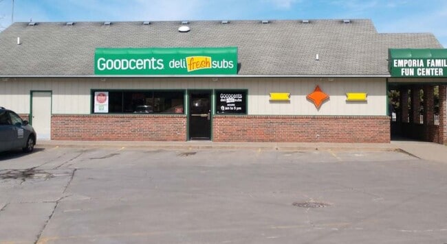
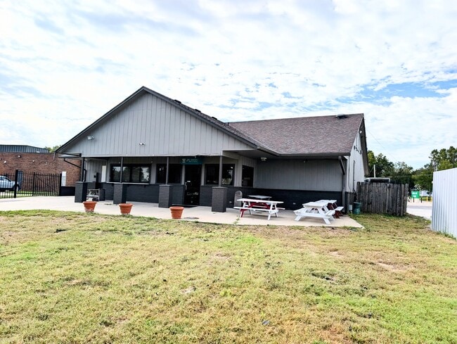
This Property Is For Sale
NEARBY LISTINGS FOR SALE OR LEASE
Property Detail
1004 E 12Th Ave
191-11-0-20-05-005.00-0
Emporia Tr
Storebuilding
S11, T19S, R11E, ACRES 1.6, BEG 1500.55W & 392.95N SE COR NW1/4 N66 SE365(S) S178(S) W150 S190 W20 S10 W71.1 N363.16 W122 TO
X
Lyon
20111C0241E
Kansas
2024
1.66 AC
2025
Kansas Area
000103
Other Market Areas
2,472 SF
Emporia, KS
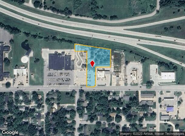
DEMOGRAPHICS near 1004 E 12Th Ave
1 Mile
3 Mile
5 Mile
2024 Total Population
7,873
22,991
25,472
2029 Population
7,852
22,764
25,194
Pop Growth 2024-2029
(0.27%)
(0.99%)
(1.09%)
Average Age
33
37
37
2024 Total Households
3,266
9,455
10,408
HH Growth 2024-2029
(0.24%)
(1.03%)
(1.12%)
Median Household Inc
$35,357
$46,243
$49,192
Avg Household Size
2.10
2.30
2.30
2024 Avg HH Vehicles
2.00
2.00
2.00
Median Home Value
$103,299
$111,242
$121,678
Median Year Built
1966
1966
1968
Nearby Places
Map Layers
Map Styles
 Street
 Aerial
- Restaurants
- Banks
- Shops
- Fitness
- Groceries
Nearby Properties
Address
Land Use
TOTAL SIZE
Lot Size
Zoning
Address
Land Use
TOTAL SIZE
Lot Size
Zoning
97,645 SF
116.32 AC
P
Address
Land Use
TOTAL SIZE
Lot Size
Zoning
91,154 SF
2.28 AC
R3
Address
Land Use
TOTAL SIZE
Lot Size
Zoning
60,239 SF
23.20 AC
P
Address
Land Use
TOTAL SIZE
Lot Size
Zoning
2,816 SF
10.57 AC
P
Address
Land Use
TOTAL SIZE
Lot Size
Zoning
102,522 SF
1.12 AC
P
Address
Land Use
TOTAL SIZE
Lot Size
Zoning
224,765 SF
10.51 AC
Address
Land Use
TOTAL SIZE
Lot Size
Zoning
530,015 SF
81.05 AC
I1
Address
Land Use
TOTAL SIZE
Lot Size
Zoning
36,648 SF
79.21 AC
P
Address
Land Use
TOTAL SIZE
Lot Size
Zoning
5,237 SF
41.81 AC
P
Address
Land Use
TOTAL SIZE
Lot Size
Zoning
11,743 SF
4.63 AC
P
Address
Land Use
TOTAL SIZE
Lot Size
Zoning
574,171 SF
81.36 AC
I1
Address
Land Use
TOTAL SIZE
Lot Size
Zoning
58,193 SF
7.90 AC
P
Address
Land Use
TOTAL SIZE
Lot Size
Zoning
34,403 SF
1.12 AC
P
Address
Land Use
TOTAL SIZE
Lot Size
Zoning
28,336 SF
0.37 AC
C4
Address
Land Use
TOTAL SIZE
Lot Size
Zoning
44,449 SF
3.90 AC
P
Address
Land Use
TOTAL SIZE
Lot Size
Zoning
0.92 AC
Address
Land Use
TOTAL SIZE
Lot Size
Zoning
23,316 SF
0.45 AC
R3
Address
Land Use
TOTAL SIZE
Lot Size
Zoning
63,004 SF
2.25 AC
P
Address
Land Use
TOTAL SIZE
Lot Size
Zoning
36,530 SF
7.08 AC
P
Address
Land Use
TOTAL SIZE
Lot Size
Zoning
16,800 SF
5.95 AC
AL
Address
Land Use
TOTAL SIZE
Lot Size
Zoning
25,596 SF
6.50 AC
R3
Address
Land Use
TOTAL SIZE
Lot Size
Zoning
2,450 SF
41 AC
AL
Address
Land Use
TOTAL SIZE
Lot Size
Zoning
382,437 SF
111.11 AC
I1
Address
Land Use
TOTAL SIZE
Lot Size
Zoning
393,475 SF
46.76 AC
I2
Address
Land Use
TOTAL SIZE
Lot Size
Zoning
7,058 SF
27.91 AC
I2
Address
Land Use
TOTAL SIZE
Lot Size
Zoning
13,600 SF
6.86 AC
R1
Address
Land Use
TOTAL SIZE
Lot Size
Zoning
6,924 SF
3.92 AC
R1
Address
Land Use
TOTAL SIZE
Lot Size
Zoning
8,771 SF
3.23 AC
Address
Land Use
TOTAL SIZE
Lot Size
Zoning
35,710 SF
2.57 AC
P
Address
Land Use
TOTAL SIZE
Lot Size
Zoning
32,799 SF
0.90 AC
C4
The World's #1 Commercial Real Estate Marketplace
Connect with us
© 2025 CoStar Group
The information above has been obtained from sources believed reliable. While we do not doubt its accuracy we have not verified it and make no guarantee, warranty or representation about it. It is your responsibility to independently confirm its accuracy and completeness. Any projections, opinions, assumptions, or estimates used are for example only and do not represent the current or future performance of the property. The value of this transaction to you depends on tax and other factors which should be evaluated by your tax, financial, and legal advisors. You and your advisors should conduct a careful, independent investigation of the property to determine to your satisfaction the suitability of the property for your needs.