Property Record
10045 Baltimore National Pike, Ellicott City, MD 21042


NEARBY LISTINGS FOR SALE OR LEASE
Property Detail
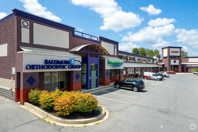
10045 Baltimore National Pike
Baltimore-Columbia-Towson, MD
Stavlas Route 40 Bus Park
02-394928
LOT A-2 3.08 A. 10045 BALTIMORE NATIONAL STAVLAS ROUTE 40 BUSINES
Communitycenter
Howard
X
Maryland
24013C0450D
a2
2024
3.08 AC
2025
Ellicott City
602304
Baltimore
38,550 SF
DEMOGRAPHICS near 10045 Baltimore National Pike
1 Mile
3 Mile
5 Mile
2024 Total Population
7,931
57,874
137,866
2029 Population
8,098
59,498
141,095
Pop Growth 2024-2029
+ 2.11%
+ 2.81%
+ 2.34%
Average Age
41
42
41
2024 Total Households
2,570
20,452
51,602
HH Growth 2024-2029
+ 2.10%
+ 2.92%
+ 2.42%
Median Household Inc
$178,130
$137,649
$126,411
Avg Household Size
3.10
2.80
2.60
2024 Avg HH Vehicles
2.00
2.00
2.00
Median Home Value
$711,583
$666,942
$580,464
Median Year Built
1983
1987
1985
Nearby Places
Map Layers
Map Styles
 Street
 Aerial
- Restaurants
- Banks
- Shops
- Fitness
- Groceries
PUBLIC TRANSPORTATION
AIRPORT
Baltimore/Washington International Thurgood Marshall
DRIVE
WALK
Distance
Baltimore/Washington International Thurgood Marshall
28 min
18.5 mi
Ronald Reagan Washington Ntl
DRIVE
WALK
Distance
Ronald Reagan Washington Ntl
59 min
37.1 mi
Freight Ports
Port of Baltimore
DRIVE
WALK
Distance
Port of Baltimore
29 min
16.9 mi
SALE & LEASE HISTORY
LISTING DATE
SALE/LEASE

Sep 25, 2016
For Lease
Jul 03, 2019
For Lease
Nearby Properties
Address
Land Use
TOTAL SIZE
Lot Size
Zoning
Address
Land Use
TOTAL SIZE
Lot Size
Zoning
33,342 SF
94.97 AC
RA15
Address
Land Use
TOTAL SIZE
Lot Size
Zoning
1,930 SF
49.68 AC
PSC
Address
Land Use
TOTAL SIZE
Lot Size
Zoning
279,539 SF
68.15 AC
R20
Address
Land Use
TOTAL SIZE
Lot Size
Zoning
36,399 SF
25.30 AC
RA15
Address
Land Use
TOTAL SIZE
Lot Size
Zoning
279,539 SF
46.77 AC
R20
Address
Land Use
TOTAL SIZE
Lot Size
Zoning
237,128 SF
24.77 AC
B2
Address
Land Use
TOTAL SIZE
Lot Size
Zoning
204,875 SF
5.81 AC
POR
Address
Land Use
TOTAL SIZE
Lot Size
Zoning
132,865 SF
27.08 AC
SC
Address
Land Use
TOTAL SIZE
Lot Size
Zoning
16,651 SF
11.65 AC
NT
Address
Land Use
TOTAL SIZE
Lot Size
Zoning
166,406 SF
11.22 AC
R20
Address
Land Use
TOTAL SIZE
Lot Size
Zoning
58,644 SF
31.75 AC
B2
Address
Land Use
TOTAL SIZE
Lot Size
Zoning
15,128 SF
10.21 AC
RA15
Address
Land Use
TOTAL SIZE
Lot Size
Zoning
117,444 SF
19.97 AC
POR
Address
Land Use
TOTAL SIZE
Lot Size
Zoning
91,716 SF
15.07 AC
POR
Address
Land Use
TOTAL SIZE
Lot Size
Zoning
14,838 SF
14.40 AC
RA15
Address
Land Use
TOTAL SIZE
Lot Size
Zoning
1,163 SF
4.49 AC
TOD
Address
Land Use
TOTAL SIZE
Lot Size
Zoning
117,518 SF
22.27 AC
RSC
Address
Land Use
TOTAL SIZE
Lot Size
Zoning
41,286 SF
12.62 AC
RA15
Address
Land Use
TOTAL SIZE
Lot Size
Zoning
23,932 SF
11.34 AC
RA15
Address
Land Use
TOTAL SIZE
Lot Size
Zoning
48,654 SF
11.36 AC
PGCC
Address
Land Use
TOTAL SIZE
Lot Size
Zoning
40,850 SF
8.43 AC
B2
Address
Land Use
TOTAL SIZE
Lot Size
Zoning
66,350 SF
15.88 AC
R20
Address
Land Use
TOTAL SIZE
Lot Size
Zoning
8,208 SF
5.09 AC
RA15
Address
Land Use
TOTAL SIZE
Lot Size
Zoning
14,328 SF
14.18 AC
PGCC
Address
Land Use
TOTAL SIZE
Lot Size
Zoning
23,431 SF
11.27 AC
SC
Address
Land Use
TOTAL SIZE
Lot Size
Zoning
103,650 SF
9.61 AC
SC
Address
Land Use
TOTAL SIZE
Lot Size
Zoning
22,204 SF
9.79 AC
NT
Address
Land Use
TOTAL SIZE
Lot Size
Zoning
118,125 SF
1.59 AC
M1
Address
Land Use
TOTAL SIZE
Lot Size
Zoning
86,390 SF
4.07 AC
POR
Address
Land Use
TOTAL SIZE
Lot Size
Zoning
100,256 SF
16.29 AC
R20
The World's #1 Commercial Real Estate Marketplace
Connect with us
© 2026 CoStar Group
The information above has been obtained from sources believed reliable. While we do not doubt its accuracy we have not verified it and make no guarantee, warranty or representation about it. It is your responsibility to independently confirm its accuracy and completeness. Any projections, opinions, assumptions, or estimates used are for example only and do not represent the current or future performance of the property. The value of this transaction to you depends on tax and other factors which should be evaluated by your tax, financial, and legal advisors. You and your advisors should conduct a careful, independent investigation of the property to determine to your satisfaction the suitability of the property for your needs.