Property Record
10046 Highway 78, Ladson, SC 29456
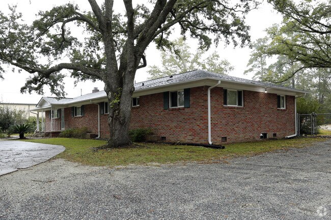


Property Detail
10046 Highway 78
242-00-02-026
ASSESSMENT DISTRICT: 946GARAGES (SMALL)SECT 14 PG 31
Officebuilding
Berkeley
BERKELEY C
South Carolina
B and X Area of moderate flood hazard, usually the area between the limits of the 100-year and 500-year floods.
3
2025
1 AC
2025
Outlying Berkeley County
020716
Charleston/N Charleston
2,220 SF
Charleston-North Charleston, SC
NEARBY LISTINGS FOR SALE OR LEASE
DEMOGRAPHICS near 10046 Highway 78
1 mile
3 mile
5 mile
2025 Total Population
5,774
62,550
169,535
2030 Population
6,214
68,501
185,253
Pop Growth 2025-2030
+ 7.62%
+ 9.51%
+ 9.27%
Average Age
38
38
38
2025 Total Households
2,067
23,820
65,624
HH Growth 2025-2030
+ 7.93%
+ 9.74%
+ 9.57%
Median Household Inc
$64,555
$81,285
$80,308
Avg Household Size
2.70
2.60
2.50
2025 Avg HH Vehicles
2.00
2.00
2.00
Median Home Value
$225,224
$288,708
$314,238
Median Year Built
1988
2000
2000
Nearby Places
Map Layers
Map Styles
 Street
 Aerial
Layers
 Traffic
 Biking
Places
Listings with unknown addresses are not visible on the map
- Restaurants
- Banks
- Shops
- Fitness
- Groceries
PUBLIC TRANSPORTATION
AIRPORT
Charleston AFB/International
Drive
Walk
Distance
Charleston AFB/International
22 min
14.7 mi
Freight Ports
North Charleston Terminal
Drive
Walk
Distance
North Charleston Terminal
18 min
11.9 mi
SALE & LEASE HISTORY
LISTING DATE
SALE/LEASE

Nov 13, 2018
For Lease
Jun 15, 2020
For Lease
Jul 09, 2020
For Sale
Nearby Properties
Address
Land Use
TOTAL SIZE
Lot Size
Zoning
Address
Land Use
TOTAL SIZE
Lot Size
Zoning
182,112 SF
38.64 AC
Address
Land Use
TOTAL SIZE
Lot Size
Zoning
152,460 SF
26.94 AC
Address
Land Use
TOTAL SIZE
Lot Size
Zoning
28,770 SF
15.53 AC
Address
Land Use
TOTAL SIZE
Lot Size
Zoning
Address
Land Use
TOTAL SIZE
Lot Size
Zoning
14.33 AC
Address
Land Use
TOTAL SIZE
Lot Size
Zoning
181,427 SF
16.47 AC
Address
Land Use
TOTAL SIZE
Lot Size
Zoning
194,515 SF
26.73 AC
Address
Land Use
TOTAL SIZE
Lot Size
Zoning
Address
Land Use
TOTAL SIZE
Lot Size
Zoning
124,678 SF
65.93 AC
Address
Land Use
TOTAL SIZE
Lot Size
Zoning
112.78 AC
Address
Land Use
TOTAL SIZE
Lot Size
Zoning
Address
Land Use
TOTAL SIZE
Lot Size
Zoning
3.71 AC
Address
Land Use
TOTAL SIZE
Lot Size
Zoning
25,014 SF
39.48 AC
BERKELEY C
Address
Land Use
TOTAL SIZE
Lot Size
Zoning
22.80 AC
Address
Land Use
TOTAL SIZE
Lot Size
Zoning
1,332 SF
21.31 AC
Address
Land Use
TOTAL SIZE
Lot Size
Zoning
1,350 SF
25.78 AC
Address
Land Use
TOTAL SIZE
Lot Size
Zoning
20,500 SF
1.63 AC
Address
Land Use
TOTAL SIZE
Lot Size
Zoning
299,616 SF
26.90 AC
R-4_DC
Address
Land Use
TOTAL SIZE
Lot Size
Zoning
3,960 SF
5.51 AC
Address
Land Use
TOTAL SIZE
Lot Size
Zoning
17,272 SF
3.02 AC
Address
Land Use
TOTAL SIZE
Lot Size
Zoning
8,442 SF
16.01 AC
BERKELEY C
Address
Land Use
TOTAL SIZE
Lot Size
Zoning
16.56 AC
Address
Land Use
TOTAL SIZE
Lot Size
Zoning
37.71 AC
Address
Land Use
TOTAL SIZE
Lot Size
Zoning
7,452 SF
17.87 AC
Address
Land Use
TOTAL SIZE
Lot Size
Zoning
Address
Land Use
TOTAL SIZE
Lot Size
Zoning
71,044 SF
8.05 AC
BERKELEY C
Address
Land Use
TOTAL SIZE
Lot Size
Zoning
511,092 SF
53.35 AC
GOOSE CREE
Address
Land Use
TOTAL SIZE
Lot Size
Zoning
7,234 SF
14.50 AC
Address
Land Use
TOTAL SIZE
Lot Size
Zoning
18.44 AC
Address
Land Use
TOTAL SIZE
Lot Size
Zoning
6,930 SF
4.36 AC
The World's #1 Commercial Real Estate Marketplace
Connect with us
© 2026 CoStar Group
The information above has been obtained from sources believed reliable. While we do not doubt its accuracy we have not verified it and make no guarantee, warranty or representation about it. It is your responsibility to independently confirm its accuracy and completeness. Any projections, opinions, assumptions, or estimates used are for example only and do not represent the current or future performance of the property. The value of this transaction to you depends on tax and other factors which should be evaluated by your tax, financial, and legal advisors. You and your advisors should conduct a careful, independent investigation of the property to determine to your satisfaction the suitability of the property for your needs.