Property Record
1005 Crossing Dr, Delano, MN 55328
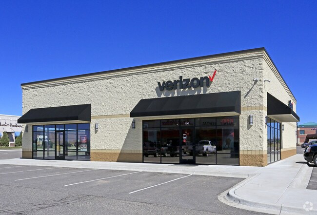

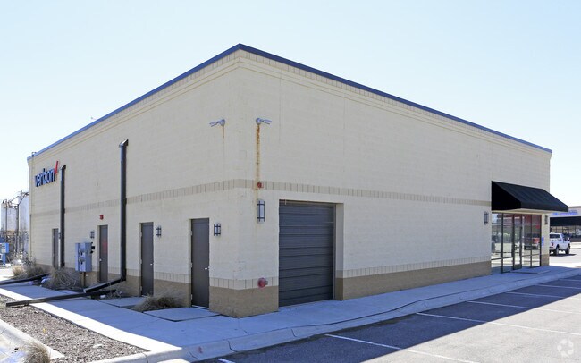

Property Detail
1005 Crossing Dr
Minneapolis/St Paul
SECT-12 TWP-118 RANGE-025 DELANO WEST CROSSING LOT-003 BLOCK-001 EX E118.00FT -001 EX E118.00FT
Minneapolis-St. Paul-Bloomington, MN-WI
Wright
107-101-001030
Minnesota
Realpropertynec
3
2026
1.69 AC
2025
Wright County
101002
NEARBY LISTINGS FOR SALE OR LEASE
-
-
View all Delano listings for sale on LoopNet.com
DEMOGRAPHICS near 1005 Crossing Dr
1 mile
3 mile
5 mile
2025 Total Population
3,600
9,717
18,878
2030 Population
3,872
10,498
20,207
Pop Growth 2025-2030
+ 7.56%
+ 8.04%
+ 7.04%
Average Age
43
39
40
2025 Total Households
1,416
3,433
6,863
HH Growth 2025-2030
+ 7.70%
+ 8.10%
+ 7.17%
Median Household Inc
$97,577
$113,909
$111,250
Avg Household Size
2.40
2.80
2.70
2025 Avg HH Vehicles
2.00
2.00
2.00
Median Home Value
$344,836
$408,511
$391,303
Median Year Built
1990
1995
1994
Nearby Places
Map Layers
Map Styles
 Street
 Aerial
Layers
 Traffic
 Biking
Places
Listings with unknown addresses are not visible on the map
- Restaurants
- Banks
- Shops
- Fitness
- Groceries
PUBLIC TRANSPORTATION
AIRPORT
Minneapolis-St Paul International/Wold-Chamberlain
Drive
Walk
Distance
Minneapolis-St Paul International/Wold-Chamberlain
51 min
36.3 mi
Freight Ports
Port Milwaukee
Drive
Walk
Distance
Port Milwaukee
410 min
365.3 mi
SALE & LEASE HISTORY
LISTING DATE
SALE/LEASE

Sep 25, 2016
For Lease
Jul 01, 2018
For Sale
Nearby Properties
Address
Land Use
TOTAL SIZE
Lot Size
Zoning
Address
Land Use
TOTAL SIZE
Lot Size
Zoning
73.93 AC
Address
Land Use
TOTAL SIZE
Lot Size
Zoning
2.42 AC
Address
Land Use
TOTAL SIZE
Lot Size
Zoning
45.40 AC
Address
Land Use
TOTAL SIZE
Lot Size
Zoning
1.43 AC
Address
Land Use
TOTAL SIZE
Lot Size
Zoning
29.60 AC
Address
Land Use
TOTAL SIZE
Lot Size
Zoning
8.75 AC
Address
Land Use
TOTAL SIZE
Lot Size
Zoning
12.85 AC
Address
Land Use
TOTAL SIZE
Lot Size
Zoning
35.30 AC
Address
Land Use
TOTAL SIZE
Lot Size
Zoning
135,530 SF
8.57 AC
Address
Land Use
TOTAL SIZE
Lot Size
Zoning
5.87 AC
Address
Land Use
TOTAL SIZE
Lot Size
Zoning
Address
Land Use
TOTAL SIZE
Lot Size
Zoning
5.71 AC
Address
Land Use
TOTAL SIZE
Lot Size
Zoning
6.72 AC
Address
Land Use
TOTAL SIZE
Lot Size
Zoning
33,518 SF
4.79 AC
Address
Land Use
TOTAL SIZE
Lot Size
Zoning
108,277 SF
5.62 AC
Address
Land Use
TOTAL SIZE
Lot Size
Zoning
58,465 SF
8.50 AC
Address
Land Use
TOTAL SIZE
Lot Size
Zoning
19,849 SF
2.83 AC
Address
Land Use
TOTAL SIZE
Lot Size
Zoning
10.85 AC
Address
Land Use
TOTAL SIZE
Lot Size
Zoning
3.11 AC
Address
Land Use
TOTAL SIZE
Lot Size
Zoning
57,715 SF
3.84 AC
Address
Land Use
TOTAL SIZE
Lot Size
Zoning
17,597 SF
2.52 AC
Address
Land Use
TOTAL SIZE
Lot Size
Zoning
23,238 SF
14.84 AC
Address
Land Use
TOTAL SIZE
Lot Size
Zoning
Address
Land Use
TOTAL SIZE
Lot Size
Zoning
0.95 AC
Address
Land Use
TOTAL SIZE
Lot Size
Zoning
58,320 SF
2.95 AC
Address
Land Use
TOTAL SIZE
Lot Size
Zoning
Address
Land Use
TOTAL SIZE
Lot Size
Zoning
28,920 SF
3.88 AC
Address
Land Use
TOTAL SIZE
Lot Size
Zoning
14,936 SF
1.58 AC
Address
Land Use
TOTAL SIZE
Lot Size
Zoning
29,997 SF
2 AC
Address
Land Use
TOTAL SIZE
Lot Size
Zoning
1.74 AC
The World's #1 Commercial Real Estate Marketplace
Connect with us
© 2026 CoStar Group
The information above has been obtained from sources believed reliable. While we do not doubt its accuracy we have not verified it and make no guarantee, warranty or representation about it. It is your responsibility to independently confirm its accuracy and completeness. Any projections, opinions, assumptions, or estimates used are for example only and do not represent the current or future performance of the property. The value of this transaction to you depends on tax and other factors which should be evaluated by your tax, financial, and legal advisors. You and your advisors should conduct a careful, independent investigation of the property to determine to your satisfaction the suitability of the property for your needs.