Property Record
1005 E Strub Rd, Sandusky, OH 44870


Property Detail
1005 E Strub Rd
Sandusky, OH
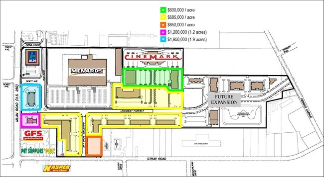
SEC 2 LOT 40 & 41 N SIDE STRUB RD 1.0032A
32-03356-004
Erie
Commercialnec
Ohio
B and X Area of moderate flood hazard, usually the area between the limits of the 100-year and 500-year floods.
40&41
2025
1 AC
2025
Erie County
041400
Cleveland
5,000 SF
NEARBY LISTINGS FOR SALE OR LEASE
DEMOGRAPHICS near 1005 E Strub Rd
1 mile
3 mile
5 mile
2025 Total Population
4,625
32,077
38,972
2030 Population
4,536
31,566
38,403
Pop Growth 2025-2030
(1.92%)
(1.59%)
(1.46%)
Average Age
45
43
43
2025 Total Households
1,752
13,481
16,535
HH Growth 2025-2030
(2.45%)
(1.78%)
(1.63%)
Median Household Inc
$53,122
$56,305
$55,606
Avg Household Size
2.20
2.20
2.20
2025 Avg HH Vehicles
2.00
2.00
2.00
Median Home Value
$179,251
$171,974
$171,631
Median Year Built
1966
1960
1960
Nearby Places
Map Layers
Map Styles
 Street
 Aerial
Transit
 Traffic
 Biking
Places
Listings with unknown addresses are not visible on the map
- Restaurants
- Banks
- Shops
- Fitness
- Groceries
PUBLIC TRANSPORTATION
COMMUTER RAIL
Drive
Walk
Distance
7 min
3.3 mi
Freight Ports
Drive
Walk
Distance
81 min
60.2 mi
Nearby Properties
Address
Land Use
TOTAL SIZE
Lot Size
Zoning
Address
Land Use
TOTAL SIZE
Lot Size
Zoning
66,569 SF
10.32 AC
Address
Land Use
TOTAL SIZE
Lot Size
Zoning
163,634 SF
30.71 AC
Address
Land Use
TOTAL SIZE
Lot Size
Zoning
50,397 SF
15.32 AC
Address
Land Use
TOTAL SIZE
Lot Size
Zoning
4,635 SF
84.11 AC
Address
Land Use
TOTAL SIZE
Lot Size
Zoning
19,208 SF
17.59 AC
Address
Land Use
TOTAL SIZE
Lot Size
Zoning
600 SF
128.66 AC
Address
Land Use
TOTAL SIZE
Lot Size
Zoning
131,774 SF
15.18 AC
Address
Land Use
TOTAL SIZE
Lot Size
Zoning
56,460 SF
4.53 AC
Address
Land Use
TOTAL SIZE
Lot Size
Zoning
73,972 SF
12.23 AC
Address
Land Use
TOTAL SIZE
Lot Size
Zoning
208,192 SF
24.39 AC
Address
Land Use
TOTAL SIZE
Lot Size
Zoning
26,358 SF
59.54 AC
Address
Land Use
TOTAL SIZE
Lot Size
Zoning
456,985 SF
65.44 AC
Address
Land Use
TOTAL SIZE
Lot Size
Zoning
17.56 AC
Address
Land Use
TOTAL SIZE
Lot Size
Zoning
109,181 SF
8.89 AC
Address
Land Use
TOTAL SIZE
Lot Size
Zoning
29,143 SF
13.73 AC
Address
Land Use
TOTAL SIZE
Lot Size
Zoning
3,623 SF
104.58 AC
Address
Land Use
TOTAL SIZE
Lot Size
Zoning
29,555 SF
39.31 AC
Address
Land Use
TOTAL SIZE
Lot Size
Zoning
31.10 AC
Address
Land Use
TOTAL SIZE
Lot Size
Zoning
14,600 SF
1.89 AC
Address
Land Use
TOTAL SIZE
Lot Size
Zoning
46,295 SF
4.31 AC
Address
Land Use
TOTAL SIZE
Lot Size
Zoning
160,380 SF
15.76 AC
Address
Land Use
TOTAL SIZE
Lot Size
Zoning
3,936 SF
26.04 AC
Address
Land Use
TOTAL SIZE
Lot Size
Zoning
26,644 SF
0.16 AC
Address
Land Use
TOTAL SIZE
Lot Size
Zoning
66,923 SF
43.99 AC
Address
Land Use
TOTAL SIZE
Lot Size
Zoning
68,204 SF
5.36 AC
Address
Land Use
TOTAL SIZE
Lot Size
Zoning
99,604 SF
10.10 AC
Address
Land Use
TOTAL SIZE
Lot Size
Zoning
36,400 SF
3.87 AC
Address
Land Use
TOTAL SIZE
Lot Size
Zoning
210,186 SF
35 AC
Address
Land Use
TOTAL SIZE
Lot Size
Zoning
38,684 SF
15.59 AC
Address
Land Use
TOTAL SIZE
Lot Size
Zoning
3,379 SF
0.15 AC
The World's #1 Commercial Real Estate Marketplace
Connect with us
© 2026 CoStar Group
The information above has been obtained from sources believed reliable. While we do not doubt its accuracy we have not verified it and make no guarantee, warranty or representation about it. It is your responsibility to independently confirm its accuracy and completeness. Any projections, opinions, assumptions, or estimates used are for example only and do not represent the current or future performance of the property. The value of this transaction to you depends on tax and other factors which should be evaluated by your tax, financial, and legal advisors. You and your advisors should conduct a careful, independent investigation of the property to determine to your satisfaction the suitability of the property for your needs.