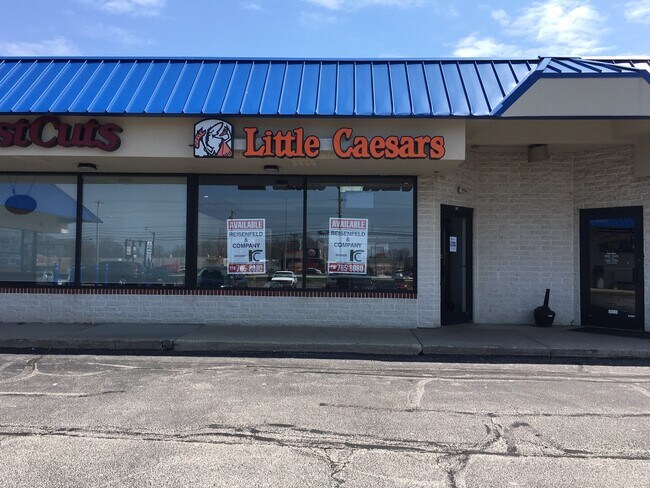
Property Record
1005 High St, Wadsworth, OH 44281


Property Detail
1005 High St
Cleveland-Elyria, OH
CITY LOT 7188 WH 3.1087 AC
040-20B-05-057
Medina
Wholesaleoutletdiscountstore
Ohio
B and X Area of moderate flood hazard, usually the area between the limits of the 100-year and 500-year floods.
7188
2025
3.04 AC
2024
Medina County
417100
Cleveland
32,305 SF
NEARBY LISTINGS FOR SALE OR LEASE
DEMOGRAPHICS near 1005 High St
1 mile
3 mile
5 mile
2025 Total Population
6,232
28,055
45,171
2030 Population
6,287
28,308
45,553
Pop Growth 2025-2030
+ 0.88%
+ 0.90%
+ 0.85%
Average Age
45
41
42
2025 Total Households
2,743
11,338
17,852
HH Growth 2025-2030
+ 0.91%
+ 0.87%
+ 0.82%
Median Household Inc
$76,864
$79,347
$85,047
Avg Household Size
2.20
2.40
2.50
2025 Avg HH Vehicles
2.00
2.00
2.00
Median Home Value
$290,593
$262,248
$267,364
Median Year Built
1987
1976
1975
Nearby Places
Map Layers
Map Styles
 Street
 Aerial
Transit
 Traffic
 Biking
Places
Listings with unknown addresses are not visible on the map
- Restaurants
- Banks
- Shops
- Fitness
- Groceries
PUBLIC TRANSPORTATION
AIRPORT
Akron-Canton Regional
Drive
Walk
Distance
Akron-Canton Regional
20 min
21.7 mi
Cleveland-Hopkins International
Drive
Walk
Distance
Cleveland-Hopkins International
35 min
31.2 mi
SALE & LEASE HISTORY
LISTING DATE
SALE/LEASE

Sep 25, 2016
For Lease
May 18, 2020
For Lease
Nearby Properties
Address
Land Use
TOTAL SIZE
Lot Size
Zoning
Address
Land Use
TOTAL SIZE
Lot Size
Zoning
73,550 SF
100.93 AC
Address
Land Use
TOTAL SIZE
Lot Size
Zoning
3,832 SF
56.46 AC
Address
Land Use
TOTAL SIZE
Lot Size
Zoning
4,697 SF
32.26 AC
Address
Land Use
TOTAL SIZE
Lot Size
Zoning
16,281 SF
14.02 AC
Address
Land Use
TOTAL SIZE
Lot Size
Zoning
80,761 SF
57.17 AC
Address
Land Use
TOTAL SIZE
Lot Size
Zoning
23,904 SF
4.36 AC
Address
Land Use
TOTAL SIZE
Lot Size
Zoning
6,986 SF
14.84 AC
Address
Land Use
TOTAL SIZE
Lot Size
Zoning
51,644 SF
7.46 AC
Address
Land Use
TOTAL SIZE
Lot Size
Zoning
29,256 SF
25.13 AC
Address
Land Use
TOTAL SIZE
Lot Size
Zoning
51,633 SF
11.04 AC
Address
Land Use
TOTAL SIZE
Lot Size
Zoning
206,479 SF
17.18 AC
Address
Land Use
TOTAL SIZE
Lot Size
Zoning
51,320 SF
16.33 AC
Address
Land Use
TOTAL SIZE
Lot Size
Zoning
138,251 SF
15.17 AC
Address
Land Use
TOTAL SIZE
Lot Size
Zoning
20,252 SF
3.14 AC
Address
Land Use
TOTAL SIZE
Lot Size
Zoning
13,832 SF
13.10 AC
Address
Land Use
TOTAL SIZE
Lot Size
Zoning
1,704 SF
5.37 AC
Address
Land Use
TOTAL SIZE
Lot Size
Zoning
92,436 SF
10.70 AC
Address
Land Use
TOTAL SIZE
Lot Size
Zoning
11,271 SF
9.07 AC
Address
Land Use
TOTAL SIZE
Lot Size
Zoning
78,960 SF
2.13 AC
Address
Land Use
TOTAL SIZE
Lot Size
Zoning
31,070 SF
0.24 AC
Address
Land Use
TOTAL SIZE
Lot Size
Zoning
6,144 SF
3.53 AC
Address
Land Use
TOTAL SIZE
Lot Size
Zoning
26,804 SF
13.64 AC
Address
Land Use
TOTAL SIZE
Lot Size
Zoning
121,395 SF
10.63 AC
Address
Land Use
TOTAL SIZE
Lot Size
Zoning
15,439 SF
3.27 AC
Address
Land Use
TOTAL SIZE
Lot Size
Zoning
15,486 SF
4.25 AC
Address
Land Use
TOTAL SIZE
Lot Size
Zoning
102,088 SF
10.87 AC
Address
Land Use
TOTAL SIZE
Lot Size
Zoning
6,608 SF
4.81 AC
Address
Land Use
TOTAL SIZE
Lot Size
Zoning
125,060 SF
12.27 AC
Address
Land Use
TOTAL SIZE
Lot Size
Zoning
89,373 SF
4.13 AC
Address
Land Use
TOTAL SIZE
Lot Size
Zoning
91,962 SF
15.90 AC
The World's #1 Commercial Real Estate Marketplace
Connect with us
© 2026 CoStar Group
The information above has been obtained from sources believed reliable. While we do not doubt its accuracy we have not verified it and make no guarantee, warranty or representation about it. It is your responsibility to independently confirm its accuracy and completeness. Any projections, opinions, assumptions, or estimates used are for example only and do not represent the current or future performance of the property. The value of this transaction to you depends on tax and other factors which should be evaluated by your tax, financial, and legal advisors. You and your advisors should conduct a careful, independent investigation of the property to determine to your satisfaction the suitability of the property for your needs.