Property Record
10050 Baltimore Ave, College Park, MD 20740

NEARBY LISTINGS FOR SALE OR LEASE
Property Detail
10050 Baltimore Ave
Washington-Arlington-Alexandria, DC-VA-MD-WV
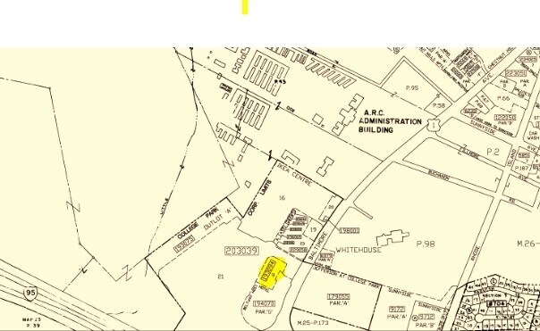
Ikea Centre
01-3437894
(TOWN ANNEXATION 04-05)
Storebuilding
Prince George's
X
Maryland
24033C0043E
9
2024
1.46 AC
2025
Beltsville/Calverton
807405
Washington, DC
4,732 SF
DEMOGRAPHICS near 10050 Baltimore Ave
1 Mile
3 Mile
5 Mile
2024 Total Population
10,017
104,914
353,635
2029 Population
9,710
102,701
346,350
Pop Growth 2024-2029
(3.06%)
(2.11%)
(2.06%)
Average Age
36
36
37
2024 Total Households
3,832
34,283
115,636
HH Growth 2024-2029
(3.24%)
(2.14%)
(2.16%)
Median Household Inc
$81,306
$79,648
$83,196
Avg Household Size
2.60
2.70
2.90
2024 Avg HH Vehicles
2.00
2.00
2.00
Median Home Value
$367,406
$392,153
$409,741
Median Year Built
1972
1972
1969
Nearby Places
Map Layers
Map Styles
 Street
 Aerial
- Restaurants
- Banks
- Shops
- Fitness
- Groceries
PUBLIC TRANSPORTATION
COMMUTER RAIL
Greenbelt (Green Line - Washington Metropolitan Area Transit Authority Metrorail (Metrorail))
DRIVE
WALK
Distance
Greenbelt (Green Line - Washington Metropolitan Area Transit Authority Metrorail (Metrorail))
4 min
1.9 mi
Greenbelt Marc Sb (CAMDEN - WASHINGTON - Maryland Transit Administration)
DRIVE
WALK
Distance
Greenbelt Marc Sb (CAMDEN - WASHINGTON - Maryland Transit Administration)
4 min
2.0 mi
AIRPORT
Ronald Reagan Washington Ntl
DRIVE
WALK
Distance
Ronald Reagan Washington Ntl
32 min
19.7 mi
Baltimore/Washington International Thurgood Marshall
DRIVE
WALK
Distance
Baltimore/Washington International Thurgood Marshall
33 min
21.2 mi
Washington Dulles International
DRIVE
WALK
Distance
Washington Dulles International
53 min
34.9 mi
Freight Ports
Port of Baltimore
DRIVE
WALK
Distance
Port of Baltimore
38 min
29.0 mi
Nearby Properties
Address
Land Use
TOTAL SIZE
Lot Size
Zoning
Address
Land Use
TOTAL SIZE
Lot Size
Zoning
2,043 SF
1,011.13 AC
RR
Address
Land Use
TOTAL SIZE
Lot Size
Zoning
13.01 AC
RR
Address
Land Use
TOTAL SIZE
Lot Size
Zoning
456,429 SF
35.07 AC
I3
Address
Land Use
TOTAL SIZE
Lot Size
Zoning
1,244,733 SF
38.03 AC
RE2
Address
Land Use
TOTAL SIZE
Lot Size
Zoning
639,347 SF
2.28 AC
RTOLE
Address
Land Use
TOTAL SIZE
Lot Size
Zoning
398,693 SF
2.57 AC
LTOE
Address
Land Use
TOTAL SIZE
Lot Size
Zoning
74,664 SF
1.83 AC
RTOLE
Address
Land Use
TOTAL SIZE
Lot Size
Zoning
3.53 AC
RTOLE
Address
Land Use
TOTAL SIZE
Lot Size
Zoning
330,003 SF
1.74 AC
RTOLE
Address
Land Use
TOTAL SIZE
Lot Size
Zoning
1,146,407 SF
60.25 AC
AG
Address
Land Use
TOTAL SIZE
Lot Size
Zoning
2.05 AC
RTOLE
Address
Land Use
TOTAL SIZE
Lot Size
Zoning
8,060 SF
1.63 AC
LTOE
Address
Land Use
TOTAL SIZE
Lot Size
Zoning
508 SF
7.27 AC
LTOE
Address
Land Use
TOTAL SIZE
Lot Size
Zoning
0.79 AC
RTOLE
Address
Land Use
TOTAL SIZE
Lot Size
Zoning
330,555 SF
2.12 AC
NAC
Address
Land Use
TOTAL SIZE
Lot Size
Zoning
132,330 SF
3.20 AC
RTOLE
Address
Land Use
TOTAL SIZE
Lot Size
Zoning
15.90 AC
RTOLE
Address
Land Use
TOTAL SIZE
Lot Size
Zoning
309,374 SF
2.01 AC
RTOLE
Address
Land Use
TOTAL SIZE
Lot Size
Zoning
2,240.90 AC
ROS
Address
Land Use
TOTAL SIZE
Lot Size
Zoning
6.39 AC
RMF48
Address
Land Use
TOTAL SIZE
Lot Size
Zoning
190,067 SF
0.72 AC
LTOE
Address
Land Use
TOTAL SIZE
Lot Size
Zoning
569,794 SF
5.70 AC
RMF48
Address
Land Use
TOTAL SIZE
Lot Size
Zoning
43,382 SF
2.18 AC
Address
Land Use
TOTAL SIZE
Lot Size
Zoning
256 SF
2.54 AC
LTOC
Address
Land Use
TOTAL SIZE
Lot Size
Zoning
17.48 AC
RMF20
Address
Land Use
TOTAL SIZE
Lot Size
Zoning
20.79 AC
RTOLE
Address
Land Use
TOTAL SIZE
Lot Size
Zoning
256,662 SF
3.69 AC
LTOE
Address
Land Use
TOTAL SIZE
Lot Size
Zoning
22.87 AC
RTOLE
Address
Land Use
TOTAL SIZE
Lot Size
Zoning
285,116 SF
14.62 AC
AG
Address
Land Use
TOTAL SIZE
Lot Size
Zoning
769.33 AC
ROS
The World's #1 Commercial Real Estate Marketplace
Connect with us
© 2025 CoStar Group
The information above has been obtained from sources believed reliable. While we do not doubt its accuracy we have not verified it and make no guarantee, warranty or representation about it. It is your responsibility to independently confirm its accuracy and completeness. Any projections, opinions, assumptions, or estimates used are for example only and do not represent the current or future performance of the property. The value of this transaction to you depends on tax and other factors which should be evaluated by your tax, financial, and legal advisors. You and your advisors should conduct a careful, independent investigation of the property to determine to your satisfaction the suitability of the property for your needs.