Property Record
10050 E Harvard Ave, Denver, CO 80231
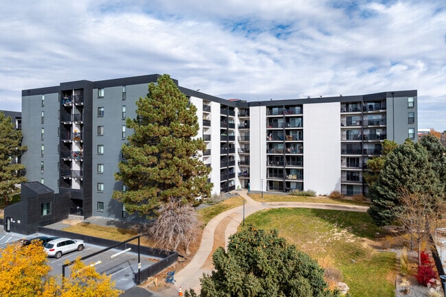


Property Detail
10050 E Harvard Ave
6274-00-042
WOODSTREAM VILLAGE B3 COM NW COR BLK 3 E 554.55FT CV/L ARC 118.64FT RAD 165FT CHORD N69.2402E 116.1FT N45.0000E 373.22 FT CV/R CHORD N67.0000E 74.92FT DAF*
Apartment
DENVER
S-MU-8
Colorado
B and X Area of moderate flood hazard, usually the area between the limits of the 100-year and 500-year floods.
6.20 AC
2024
Hampden
2025
Denver
006813
Denver-Aurora-Centennial, CO
301,472 SF
NEARBY LISTINGS FOR SALE OR LEASE
DEMOGRAPHICS near 10050 E Harvard Ave
1 mile
3 mile
5 mile
2025 Total Population
17,182
172,638
448,188
2030 Population
17,576
176,185
457,249
Pop Growth 2025-2030
+ 2.29%
+ 2.05%
+ 2.02%
Average Age
41
40
39
2025 Total Households
7,808
78,327
189,283
HH Growth 2025-2030
+ 2.37%
+ 2.10%
+ 2.17%
Median Household Inc
$83,238
$73,161
$81,882
Avg Household Size
2.10
2.10
2.30
2025 Avg HH Vehicles
2.00
2.00
2.00
Median Home Value
$542,276
$455,745
$535,685
Median Year Built
1981
1979
1979
Nearby Places
Map Layers
Map Styles
 Street
 Aerial
Layers
 Traffic
 Biking
Places
Listings with unknown addresses are not visible on the map
- Restaurants
- Banks
- Shops
- Fitness
- Groceries
PUBLIC TRANSPORTATION
COMMUTER RAIL
Drive
Walk
Distance
19 min
8.6 mi
Drive
Walk
Distance
18 min
8.8 mi
AIRPORT
Denver International
Drive
Walk
Distance
Denver International
31 min
23.6 mi
Nearby Properties
Address
Land Use
TOTAL SIZE
Lot Size
Zoning
Address
Land Use
TOTAL SIZE
Lot Size
Zoning
508,135 SF
6.99 AC
C-RX
Address
Land Use
TOTAL SIZE
Lot Size
Zoning
163,033 SF
5.94 AC
PUD
Address
Land Use
TOTAL SIZE
Lot Size
Zoning
496,493 SF
33.45 AC
Address
Land Use
TOTAL SIZE
Lot Size
Zoning
898,130 SF
89.50 AC
Address
Land Use
TOTAL SIZE
Lot Size
Zoning
87,207 SF
Address
Land Use
TOTAL SIZE
Lot Size
Zoning
476,186 SF
42.62 AC
Address
Land Use
TOTAL SIZE
Lot Size
Zoning
70,296 SF
4.96 AC
Address
Land Use
TOTAL SIZE
Lot Size
Zoning
74,888 SF
4.35 AC
AMU
Address
Land Use
TOTAL SIZE
Lot Size
Zoning
83,951 SF
0.30 AC
R2
Address
Land Use
TOTAL SIZE
Lot Size
Zoning
50,106 SF
1.67 AC
RB1
Address
Land Use
TOTAL SIZE
Lot Size
Zoning
231,867 SF
19.33 AC
S-MX-3A
Address
Land Use
TOTAL SIZE
Lot Size
Zoning
613,600 SF
29.40 AC
R-3
Address
Land Use
TOTAL SIZE
Lot Size
Zoning
112,322 SF
10.26 AC
S-CC-3
Address
Land Use
TOTAL SIZE
Lot Size
Zoning
295,877 SF
6 AC
S-MX-12
Address
Land Use
TOTAL SIZE
Lot Size
Zoning
61,018 SF
2.72 AC
C-MX
Address
Land Use
TOTAL SIZE
Lot Size
Zoning
130,531 SF
3.41 AC
Address
Land Use
TOTAL SIZE
Lot Size
Zoning
258,612 SF
4.91 AC
B-8
Address
Land Use
TOTAL SIZE
Lot Size
Zoning
478,994 SF
26.07 AC
Address
Land Use
TOTAL SIZE
Lot Size
Zoning
193,299 SF
2.90 AC
S-MX-12
Address
Land Use
TOTAL SIZE
Lot Size
Zoning
48,961 SF
4.15 AC
Address
Land Use
TOTAL SIZE
Lot Size
Zoning
205,250 SF
10 AC
I-A
Address
Land Use
TOTAL SIZE
Lot Size
Zoning
154,808 SF
16.71 AC
S-SU-D
Address
Land Use
TOTAL SIZE
Lot Size
Zoning
341,616 SF
4.88 AC
S-MX-5
Address
Land Use
TOTAL SIZE
Lot Size
Zoning
138,750 SF
12.17 AC
OS-A
Address
Land Use
TOTAL SIZE
Lot Size
Zoning
540,380 SF
26.03 AC
RR3
Address
Land Use
TOTAL SIZE
Lot Size
Zoning
49,627 SF
4.18 AC
B-2
Address
Land Use
TOTAL SIZE
Lot Size
Zoning
209,690 SF
7.21 AC
S-SU-D
Address
Land Use
TOTAL SIZE
Lot Size
Zoning
383,436 SF
9.77 AC
Address
Land Use
TOTAL SIZE
Lot Size
Zoning
283,199 SF
9.74 AC
PUD
Address
Land Use
TOTAL SIZE
Lot Size
Zoning
368,676 SF
17.71 AC
R-2-A
The World's #1 Commercial Real Estate Marketplace
Connect with us
© 2026 CoStar Group
The information above has been obtained from sources believed reliable. While we do not doubt its accuracy we have not verified it and make no guarantee, warranty or representation about it. It is your responsibility to independently confirm its accuracy and completeness. Any projections, opinions, assumptions, or estimates used are for example only and do not represent the current or future performance of the property. The value of this transaction to you depends on tax and other factors which should be evaluated by your tax, financial, and legal advisors. You and your advisors should conduct a careful, independent investigation of the property to determine to your satisfaction the suitability of the property for your needs.