Property Record
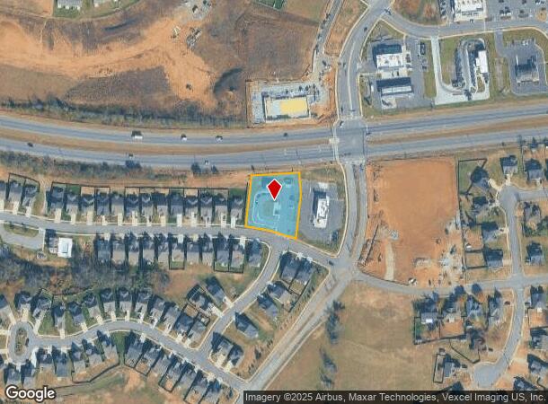
Westgate Dr, Gallatin, TN 37066

NEARBY LISTINGS FOR SALE OR LEASE
Property Detail
Westgate Dr
Nashville
Patterson Farms Ph 1 Resub 207
Nashville-Davidson--Murfreesboro--Franklin, TN
PB33 PG397 LOT1 PB30 PG300 LOT207 PNT PCL 135-2.03
083135F F 00101
Sumner
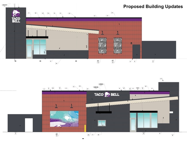
Restaurantdrivein
Tennessee
2024
1
2025
0.85 AC
020905
Hendersonville-Gallatin
1,456 SF
DEMOGRAPHICS near Westgate Dr
1 Mile
3 Mile
5 Mile
2024 Total Population
7,373
34,291
59,074
2029 Population
8,206
38,029
66,091
Pop Growth 2024-2029
+ 11.30%
+ 10.90%
+ 11.88%
Average Age
40
40
41
2024 Total Households
2,916
13,467
23,226
HH Growth 2024-2029
+ 11.42%
+ 11.14%
+ 12.12%
Median Household Inc
$54,915
$50,712
$64,607
Avg Household Size
2.40
2.40
2.50
2024 Avg HH Vehicles
2.00
2.00
2.00
Median Home Value
$232,270
$280,988
$352,918
Median Year Built
1992
1992
1998
Nearby Places
Map Layers
Map Styles
 Street
 Aerial
- Restaurants
- Banks
- Shops
- Fitness
- Groceries
PUBLIC TRANSPORTATION
COMMUTER RAIL
Martha (East Corridor Line - Tennessee Regional Transportation Authority Music City Star (Music City Star))
DRIVE
WALK
Distance
Martha (East Corridor Line - Tennessee Regional Transportation Authority Music City Star (Music City Star))
15 min
9.9 mi
AIRPORT
Nashville International
DRIVE
WALK
Distance
Nashville International
39 min
30.6 mi
Freight Ports
Port of Toledo
DRIVE
WALK
Distance
Port of Toledo
525 min
461.2 mi
SALE & LEASE HISTORY
LISTING DATE
SALE/LEASE

Jul 09, 2025
For Sale
Jan 17, 2025
For Sale
Jan 16, 2025
For Lease
Nearby Properties
Address
Land Use
TOTAL SIZE
Lot Size
Zoning
Address
Land Use
TOTAL SIZE
Lot Size
Zoning
38,900 SF
11.14 AC
Address
Land Use
TOTAL SIZE
Lot Size
Zoning
1,055,495 SF
126.40 AC
Address
Land Use
TOTAL SIZE
Lot Size
Zoning
27,317 SF
22.74 AC
Address
Land Use
TOTAL SIZE
Lot Size
Zoning
52,475 SF
14.46 AC
Address
Land Use
TOTAL SIZE
Lot Size
Zoning
15,189 SF
7.84 AC
Address
Land Use
TOTAL SIZE
Lot Size
Zoning
16,736 SF
14.10 AC
Address
Land Use
TOTAL SIZE
Lot Size
Zoning
5,992 SF
15.38 AC
Address
Land Use
TOTAL SIZE
Lot Size
Zoning
416,888 SF
42.88 AC
Address
Land Use
TOTAL SIZE
Lot Size
Zoning
10,320 SF
76.70 AC
IG
Address
Land Use
TOTAL SIZE
Lot Size
Zoning
10,656 SF
1.71 AC
R06
Address
Land Use
TOTAL SIZE
Lot Size
Zoning
205,182 SF
21.90 AC
CG
Address
Land Use
TOTAL SIZE
Lot Size
Zoning
7,424 SF
15.77 AC
Address
Land Use
TOTAL SIZE
Lot Size
Zoning
56,492 SF
4.72 AC
Address
Land Use
TOTAL SIZE
Lot Size
Zoning
426,312 SF
40 AC
IG
Address
Land Use
TOTAL SIZE
Lot Size
Zoning
9,568 SF
16.50 AC
Address
Land Use
TOTAL SIZE
Lot Size
Zoning
127,050 SF
Address
Land Use
TOTAL SIZE
Lot Size
Zoning
156,213 SF
14.80 AC
PGC
Address
Land Use
TOTAL SIZE
Lot Size
Zoning
35,569 SF
6.99 AC
Address
Land Use
TOTAL SIZE
Lot Size
Zoning
73,567 SF
9.99 AC
MRO
Address
Land Use
TOTAL SIZE
Lot Size
Zoning
20,000 SF
16.70 AC
Address
Land Use
TOTAL SIZE
Lot Size
Zoning
64,960 SF
15.11 AC
IG
Address
Land Use
TOTAL SIZE
Lot Size
Zoning
370,211 SF
28.30 AC
Address
Land Use
TOTAL SIZE
Lot Size
Zoning
106,660 SF
18.74 AC
IG
Address
Land Use
TOTAL SIZE
Lot Size
Zoning
18,016 SF
17.90 AC
Address
Land Use
TOTAL SIZE
Lot Size
Zoning
63,334 SF
2.45 AC
Address
Land Use
TOTAL SIZE
Lot Size
Zoning
142,992 SF
18.11 AC
Address
Land Use
TOTAL SIZE
Lot Size
Zoning
865 SF
0.77 AC
Address
Land Use
TOTAL SIZE
Lot Size
Zoning
70,889 SF
7.02 AC
Address
Land Use
TOTAL SIZE
Lot Size
Zoning
24,740 SF
5.91 AC
CS
Address
Land Use
TOTAL SIZE
Lot Size
Zoning
31,700 SF
8.50 AC
The World's #1 Commercial Real Estate Marketplace
Connect with us
© 2026 CoStar Group
The information above has been obtained from sources believed reliable. While we do not doubt its accuracy we have not verified it and make no guarantee, warranty or representation about it. It is your responsibility to independently confirm its accuracy and completeness. Any projections, opinions, assumptions, or estimates used are for example only and do not represent the current or future performance of the property. The value of this transaction to you depends on tax and other factors which should be evaluated by your tax, financial, and legal advisors. You and your advisors should conduct a careful, independent investigation of the property to determine to your satisfaction the suitability of the property for your needs.