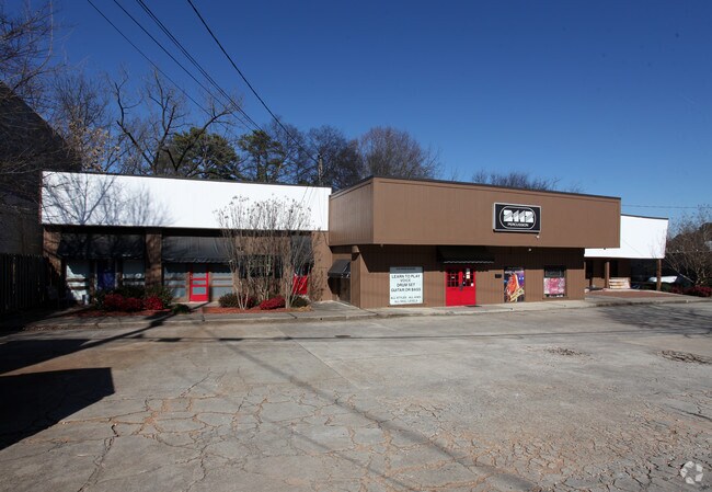
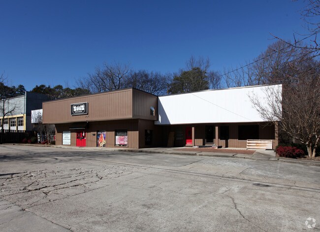
Property Record
1007 E Whitaker Mill Rd, Raleigh, NC 27608


NEARBY LISTINGS FOR SALE OR LEASE
Property Detail
1007 E Whitaker Mill Rd
1714.05-19-4255-000
John E Skvarla Iii
Commercialnec
OFFICE
X
Wake
3720171400K
North Carolina
2025
0.40 AC
2025
Six Forks/Falls of Neuse
051800
Raleigh/Durham
5,790 SF
Raleigh, NC
DEMOGRAPHICS near 1007 E Whitaker Mill Rd
1 Mile
3 Mile
5 Mile
2024 Total Population
9,375
105,382
263,097
2029 Population
10,171
114,787
286,221
Pop Growth 2024-2029
+ 8.49%
+ 8.92%
+ 8.79%
Average Age
38
38
37
2024 Total Households
4,424
46,875
110,620
HH Growth 2024-2029
+ 8.57%
+ 9.41%
+ 9.16%
Median Household Inc
$106,479
$79,954
$69,573
Avg Household Size
2.10
2.10
2.20
2024 Avg HH Vehicles
2.00
2.00
2.00
Median Home Value
$479,955
$470,506
$357,668
Median Year Built
1978
1983
1987
Nearby Places
Map Layers
Map Styles
 Street
 Aerial
- Restaurants
- Banks
- Shops
- Fitness
- Groceries
PUBLIC TRANSPORTATION
AIRPORT
Raleigh-Durham International
DRIVE
WALK
Distance
Raleigh-Durham International
24 min
13.9 mi
Freight Ports
Port of Wilmington
DRIVE
WALK
Distance
Port of Wilmington
154 min
134.3 mi
Nearby Properties
Address
Land Use
TOTAL SIZE
Lot Size
Zoning
Address
Land Use
TOTAL SIZE
Lot Size
Zoning
5,616,802 SF
507.97 AC
OX-12
Address
Land Use
TOTAL SIZE
Lot Size
Zoning
972,279 SF
4.05 AC
DX-20
Address
Land Use
TOTAL SIZE
Lot Size
Zoning
2,660,245 SF
38.98 AC
CMP
Address
Land Use
TOTAL SIZE
Lot Size
Zoning
1,597,789 SF
13.35 AC
DX-20
Address
Land Use
TOTAL SIZE
Lot Size
Zoning
458,830 SF
3.98 AC
DX-20
Address
Land Use
TOTAL SIZE
Lot Size
Zoning
706,810 SF
40.78 AC
IH
Address
Land Use
TOTAL SIZE
Lot Size
Zoning
1,085,654 SF
16.87 AC
OX-5
Address
Land Use
TOTAL SIZE
Lot Size
Zoning
675,817 SF
3.56 AC
DX-12
Address
Land Use
TOTAL SIZE
Lot Size
Zoning
372,222 SF
9.64 AC
DX-12
Address
Land Use
TOTAL SIZE
Lot Size
Zoning
250,448 SF
25.28 AC
OX-3
Address
Land Use
TOTAL SIZE
Lot Size
Zoning
517,826 SF
2.52 AC
DX-7
Address
Land Use
TOTAL SIZE
Lot Size
Zoning
179,565 SF
1.10 AC
DX-7
Address
Land Use
TOTAL SIZE
Lot Size
Zoning
344,814 SF
1.95 AC
DX-40
Address
Land Use
TOTAL SIZE
Lot Size
Zoning
658,580 SF
3.30 AC
PD
Address
Land Use
TOTAL SIZE
Lot Size
Zoning
654,148 SF
1.21 AC
DX-40
Address
Land Use
TOTAL SIZE
Lot Size
Zoning
747,658 SF
11.12 AC
CX-12
Address
Land Use
TOTAL SIZE
Lot Size
Zoning
465,052 SF
2.65 AC
PD
Address
Land Use
TOTAL SIZE
Lot Size
Zoning
462,217 SF
1.01 AC
DX-20
Address
Land Use
TOTAL SIZE
Lot Size
Zoning
364,025 SF
2.19 AC
PD
Address
Land Use
TOTAL SIZE
Lot Size
Zoning
834,950 SF
3.91 AC
OX-12
Address
Land Use
TOTAL SIZE
Lot Size
Zoning
561,966 SF
3.81 AC
IX-7
Address
Land Use
TOTAL SIZE
Lot Size
Zoning
765,252 SF
1.72 AC
DX-20
Address
Land Use
TOTAL SIZE
Lot Size
Zoning
159,921 SF
4.99 AC
DX-5
Address
Land Use
TOTAL SIZE
Lot Size
Zoning
376,902 SF
189.85 AC
OX-3
Address
Land Use
TOTAL SIZE
Lot Size
Zoning
701,923 SF
64.64 AC
RX-5
Address
Land Use
TOTAL SIZE
Lot Size
Zoning
40,024 SF
6.19 AC
DX-3
Address
Land Use
TOTAL SIZE
Lot Size
Zoning
539,902 SF
1.28 AC
O&I-1
Address
Land Use
TOTAL SIZE
Lot Size
Zoning
580,268 SF
9.02 AC
PD
Address
Land Use
TOTAL SIZE
Lot Size
Zoning
197,029 SF
6.27 AC
DX-5
Address
Land Use
TOTAL SIZE
Lot Size
Zoning
201,558 SF
4.05 AC
DX-12
The World's #1 Commercial Real Estate Marketplace
Connect with us
© 2025 CoStar Group
The information above has been obtained from sources believed reliable. While we do not doubt its accuracy we have not verified it and make no guarantee, warranty or representation about it. It is your responsibility to independently confirm its accuracy and completeness. Any projections, opinions, assumptions, or estimates used are for example only and do not represent the current or future performance of the property. The value of this transaction to you depends on tax and other factors which should be evaluated by your tax, financial, and legal advisors. You and your advisors should conduct a careful, independent investigation of the property to determine to your satisfaction the suitability of the property for your needs.