Property Record
1007 Red Farmer Dr, Bessemer, AL 35023

NEARBY LISTINGS FOR SALE OR LEASE
Property Detail
1007 Red Farmer Dr
Birmingham-Hoover, AL
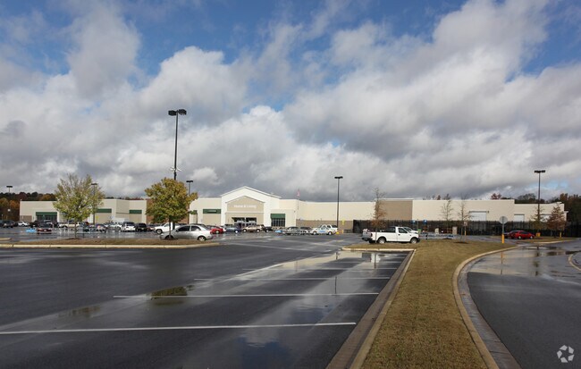
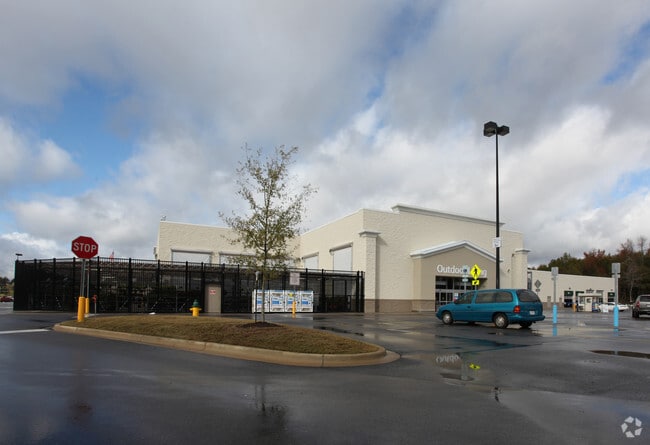
Walmart Of Hueytown
30-00-21-2-001-002.000
LOT 2-B WAL-MART OF HUEYTOWN SUB PB 43 PG 44
Storebuilding
Jefferson
X
Alabama
01073C0529G
2-b
2023
28.97 AC
2024
Bessemer
013901
Birmingham
195,495 SF
DEMOGRAPHICS near 1007 Red Farmer Dr
1 Mile
3 Mile
5 Mile
2024 Total Population
3,517
34,216
83,457
2029 Population
3,427
33,672
82,736
Pop Growth 2024-2029
(2.56%)
(1.59%)
(0.86%)
Average Age
44
41
41
2024 Total Households
1,311
13,403
33,436
HH Growth 2024-2029
(2.75%)
(1.69%)
(0.96%)
Median Household Inc
$61,708
$54,569
$44,768
Avg Household Size
2.50
2.50
2.40
2024 Avg HH Vehicles
2.00
2.00
2.00
Median Home Value
$155,086
$139,875
$109,794
Median Year Built
1971
1970
1964
Nearby Places
Map Layers
Map Styles
 Street
 Aerial
- Restaurants
- Banks
- Shops
- Fitness
- Groceries
PUBLIC TRANSPORTATION
AIRPORT
Birmingham-Shuttlesworth International
DRIVE
WALK
Distance
Birmingham-Shuttlesworth International
23 min
16.7 mi
Freight Ports
Port of Mobile
DRIVE
WALK
Distance
Port of Mobile
286 min
243.1 mi
Nearby Properties
Address
Land Use
TOTAL SIZE
Lot Size
Zoning
Address
Land Use
TOTAL SIZE
Lot Size
Zoning
1,244,986 SF
I2
Address
Land Use
TOTAL SIZE
Lot Size
Zoning
2,573,547 SF
112 AC
I2
Address
Land Use
TOTAL SIZE
Lot Size
Zoning
460,483 SF
20 AC
I3
Address
Land Use
TOTAL SIZE
Lot Size
Zoning
116,442 SF
2.67 AC
B6
Address
Land Use
TOTAL SIZE
Lot Size
Zoning
553,137 SF
87 AC
I2
Address
Land Use
TOTAL SIZE
Lot Size
Zoning
191,664 SF
14.73 AC
R4
Address
Land Use
TOTAL SIZE
Lot Size
Zoning
145,300 SF
25 AC
R3
Address
Land Use
TOTAL SIZE
Lot Size
Zoning
219,210 SF
19.40 AC
M2
Address
Land Use
TOTAL SIZE
Lot Size
Zoning
230,088 SF
I3
Address
Land Use
TOTAL SIZE
Lot Size
Zoning
110,770 SF
7.20 AC
R3
Address
Land Use
TOTAL SIZE
Lot Size
Zoning
218,210 SF
11.24 AC
CM-2
Address
Land Use
TOTAL SIZE
Lot Size
Zoning
66,928 SF
5.70 AC
B2-R
Address
Land Use
TOTAL SIZE
Lot Size
Zoning
77,902 SF
44 AC
I3
Address
Land Use
TOTAL SIZE
Lot Size
Zoning
58,822 SF
7.80 AC
B3
Address
Land Use
TOTAL SIZE
Lot Size
Zoning
1,200 SF
13.40 AC
R3
Address
Land Use
TOTAL SIZE
Lot Size
Zoning
69,344 SF
2.30 AC
B-1
Address
Land Use
TOTAL SIZE
Lot Size
Zoning
26,234 SF
3.30 AC
B2
Address
Land Use
TOTAL SIZE
Lot Size
Zoning
66,935 SF
1.99 AC
B2
Address
Land Use
TOTAL SIZE
Lot Size
Zoning
104,775 SF
9.40 AC
B-2
Address
Land Use
TOTAL SIZE
Lot Size
Zoning
1,437,077 SF
I2
Address
Land Use
TOTAL SIZE
Lot Size
Zoning
80,043 SF
10.89 AC
B3-C
Address
Land Use
TOTAL SIZE
Lot Size
Zoning
94,026 SF
4.90 AC
I2R2
Address
Land Use
TOTAL SIZE
Lot Size
Zoning
163,056 SF
I-3
Address
Land Use
TOTAL SIZE
Lot Size
Zoning
49,022 SF
5.50 AC
R2
Address
Land Use
TOTAL SIZE
Lot Size
Zoning
80,220 SF
6.68 AC
M2
Address
Land Use
TOTAL SIZE
Lot Size
Zoning
52,810 SF
3.44 AC
B-3
Address
Land Use
TOTAL SIZE
Lot Size
Zoning
65,232 SF
3.60 AC
R-5
Address
Land Use
TOTAL SIZE
Lot Size
Zoning
59,554 SF
1.37 AC
R2
Address
Land Use
TOTAL SIZE
Lot Size
Zoning
32,606 SF
2.18 AC
B2-R
The World's #1 Commercial Real Estate Marketplace
Connect with us
© 2025 CoStar Group
The information above has been obtained from sources believed reliable. While we do not doubt its accuracy we have not verified it and make no guarantee, warranty or representation about it. It is your responsibility to independently confirm its accuracy and completeness. Any projections, opinions, assumptions, or estimates used are for example only and do not represent the current or future performance of the property. The value of this transaction to you depends on tax and other factors which should be evaluated by your tax, financial, and legal advisors. You and your advisors should conduct a careful, independent investigation of the property to determine to your satisfaction the suitability of the property for your needs.