Property Record
1007 Us Highway 231, Wetumpka, AL 36093

NEARBY LISTINGS FOR SALE OR LEASE
-
-
View all Wetumpka listings for sale on LoopNet.com
Property Detail
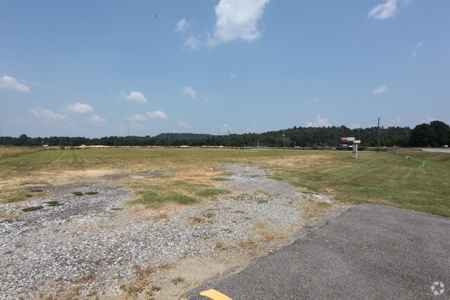
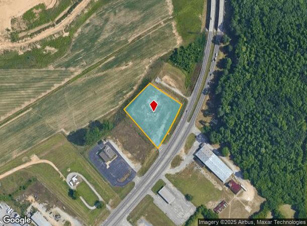
1007 Us Highway 231
Montgomery, AL
Hepburn Property Plat 2
24-03-07-0-001-021000-0
LOT 3 HEPBURN PROPERTY PLAT 2 16/60 SEC 7 T17 R19 (1.92 AC)
Vacantlandnec
Elmore
AE
Alabama
01101C0104J
3
2025
1.92 AC
2024
Outlying Elmore County
030701
Montgomery
DEMOGRAPHICS near 1007 Us Highway 231
1 Mile
3 Mile
5 Mile
2024 Total Population
552
3,957
14,824
2029 Population
566
4,033
14,795
Pop Growth 2024-2029
+ 2.54%
+ 1.92%
(0.20%)
Average Age
43
45
40
2024 Total Households
207
1,518
5,589
HH Growth 2024-2029
+ 2.42%
+ 1.98%
(0.20%)
Median Household Inc
$105,410
$75,253
$76,948
Avg Household Size
2.60
2.50
2.50
2024 Avg HH Vehicles
2.00
2.00
2.00
Median Home Value
$269,780
$260,560
$192,351
Median Year Built
1997
1990
1992
Nearby Places
Map Layers
Map Styles
 Street
 Aerial
- Restaurants
- Banks
- Shops
- Fitness
- Groceries
PUBLIC TRANSPORTATION
AIRPORT
Montgomery Regional (Dannelly Field)
DRIVE
WALK
Distance
Montgomery Regional (Dannelly Field)
25 min
19.8 mi
Freight Ports
Port of Panama City
DRIVE
WALK
Distance
Port of Panama City
244 min
193.6 mi
SALE & LEASE HISTORY
LISTING DATE
SALE/LEASE

Mar 26, 2020
For Sale
Nearby Properties
Address
Land Use
TOTAL SIZE
Lot Size
Zoning
Address
Land Use
TOTAL SIZE
Lot Size
Zoning
48,672 SF
31 AC
Address
Land Use
TOTAL SIZE
Lot Size
Zoning
76,213 SF
15 AC
Address
Land Use
TOTAL SIZE
Lot Size
Zoning
11,297 SF
4.86 AC
Address
Land Use
TOTAL SIZE
Lot Size
Zoning
69,536 SF
7.81 AC
Address
Land Use
TOTAL SIZE
Lot Size
Zoning
27,436 SF
19 AC
AGR-2
Address
Land Use
TOTAL SIZE
Lot Size
Zoning
24,820 SF
3.68 AC
Address
Land Use
TOTAL SIZE
Lot Size
Zoning
15,178 SF
6.15 AC
Address
Land Use
TOTAL SIZE
Lot Size
Zoning
7,990 SF
0.90 AC
Address
Land Use
TOTAL SIZE
Lot Size
Zoning
15,712 SF
1.06 AC
Address
Land Use
TOTAL SIZE
Lot Size
Zoning
26,642 SF
5.10 AC
B-2
Address
Land Use
TOTAL SIZE
Lot Size
Zoning
30,646 SF
1.70 AC
B-3
Address
Land Use
TOTAL SIZE
Lot Size
Zoning
5,224 SF
1.36 AC
Address
Land Use
TOTAL SIZE
Lot Size
Zoning
15,863 SF
4.50 AC
Address
Land Use
TOTAL SIZE
Lot Size
Zoning
6,903 SF
1.10 AC
Address
Land Use
TOTAL SIZE
Lot Size
Zoning
10,315 SF
1.70 AC
B-2
Address
Land Use
TOTAL SIZE
Lot Size
Zoning
10,772 SF
3.10 AC
Address
Land Use
TOTAL SIZE
Lot Size
Zoning
12,064 SF
2.79 AC
Address
Land Use
TOTAL SIZE
Lot Size
Zoning
11,984 SF
1.47 AC
Address
Land Use
TOTAL SIZE
Lot Size
Zoning
21,206 SF
2.25 AC
B-3
Address
Land Use
TOTAL SIZE
Lot Size
Zoning
494 SF
20 AC
AGR-2
Address
Land Use
TOTAL SIZE
Lot Size
Zoning
35,822 SF
6.83 AC
Address
Land Use
TOTAL SIZE
Lot Size
Zoning
3,420 SF
1.32 AC
Address
Land Use
TOTAL SIZE
Lot Size
Zoning
13,708 SF
5 AC
Address
Land Use
TOTAL SIZE
Lot Size
Zoning
5,094 SF
3.55 AC
Address
Land Use
TOTAL SIZE
Lot Size
Zoning
Address
Land Use
TOTAL SIZE
Lot Size
Zoning
2,070 SF
13.30 AC
B-2
Address
Land Use
TOTAL SIZE
Lot Size
Zoning
10,420 SF
7 AC
Address
Land Use
TOTAL SIZE
Lot Size
Zoning
1,200 SF
3.61 AC
Address
Land Use
TOTAL SIZE
Lot Size
Zoning
2,242 SF
1.26 AC
Address
Land Use
TOTAL SIZE
Lot Size
Zoning
11,106 SF
15 AC
B-2
The World's #1 Commercial Real Estate Marketplace
Connect with us
© 2025 CoStar Group
The information above has been obtained from sources believed reliable. While we do not doubt its accuracy we have not verified it and make no guarantee, warranty or representation about it. It is your responsibility to independently confirm its accuracy and completeness. Any projections, opinions, assumptions, or estimates used are for example only and do not represent the current or future performance of the property. The value of this transaction to you depends on tax and other factors which should be evaluated by your tax, financial, and legal advisors. You and your advisors should conduct a careful, independent investigation of the property to determine to your satisfaction the suitability of the property for your needs.