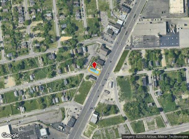
Property Record
10075 Gratiot Ave, Detroit, MI 48213
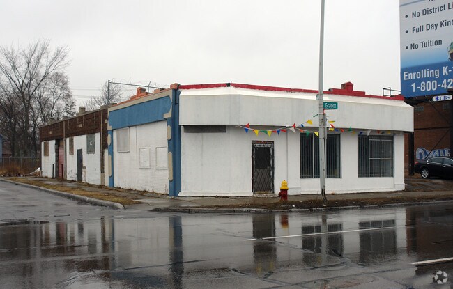
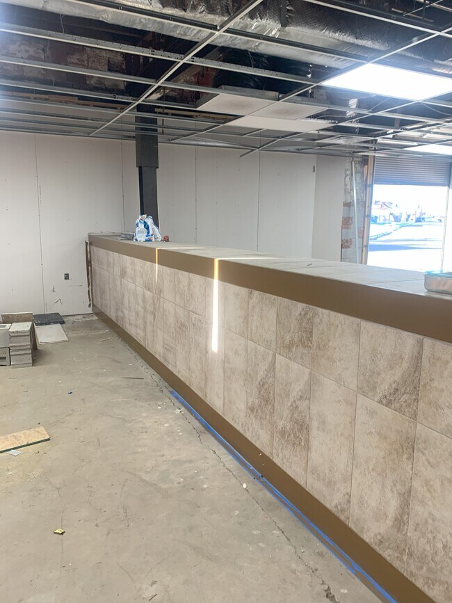
This Property Is For Sale
NEARBY LISTINGS FOR SALE OR LEASE
Property Detail
10075 Gratiot Ave
19-001748
Gratiot Ave
Commercialnec
N GRATIOT 28&29 BESSENGER & MOORE GRATIOT AVE SUB L26 P55 PLATS, W C R 19/422 39.62 X 100
X
Wayne
26163C0125E
Michigan
2024
0.09 AC
2025
Detroit E of Woodward
505700
Detroit
1,860 SF
Detroit-Warren-Dearborn, MI
DEMOGRAPHICS near 10075 Gratiot Ave
1 Mile
3 Mile
5 Mile
2024 Total Population
9,692
123,125
356,894
2029 Population
10,048
124,625
355,974
Pop Growth 2024-2029
+ 3.67%
+ 1.22%
(0.26%)
Average Age
42
37
38
2024 Total Households
3,781
45,209
142,661
HH Growth 2024-2029
+ 3.81%
+ 1.51%
(0.29%)
Median Household Inc
$30,044
$34,193
$39,602
Avg Household Size
2.40
2.60
2.40
2024 Avg HH Vehicles
1.00
1.00
1.00
Median Home Value
$63,527
$75,019
$87,764
Median Year Built
1948
1948
1950
Nearby Places
- Restaurants
- Banks
- Shops
- Fitness
- Groceries
PUBLIC TRANSPORTATION
AIRPORT
Windsor International
DRIVE
WALK
Distance
Windsor International
34 min
16.0 mi
Detroit Metro Wayne County
DRIVE
WALK
Distance
Detroit Metro Wayne County
37 min
25.5 mi
Freight Ports
DRIVE
WALK
Distance
83 min
66.2 mi
Nearby Properties
Address
Land Use
TOTAL SIZE
Lot Size
Zoning
Address
Land Use
TOTAL SIZE
Lot Size
Zoning
3,793,609 SF
265.70 AC
M4
Address
Land Use
TOTAL SIZE
Lot Size
Zoning
2,958,207 SF
277.38 AC
M4
Address
Land Use
TOTAL SIZE
Lot Size
Zoning
2,005,073 SF
108.66 AC
M4
Address
Land Use
TOTAL SIZE
Lot Size
Zoning
996,200 SF
2.14 AC
Address
Land Use
TOTAL SIZE
Lot Size
Zoning
482,649 SF
M4
Address
Land Use
TOTAL SIZE
Lot Size
Zoning
648,928 SF
5.46 AC
R6
Address
Land Use
TOTAL SIZE
Lot Size
Zoning
506,404 SF
198 AC
M4
Address
Land Use
TOTAL SIZE
Lot Size
Zoning
892,351 SF
92.45 AC
I
Address
Land Use
TOTAL SIZE
Lot Size
Zoning
144,578 SF
7.10 AC
PD
Address
Land Use
TOTAL SIZE
Lot Size
Zoning
300,000 SF
0.29 AC
M4
Address
Land Use
TOTAL SIZE
Lot Size
Zoning
405,004 SF
28.13 AC
M4
Address
Land Use
TOTAL SIZE
Lot Size
Zoning
358,327 SF
M4
Address
Land Use
TOTAL SIZE
Lot Size
Zoning
455,634 SF
0.58 AC
Address
Land Use
TOTAL SIZE
Lot Size
Zoning
161,250 SF
0.50 AC
R2
Address
Land Use
TOTAL SIZE
Lot Size
Zoning
116,060 SF
6.95 AC
R2
Address
Land Use
TOTAL SIZE
Lot Size
Zoning
302,305 SF
M4
Address
Land Use
TOTAL SIZE
Lot Size
Zoning
122,600 SF
0.07 AC
B4
Address
Land Use
TOTAL SIZE
Lot Size
Zoning
286,023 SF
M4
Address
Land Use
TOTAL SIZE
Lot Size
Zoning
129,260 SF
3 AC
B4
Address
Land Use
TOTAL SIZE
Lot Size
Zoning
88,592 SF
0.46 AC
R2
Address
Land Use
TOTAL SIZE
Lot Size
Zoning
307,262 SF
M4
Address
Land Use
TOTAL SIZE
Lot Size
Zoning
72,940 SF
83.37 AC
M4
Address
Land Use
TOTAL SIZE
Lot Size
Zoning
93,850 SF
6.56 AC
Address
Land Use
TOTAL SIZE
Lot Size
Zoning
88,695 SF
6.53 AC
PD
Address
Land Use
TOTAL SIZE
Lot Size
Zoning
115,839 SF
8.54 AC
M4
Address
Land Use
TOTAL SIZE
Lot Size
Zoning
265,929 SF
4.51 AC
M3
Address
Land Use
TOTAL SIZE
Lot Size
Zoning
105,847 SF
2.28 AC
R5
Address
Land Use
TOTAL SIZE
Lot Size
Zoning
62,402 SF
0.28 AC
B4
Address
Land Use
TOTAL SIZE
Lot Size
Zoning
73,398 SF
1.27 AC
R5
Address
Land Use
TOTAL SIZE
Lot Size
Zoning
192,452 SF
10.89 AC
M4
The World's #1 Commercial Real Estate Marketplace
Connect with us
© 2025 CoStar Group
The information above has been obtained from sources believed reliable. While we do not doubt its accuracy we have not verified it and make no guarantee, warranty or representation about it. It is your responsibility to independently confirm its accuracy and completeness. Any projections, opinions, assumptions, or estimates used are for example only and do not represent the current or future performance of the property. The value of this transaction to you depends on tax and other factors which should be evaluated by your tax, financial, and legal advisors. You and your advisors should conduct a careful, independent investigation of the property to determine to your satisfaction the suitability of the property for your needs.