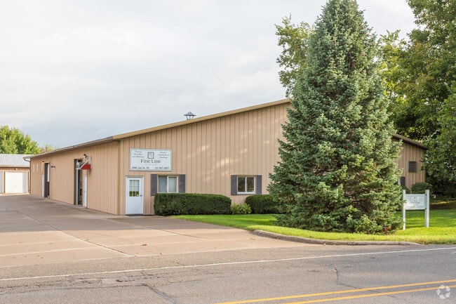
Property Record
1008 2Nd St Ne, Bondurant, IA 50035


NEARBY LISTINGS FOR SALE OR LEASE
Property Detail
1008 2Nd St Ne
231-00028002005
Sec 30-80-22
Warehouse
W 140F E 939.65F SE 1/4 SE 1/4 S OF RR LESS RD SEC 30-80-22
X
Polk
19153C0230F
Iowa
2024
0.83 AC
2025
Northeast
010102
Des Moines
13,400 SF
Des Moines-West Des Moines, IA
DEMOGRAPHICS near 1008 2Nd St Ne
1 Mile
3 Mile
5 Mile
2024 Total Population
4,398
9,686
27,481
2029 Population
4,652
10,349
28,963
Pop Growth 2024-2029
+ 5.78%
+ 6.84%
+ 5.39%
Average Age
33
33
37
2024 Total Households
1,455
3,086
9,924
HH Growth 2024-2029
+ 5.84%
+ 6.93%
+ 5.37%
Median Household Inc
$104,622
$111,634
$92,589
Avg Household Size
3.00
3.10
2.70
2024 Avg HH Vehicles
2.00
2.00
2.00
Median Home Value
$261,452
$280,698
$260,819
Median Year Built
2010
2010
2000
Nearby Places
Map Layers
Map Styles
 Street
 Aerial
- Restaurants
- Banks
- Shops
- Fitness
- Groceries
PUBLIC TRANSPORTATION
AIRPORT
Des Moines International
DRIVE
WALK
Distance
Des Moines International
33 min
20.0 mi
Freight Ports
Port Milwaukee
DRIVE
WALK
Distance
Port Milwaukee
406 min
365.3 mi
SALE & LEASE HISTORY
LISTING DATE
SALE/LEASE

Mar 31, 2022
For Sale
Nearby Properties
Address
Land Use
TOTAL SIZE
Lot Size
Zoning
Address
Land Use
TOTAL SIZE
Lot Size
Zoning
2,693,534 SF
167.13 AC
Address
Land Use
TOTAL SIZE
Lot Size
Zoning
497,587 SF
31.46 AC
Address
Land Use
TOTAL SIZE
Lot Size
Zoning
279,650 SF
48.24 AC
Address
Land Use
TOTAL SIZE
Lot Size
Zoning
327,600 SF
16.57 AC
Address
Land Use
TOTAL SIZE
Lot Size
Zoning
325,160 SF
17.24 AC
Address
Land Use
TOTAL SIZE
Lot Size
Zoning
265,726 SF
14.76 AC
Address
Land Use
TOTAL SIZE
Lot Size
Zoning
195,500 SF
8.09 AC
Address
Land Use
TOTAL SIZE
Lot Size
Zoning
106,824 SF
4.50 AC
Address
Land Use
TOTAL SIZE
Lot Size
Zoning
78,180 SF
7.31 AC
Address
Land Use
TOTAL SIZE
Lot Size
Zoning
49,145 SF
6.06 AC
Address
Land Use
TOTAL SIZE
Lot Size
Zoning
134,400 SF
6.01 AC
M-1
Address
Land Use
TOTAL SIZE
Lot Size
Zoning
27,908 SF
14.43 AC
Address
Land Use
TOTAL SIZE
Lot Size
Zoning
72,024 SF
30 AC
Address
Land Use
TOTAL SIZE
Lot Size
Zoning
12,439 SF
6.87 AC
Address
Land Use
TOTAL SIZE
Lot Size
Zoning
29,000 SF
6.36 AC
M-1
Address
Land Use
TOTAL SIZE
Lot Size
Zoning
38,997 SF
5.86 AC
R-3
Address
Land Use
TOTAL SIZE
Lot Size
Zoning
34,960 SF
14.09 AC
Address
Land Use
TOTAL SIZE
Lot Size
Zoning
60,321 SF
3.29 AC
C-2
Address
Land Use
TOTAL SIZE
Lot Size
Zoning
5,402 SF
15.09 AC
Address
Land Use
TOTAL SIZE
Lot Size
Zoning
26,250 SF
10.17 AC
Address
Land Use
TOTAL SIZE
Lot Size
Zoning
34,122 SF
8.08 AC
M-1
Address
Land Use
TOTAL SIZE
Lot Size
Zoning
58,443 SF
3.16 AC
C-2
Address
Land Use
TOTAL SIZE
Lot Size
Zoning
22,000 SF
8.52 AC
Address
Land Use
TOTAL SIZE
Lot Size
Zoning
45,372 SF
3.21 AC
C-2
Address
Land Use
TOTAL SIZE
Lot Size
Zoning
12,798 SF
1.74 AC
Address
Land Use
TOTAL SIZE
Lot Size
Zoning
25,979 SF
3.44 AC
C2
Address
Land Use
TOTAL SIZE
Lot Size
Zoning
22,398 SF
3.02 AC
Address
Land Use
TOTAL SIZE
Lot Size
Zoning
7,500 SF
8.99 AC
Address
Land Use
TOTAL SIZE
Lot Size
Zoning
8,840 SF
3.11 AC
The World's #1 Commercial Real Estate Marketplace
Connect with us
© 2026 CoStar Group
The information above has been obtained from sources believed reliable. While we do not doubt its accuracy we have not verified it and make no guarantee, warranty or representation about it. It is your responsibility to independently confirm its accuracy and completeness. Any projections, opinions, assumptions, or estimates used are for example only and do not represent the current or future performance of the property. The value of this transaction to you depends on tax and other factors which should be evaluated by your tax, financial, and legal advisors. You and your advisors should conduct a careful, independent investigation of the property to determine to your satisfaction the suitability of the property for your needs.