Property Record
1008 2Nd St, Sacramento, CA 95814
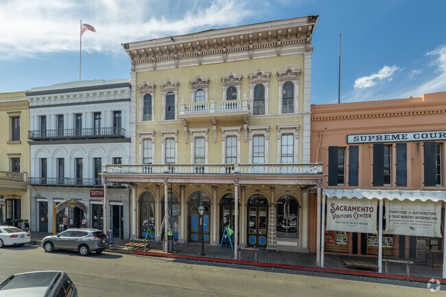

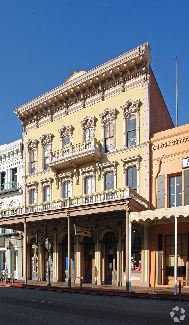

This Property Is For Sale
NEARBY LISTINGS FOR SALE OR LEASE
Property Detail
1008 2Nd St
Sacramento--Roseville--Arden-Arcade, CA
Parcel Map
006-0071-043
PARCEL MAP, LOT 16
Storesoffices
Sacramento
X
California
06067C0160J
16
2024
0.12 AC
2025
Downtown
000700
Sacramento
15,128 SF
DEMOGRAPHICS near 1008 2Nd St
1 Mile
3 Mile
5 Mile
2024 Total Population
17,855
146,895
330,046
2029 Population
18,279
148,977
334,252
Pop Growth 2024-2029
+ 2.37%
+ 1.42%
+ 1.27%
Average Age
39
39
38
2024 Total Households
8,149
63,499
130,941
HH Growth 2024-2029
+ 2.88%
+ 1.65%
+ 1.39%
Median Household Inc
$51,793
$74,447
$73,700
Avg Household Size
1.80
2.10
2.40
2024 Avg HH Vehicles
1.00
2.00
2.00
Median Home Value
$484,584
$531,690
$485,982
Median Year Built
1976
1970
1970
Nearby Places
- Restaurants
- Banks
- Shops
- Fitness
- Groceries
PUBLIC TRANSPORTATION
TRANSIT/SUBWAY
Sacramento Valley Station (Gold Line - Sacramento Regional Transit District Light Rail (The RT))
DRIVE
WALK
Distance
Sacramento Valley Station (Gold Line - Sacramento Regional Transit District Light Rail (The RT))
3 min
9 min
0.5 mi
7th & I/County Center (Gold Line - Sacramento Regional Transit District Light Rail (The RT))
DRIVE
WALK
Distance
7th & I/County Center (Gold Line - Sacramento Regional Transit District Light Rail (The RT))
3 min
10 min
0.6 mi
7th & Capitol (Blue Line - Sacramento Regional Transit District Light Rail (The RT), Gold Line - Sacramento Regional Transit District Light Rail (The RT))
DRIVE
WALK
Distance
7th & Capitol (Blue Line - Sacramento Regional Transit District Light Rail (The RT), Gold Line - Sacramento Regional Transit District Light Rail (The RT))
3 min
12 min
0.6 mi
St. Rose of Lima Park - 7th & K (Blue Line - Sacramento Regional Transit District Light Rail (The RT))
DRIVE
WALK
Distance
St. Rose of Lima Park - 7th & K (Blue Line - Sacramento Regional Transit District Light Rail (The RT))
3 min
13 min
0.7 mi
8th & K (Gold Line - Sacramento Regional Transit District Light Rail (The RT))
DRIVE
WALK
Distance
8th & K (Gold Line - Sacramento Regional Transit District Light Rail (The RT))
4 min
14 min
0.7 mi
AIRPORT
Sacramento International
DRIVE
WALK
Distance
Sacramento International
14 min
11.4 mi
Freight Ports
Port of Richmond
DRIVE
WALK
Distance
Port of Richmond
1 min
66.1 mi
Nearby Properties
Address
Land Use
TOTAL SIZE
Lot Size
Zoning
Address
Land Use
TOTAL SIZE
Lot Size
Zoning
1,095,507 SF
1.39 AC
H-SPD C-2-
Address
Land Use
TOTAL SIZE
Lot Size
Zoning
5.64 AC
C-3-SPD
Address
Land Use
TOTAL SIZE
Lot Size
Zoning
10.28 AC
H
Address
Land Use
TOTAL SIZE
Lot Size
Zoning
487,483 SF
1.12 AC
C-3-SPD
Address
Land Use
TOTAL SIZE
Lot Size
Zoning
756,831 SF
1.39 AC
C-2-SPD
Address
Land Use
TOTAL SIZE
Lot Size
Zoning
399,626 SF
2.41 AC
C-3-SPD
Address
Land Use
TOTAL SIZE
Lot Size
Zoning
366,730 SF
0.89 AC
C-3-SPD
Address
Land Use
TOTAL SIZE
Lot Size
Zoning
200,616 SF
2.54 AC
C-2-SPD
Address
Land Use
TOTAL SIZE
Lot Size
Zoning
594,942 SF
2.39 AC
C-3-SPD
Address
Land Use
TOTAL SIZE
Lot Size
Zoning
676,447 SF
1.43 AC
C-3-SPD
Address
Land Use
TOTAL SIZE
Lot Size
Zoning
193,521 SF
0.60 AC
C-3-SPD
Address
Land Use
TOTAL SIZE
Lot Size
Zoning
339,329 SF
6.40 AC
R-5-PUD-SP
Address
Land Use
TOTAL SIZE
Lot Size
Zoning
213,557 SF
2.33 AC
C-3-SPD
Address
Land Use
TOTAL SIZE
Lot Size
Zoning
0.65 AC
C-4-SPD
Address
Land Use
TOTAL SIZE
Lot Size
Zoning
467,970 SF
4.59 AC
W-F
Address
Land Use
TOTAL SIZE
Lot Size
Zoning
410,420 SF
0.95 AC
C-3-SPD
Address
Land Use
TOTAL SIZE
Lot Size
Zoning
320,072 SF
2.65 AC
C-2
Address
Land Use
TOTAL SIZE
Lot Size
Zoning
318,616 SF
16.40 AC
R-2B-PUD
Address
Land Use
TOTAL SIZE
Lot Size
Zoning
R-4-PUD C-
Address
Land Use
TOTAL SIZE
Lot Size
Zoning
0.13 AC
WF
Address
Land Use
TOTAL SIZE
Lot Size
Zoning
26,712 SF
1.90 AC
R-5-PUD-SP
Address
Land Use
TOTAL SIZE
Lot Size
Zoning
26,712 SF
1.85 AC
R-5-PUD-SP
Address
Land Use
TOTAL SIZE
Lot Size
Zoning
2.88 AC
C-3-SPD
Address
Land Use
TOTAL SIZE
Lot Size
Zoning
508,916 SF
0.71 AC
C-3-SPD
Address
Land Use
TOTAL SIZE
Lot Size
Zoning
303,254 SF
10.63 AC
OB-PUD
Address
Land Use
TOTAL SIZE
Lot Size
Zoning
246,417 SF
1.19 AC
C-3-SPD
Address
Land Use
TOTAL SIZE
Lot Size
Zoning
405,074 SF
2.39 AC
C-3-SPD
Address
Land Use
TOTAL SIZE
Lot Size
Zoning
119,055 SF
1.18 AC
C-2-SPD
Address
Land Use
TOTAL SIZE
Lot Size
Zoning
383,000 SF
25.52 AC
M-1
Address
Land Use
TOTAL SIZE
Lot Size
Zoning
0.90 AC
C-3-SPD
The World's #1 Commercial Real Estate Marketplace
Connect with us
© 2025 CoStar Group
The information above has been obtained from sources believed reliable. While we do not doubt its accuracy we have not verified it and make no guarantee, warranty or representation about it. It is your responsibility to independently confirm its accuracy and completeness. Any projections, opinions, assumptions, or estimates used are for example only and do not represent the current or future performance of the property. The value of this transaction to you depends on tax and other factors which should be evaluated by your tax, financial, and legal advisors. You and your advisors should conduct a careful, independent investigation of the property to determine to your satisfaction the suitability of the property for your needs.