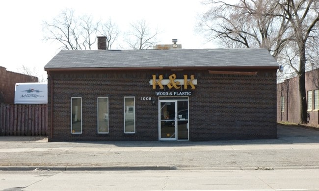
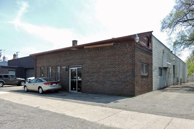
Property Record
1008 E 10 Mile Rd, Hazel Park, MI 48030
NEARBY LISTINGS FOR SALE OR LEASE
Property Detail
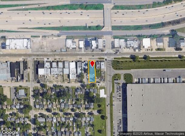
1008 E 10 Mile Rd
Detroit-Warren-Dearborn, MI
John Ickler's Sunnyside Sub
25-25-131-010
T1N, R11E, SEC 25 JOHN ICKLER'S SUNNYSIDE SUB LOT 141, ALSO W 20 FT OF LOT 142, ALSO ALL OF LOTS 149, 150 & 151, ALSO ALL OF VAC ALLEY ADJ TO SAME
Warehouse
Oakland
X
Michigan
26163C0125E
141
2024
0.28 AC
2025
Royal Oak
175000
Detroit
4,960 SF
DEMOGRAPHICS near 1008 E 10 Mile Rd
1 mile
3 mile
5 mile
2024 Total Population
14,910
131,201
351,013
2029 Population
14,847
130,194
348,345
Pop Growth 2024-2029
(0.42%)
(0.77%)
(0.76%)
Average Age
41
40
40
2024 Total Households
6,982
58,529
150,276
HH Growth 2024-2029
(0.39%)
(0.75%)
(0.75%)
Median Household Inc
$51,299
$63,738
$57,912
Avg Household Size
2.10
2.20
2.30
2024 Avg HH Vehicles
2.00
2.00
2.00
Median Home Value
$111,934
$168,339
$169,393
Median Year Built
1958
1956
1955
Nearby Places
Map Layers
Map Styles
 Street
 Aerial
Transit
 Traffic
 Biking
Places
Listings with unknown addresses are not visible on the map
- Restaurants
- Banks
- Shops
- Fitness
- Groceries
PUBLIC TRANSPORTATION
COMMUTER RAIL
Drive
Walk
Distance
7 min
3.6 mi
Drive
Walk
Distance
16 min
8.6 mi
AIRPORT
Windsor International
Drive
Walk
Distance
Windsor International
39 min
21.7 mi
Detroit Metro Wayne County
Drive
Walk
Distance
Detroit Metro Wayne County
44 min
31.3 mi
SALE & LEASE HISTORY
LISTING DATE
SALE/LEASE

May 02, 2017
For Sale
Nearby Properties
Address
Land Use
TOTAL SIZE
Lot Size
Zoning
Address
Land Use
TOTAL SIZE
Lot Size
Zoning
3,529,575 SF
84.46 AC
B4
Address
Land Use
TOTAL SIZE
Lot Size
Zoning
4.20 AC
REG BUS
Address
Land Use
TOTAL SIZE
Lot Size
Zoning
910,140 SF
47.78 AC
Address
Land Use
TOTAL SIZE
Lot Size
Zoning
0.81 AC
CBD
Address
Land Use
TOTAL SIZE
Lot Size
Zoning
419,600 SF
Address
Land Use
TOTAL SIZE
Lot Size
Zoning
10,734 SF
3.52 AC
SPEC REDEV
Address
Land Use
TOTAL SIZE
Lot Size
Zoning
649,140 SF
43.98 AC
Address
Land Use
TOTAL SIZE
Lot Size
Zoning
576,924 SF
31.35 AC
Address
Land Use
TOTAL SIZE
Lot Size
Zoning
157,004 SF
1.78 AC
PUD
Address
Land Use
TOTAL SIZE
Lot Size
Zoning
228,421 SF
17.18 AC
RMMUL
Address
Land Use
TOTAL SIZE
Lot Size
Zoning
306,345 SF
Address
Land Use
TOTAL SIZE
Lot Size
Zoning
455,425 SF
Address
Land Use
TOTAL SIZE
Lot Size
Zoning
348,256 SF
46.10 AC
MZ
Address
Land Use
TOTAL SIZE
Lot Size
Zoning
576,924 SF
36.24 AC
Address
Land Use
TOTAL SIZE
Lot Size
Zoning
146,981 SF
4.11 AC
Address
Land Use
TOTAL SIZE
Lot Size
Zoning
1.46 AC
CBD
Address
Land Use
TOTAL SIZE
Lot Size
Zoning
804 SF
1.50 AC
CBD
Address
Land Use
TOTAL SIZE
Lot Size
Zoning
150,703 SF
Address
Land Use
TOTAL SIZE
Lot Size
Zoning
132,512 SF
0.50 AC
CBD
Address
Land Use
TOTAL SIZE
Lot Size
Zoning
233,900 SF
15.56 AC
M-2
Address
Land Use
TOTAL SIZE
Lot Size
Zoning
Address
Land Use
TOTAL SIZE
Lot Size
Zoning
272,046 SF
17.63 AC
M-2
Address
Land Use
TOTAL SIZE
Lot Size
Zoning
171,259 SF
1.26 AC
CBD
Address
Land Use
TOTAL SIZE
Lot Size
Zoning
362,895 SF
14.85 AC
M-2
Address
Land Use
TOTAL SIZE
Lot Size
Zoning
259,959 SF
27.39 AC
MZ
Address
Land Use
TOTAL SIZE
Lot Size
Zoning
62,528 SF
5.27 AC
M-1 LT
Address
Land Use
TOTAL SIZE
Lot Size
Zoning
13.89 AC
PUD
Address
Land Use
TOTAL SIZE
Lot Size
Zoning
199,592 SF
17.02 AC
B3
Address
Land Use
TOTAL SIZE
Lot Size
Zoning
103,320 SF
Address
Land Use
TOTAL SIZE
Lot Size
Zoning
220,561 SF
10.62 AC
M-2
The World's #1 Commercial Real Estate Marketplace
Connect with us
© 2026 CoStar Group
The information above has been obtained from sources believed reliable. While we do not doubt its accuracy we have not verified it and make no guarantee, warranty or representation about it. It is your responsibility to independently confirm its accuracy and completeness. Any projections, opinions, assumptions, or estimates used are for example only and do not represent the current or future performance of the property. The value of this transaction to you depends on tax and other factors which should be evaluated by your tax, financial, and legal advisors. You and your advisors should conduct a careful, independent investigation of the property to determine to your satisfaction the suitability of the property for your needs.