Property Record
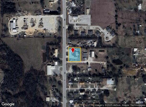
1008 N Highway 77, Marietta, OK 73448
NEARBY LISTINGS FOR SALE OR LEASE
-
-
View all Marietta listings for sale on LoopNet.com
Property Detail
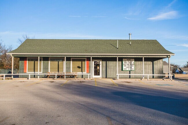
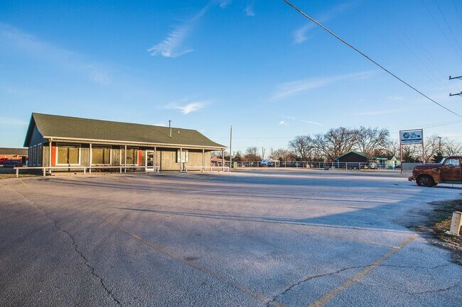
1008 N Highway 77
0000-17-07S-02E-0-065-00
COMM @ SW/C OF SW/4 TH N00 02 47"W 1979.88' TH N89 46 21"E 50.00' POB TH S89 46 21"E 162.00' TH S00 02 47"E 190.00' TH N89 46
Restaurantbuilding
Love
2024
Oklahoma
2025
0.70 AC
094100
Oklahoma East Area
480 SF
Other Market Areas
DEMOGRAPHICS near 1008 N Highway 77
1 Mile
3 Mile
5 Mile
2024 Total Population
1,668
3,368
4,223
2029 Population
1,691
3,424
4,292
Pop Growth 2024-2029
+ 1.38%
+ 1.66%
+ 1.63%
Average Age
38
39
40
2024 Total Households
602
1,230
1,576
HH Growth 2024-2029
+ 1.16%
+ 1.46%
+ 1.52%
Median Household Inc
$42,000
$44,382
$48,047
Avg Household Size
2.70
2.60
2.60
2024 Avg HH Vehicles
2.00
2.00
2.00
Median Home Value
$96,950
$108,079
$124,567
Median Year Built
1973
1974
1976
Nearby Places
Map Layers
Map Styles
 Street
 Aerial
- Restaurants
- Banks
- Shops
- Fitness
- Groceries
SALE & LEASE HISTORY
LISTING DATE
SALE/LEASE

Oct 09, 2022
For Sale
Feb 25, 2021
For Sale
Nearby Properties
Address
Land Use
TOTAL SIZE
Lot Size
Zoning
Address
Land Use
TOTAL SIZE
Lot Size
Zoning
60,000 SF
8.10 AC
C2
Address
Land Use
TOTAL SIZE
Lot Size
Zoning
3,402 SF
2.53 AC
C1
Address
Land Use
TOTAL SIZE
Lot Size
Zoning
17,560 SF
5.18 AC
C1
Address
Land Use
TOTAL SIZE
Lot Size
Zoning
603,681 SF
85.64 AC
C2
Address
Land Use
TOTAL SIZE
Lot Size
Zoning
16,660 SF
5.36 AC
C1
Address
Land Use
TOTAL SIZE
Lot Size
Zoning
373 SF
1.49 AC
C1
Address
Land Use
TOTAL SIZE
Lot Size
Zoning
4,158 SF
1.66 AC
C1
Address
Land Use
TOTAL SIZE
Lot Size
Zoning
84.53 AC
IP
Address
Land Use
TOTAL SIZE
Lot Size
Zoning
4,419 SF
8.02 AC
C1
Address
Land Use
TOTAL SIZE
Lot Size
Zoning
50 SF
2.55 AC
C1
Address
Land Use
TOTAL SIZE
Lot Size
Zoning
3,798 SF
0.86 AC
C1
Address
Land Use
TOTAL SIZE
Lot Size
Zoning
7,572 SF
1.09 AC
C2
Address
Land Use
TOTAL SIZE
Lot Size
Zoning
6,351 SF
3 AC
C2
Address
Land Use
TOTAL SIZE
Lot Size
Zoning
450 SF
0.65 AC
C2
Address
Land Use
TOTAL SIZE
Lot Size
Zoning
480 SF
1.07 AC
C2
Address
Land Use
TOTAL SIZE
Lot Size
Zoning
2,060 SF
0.45 AC
C1
Address
Land Use
TOTAL SIZE
Lot Size
Zoning
3,812 SF
4.57 AC
C2
Address
Land Use
TOTAL SIZE
Lot Size
Zoning
1,200 SF
0.67 AC
C2
Address
Land Use
TOTAL SIZE
Lot Size
Zoning
2,576 SF
2.48 AC
Address
Land Use
TOTAL SIZE
Lot Size
Zoning
4,132 SF
0.46 AC
C1
Address
Land Use
TOTAL SIZE
Lot Size
Zoning
9,920 SF
0.32 AC
C1
Address
Land Use
TOTAL SIZE
Lot Size
Zoning
4,550 SF
0.92 AC
C2
Address
Land Use
TOTAL SIZE
Lot Size
Zoning
1,200 SF
2.44 AC
Address
Land Use
TOTAL SIZE
Lot Size
Zoning
5,000 SF
10.53 AC
C1
Address
Land Use
TOTAL SIZE
Lot Size
Zoning
644 SF
0.16 AC
C1
Address
Land Use
TOTAL SIZE
Lot Size
Zoning
3,096 SF
0.13 AC
C1
Address
Land Use
TOTAL SIZE
Lot Size
Zoning
3,000 SF
10.24 AC
R1
Address
Land Use
TOTAL SIZE
Lot Size
Zoning
2,400 SF
0.56 AC
C1
Address
Land Use
TOTAL SIZE
Lot Size
Zoning
3,096 SF
0.46 AC
C1
The World's #1 Commercial Real Estate Marketplace
Connect with us
© 2026 CoStar Group
The information above has been obtained from sources believed reliable. While we do not doubt its accuracy we have not verified it and make no guarantee, warranty or representation about it. It is your responsibility to independently confirm its accuracy and completeness. Any projections, opinions, assumptions, or estimates used are for example only and do not represent the current or future performance of the property. The value of this transaction to you depends on tax and other factors which should be evaluated by your tax, financial, and legal advisors. You and your advisors should conduct a careful, independent investigation of the property to determine to your satisfaction the suitability of the property for your needs.