Property Record
1008 W Farmer St, Ozark, MO 65721
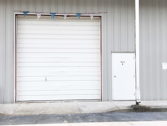

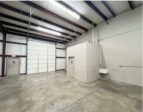
Current Lease Availabilities
Property Detail
1008 W Farmer St
11-0.5-22-004-002-005.002
BEG 586 SW INTERSEC E LINE OF SEC & CENTER OF RR TH NW 200SW 318.5, SE 258.25, NW 319.03, ETC. NW 73.89 TO POB
Commercialnec
Christian
C and X Area of minimal flood hazard, usually depicted on FIRMs as above the 500-year flood level.
Missouri
2024
1.50 AC
2025
East Christian County
020304
Springfield
10,010 SF
Springfield, MO
NEARBY LISTINGS FOR SALE OR LEASE
-
-
View all Ozark listings for lease on LoopNet.com
DEMOGRAPHICS near 1008 W Farmer St
1 mile
3 mile
5 mile
2025 Total Population
5,367
24,666
52,493
2030 Population
5,695
26,158
55,771
Pop Growth 2025-2030
+ 6.11%
+ 6.05%
+ 6.24%
Average Age
38
38
39
2025 Total Households
1,970
9,015
19,590
HH Growth 2025-2030
+ 6.24%
+ 6.10%
+ 6.28%
Median Household Inc
$76,904
$74,132
$81,058
Avg Household Size
2.60
2.70
2.60
2025 Avg HH Vehicles
2.00
2.00
2.00
Median Home Value
$230,030
$286,935
$318,546
Median Year Built
1991
1998
2000
Nearby Places
Map Layers
Map Styles
 Street
 Aerial
Layers
 Traffic
 Biking
Places
Listings with unknown addresses are not visible on the map
- Restaurants
- Banks
- Shops
- Fitness
- Groceries
PUBLIC TRANSPORTATION
AIRPORT
Springfield-Branson Ntl
Drive
Walk
Distance
Springfield-Branson Ntl
43 min
29.9 mi
Nearby Properties
Address
Land Use
TOTAL SIZE
Lot Size
Zoning
Address
Land Use
TOTAL SIZE
Lot Size
Zoning
13,048 SF
9.29 AC
Address
Land Use
TOTAL SIZE
Lot Size
Zoning
6,000 SF
50.60 AC
Address
Land Use
TOTAL SIZE
Lot Size
Zoning
129,257 SF
32 AC
Address
Land Use
TOTAL SIZE
Lot Size
Zoning
2,942 SF
17.41 AC
Address
Land Use
TOTAL SIZE
Lot Size
Zoning
33,019 SF
6.24 AC
Address
Land Use
TOTAL SIZE
Lot Size
Zoning
3,942 SF
40 AC
Address
Land Use
TOTAL SIZE
Lot Size
Zoning
131,905 SF
17.94 AC
Address
Land Use
TOTAL SIZE
Lot Size
Zoning
3,025 SF
2.20 AC
Address
Land Use
TOTAL SIZE
Lot Size
Zoning
968 SF
18.67 AC
Address
Land Use
TOTAL SIZE
Lot Size
Zoning
4,800 SF
10.57 AC
Address
Land Use
TOTAL SIZE
Lot Size
Zoning
2,100 SF
20 AC
Address
Land Use
TOTAL SIZE
Lot Size
Zoning
77,079 SF
28.40 AC
Address
Land Use
TOTAL SIZE
Lot Size
Zoning
48,227 SF
3.07 AC
Address
Land Use
TOTAL SIZE
Lot Size
Zoning
53,125 SF
8.01 AC
Address
Land Use
TOTAL SIZE
Lot Size
Zoning
38,524 SF
6.54 AC
Address
Land Use
TOTAL SIZE
Lot Size
Zoning
13,634 SF
3.51 AC
Address
Land Use
TOTAL SIZE
Lot Size
Zoning
5,824 SF
6.68 AC
Address
Land Use
TOTAL SIZE
Lot Size
Zoning
41,000 SF
4.50 AC
Address
Land Use
TOTAL SIZE
Lot Size
Zoning
23,625 SF
7.98 AC
Address
Land Use
TOTAL SIZE
Lot Size
Zoning
Address
Land Use
TOTAL SIZE
Lot Size
Zoning
3,003 SF
6.46 AC
Address
Land Use
TOTAL SIZE
Lot Size
Zoning
20,765 SF
3 AC
Address
Land Use
TOTAL SIZE
Lot Size
Zoning
8,802 SF
5.26 AC
Address
Land Use
TOTAL SIZE
Lot Size
Zoning
5,760 SF
8.62 AC
Address
Land Use
TOTAL SIZE
Lot Size
Zoning
Address
Land Use
TOTAL SIZE
Lot Size
Zoning
23,112 SF
0.54 AC
Address
Land Use
TOTAL SIZE
Lot Size
Zoning
3,464 SF
13.34 AC
Address
Land Use
TOTAL SIZE
Lot Size
Zoning
28,000 SF
3.62 AC
Address
Land Use
TOTAL SIZE
Lot Size
Zoning
2,025 SF
4.89 AC
Address
Land Use
TOTAL SIZE
Lot Size
Zoning
3,960 SF
19.16 AC
The World's #1 Commercial Real Estate Marketplace
Connect with us
© 2026 CoStar Group
The information above has been obtained from sources believed reliable. While we do not doubt its accuracy we have not verified it and make no guarantee, warranty or representation about it. It is your responsibility to independently confirm its accuracy and completeness. Any projections, opinions, assumptions, or estimates used are for example only and do not represent the current or future performance of the property. The value of this transaction to you depends on tax and other factors which should be evaluated by your tax, financial, and legal advisors. You and your advisors should conduct a careful, independent investigation of the property to determine to your satisfaction the suitability of the property for your needs.