Property Record
10081 Ridge Rd, Girard, PA 16417
NEARBY LISTINGS FOR SALE OR LEASE
-
-
View all Girard listings for sale on LoopNet.com
Property Detail
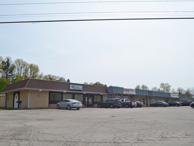
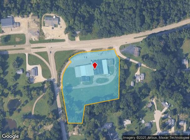
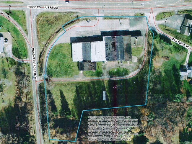
10081 Ridge Rd
24-011-057.0-001.01
10081 RIDGE RD 5.796 AC
Stripcommercialcenter
Erie
X
Pennsylvania
42049C0330D
5.79 AC
2025
Outlying Erie County
2025
Erie
010202
Erie, PA
38,944 SF
DEMOGRAPHICS near 10081 Ridge Rd
1 Mile
3 Mile
5 Mile
2024 Total Population
1,190
9,943
15,072
2029 Population
1,185
9,837
14,867
Pop Growth 2024-2029
(0.42%)
(1.07%)
(1.36%)
Average Age
44
42
43
2024 Total Households
498
4,117
6,030
HH Growth 2024-2029
(0.60%)
(1.17%)
(1.48%)
Median Household Inc
$80,063
$66,757
$70,969
Avg Household Size
2.40
2.40
2.50
2024 Avg HH Vehicles
2.00
2.00
2.00
Median Home Value
$188,130
$156,376
$164,086
Median Year Built
1972
1973
1975
Nearby Places
Map Layers
Map Styles
 Street
 Aerial
- Restaurants
- Banks
- Shops
- Fitness
- Groceries
PUBLIC TRANSPORTATION
AIRPORT
Erie International/Tom Ridge Field
DRIVE
WALK
Distance
Erie International/Tom Ridge Field
22 min
11.5 mi
SALE & LEASE HISTORY
LISTING DATE
SALE/LEASE

Sep 25, 2016
For Lease
Nov 17, 2016
For Sale
May 05, 2021
For Sale
Nearby Properties
Address
Land Use
TOTAL SIZE
Lot Size
Zoning
Address
Land Use
TOTAL SIZE
Lot Size
Zoning
17.11 AC
R1A
Address
Land Use
TOTAL SIZE
Lot Size
Zoning
1,150 SF
27 AC
RA
Address
Land Use
TOTAL SIZE
Lot Size
Zoning
22.86 AC
R1A
Address
Land Use
TOTAL SIZE
Lot Size
Zoning
792 SF
110 AC
R2
Address
Land Use
TOTAL SIZE
Lot Size
Zoning
193,924 SF
16.09 AC
M1
Address
Land Use
TOTAL SIZE
Lot Size
Zoning
73.68 AC
R2
Address
Land Use
TOTAL SIZE
Lot Size
Zoning
2,472 SF
6.28 AC
R2
Address
Land Use
TOTAL SIZE
Lot Size
Zoning
62,750 SF
6.89 AC
F1
Address
Land Use
TOTAL SIZE
Lot Size
Zoning
37,500 SF
1.52 AC
R2
Address
Land Use
TOTAL SIZE
Lot Size
Zoning
286,300 SF
36.12 AC
M1
Address
Land Use
TOTAL SIZE
Lot Size
Zoning
1.97 AC
R3
Address
Land Use
TOTAL SIZE
Lot Size
Zoning
22,256 SF
5.53 AC
C2
Address
Land Use
TOTAL SIZE
Lot Size
Zoning
27,768 SF
1.93 AC
C2
Address
Land Use
TOTAL SIZE
Lot Size
Zoning
1,622 SF
22.50 AC
R1
Address
Land Use
TOTAL SIZE
Lot Size
Zoning
7,186 SF
2.44 AC
C2
Address
Land Use
TOTAL SIZE
Lot Size
Zoning
99,882 SF
5.52 AC
M1
Address
Land Use
TOTAL SIZE
Lot Size
Zoning
1.78 AC
R3
Address
Land Use
TOTAL SIZE
Lot Size
Zoning
210,039 SF
8.08 AC
M1
Address
Land Use
TOTAL SIZE
Lot Size
Zoning
5,076 SF
4.56 AC
R1A
Address
Land Use
TOTAL SIZE
Lot Size
Zoning
15,883 SF
3.99 AC
C2
Address
Land Use
TOTAL SIZE
Lot Size
Zoning
11,869 SF
3.91 AC
R3
Address
Land Use
TOTAL SIZE
Lot Size
Zoning
240 SF
39.38 AC
F1
Address
Land Use
TOTAL SIZE
Lot Size
Zoning
48,300 SF
20.06 AC
F1
Address
Land Use
TOTAL SIZE
Lot Size
Zoning
6,633 SF
10.96 AC
R2
Address
Land Use
TOTAL SIZE
Lot Size
Zoning
5,515 SF
12.40 AC
R2
Address
Land Use
TOTAL SIZE
Lot Size
Zoning
17,600 SF
2 AC
C1
Address
Land Use
TOTAL SIZE
Lot Size
Zoning
1.86 AC
R2
Address
Land Use
TOTAL SIZE
Lot Size
Zoning
57,280 SF
2.31 AC
M1
Address
Land Use
TOTAL SIZE
Lot Size
Zoning
15,360 SF
1.45 AC
R2
Address
Land Use
TOTAL SIZE
Lot Size
Zoning
24,728 SF
3 AC
The World's #1 Commercial Real Estate Marketplace
Connect with us
© 2026 CoStar Group
The information above has been obtained from sources believed reliable. While we do not doubt its accuracy we have not verified it and make no guarantee, warranty or representation about it. It is your responsibility to independently confirm its accuracy and completeness. Any projections, opinions, assumptions, or estimates used are for example only and do not represent the current or future performance of the property. The value of this transaction to you depends on tax and other factors which should be evaluated by your tax, financial, and legal advisors. You and your advisors should conduct a careful, independent investigation of the property to determine to your satisfaction the suitability of the property for your needs.