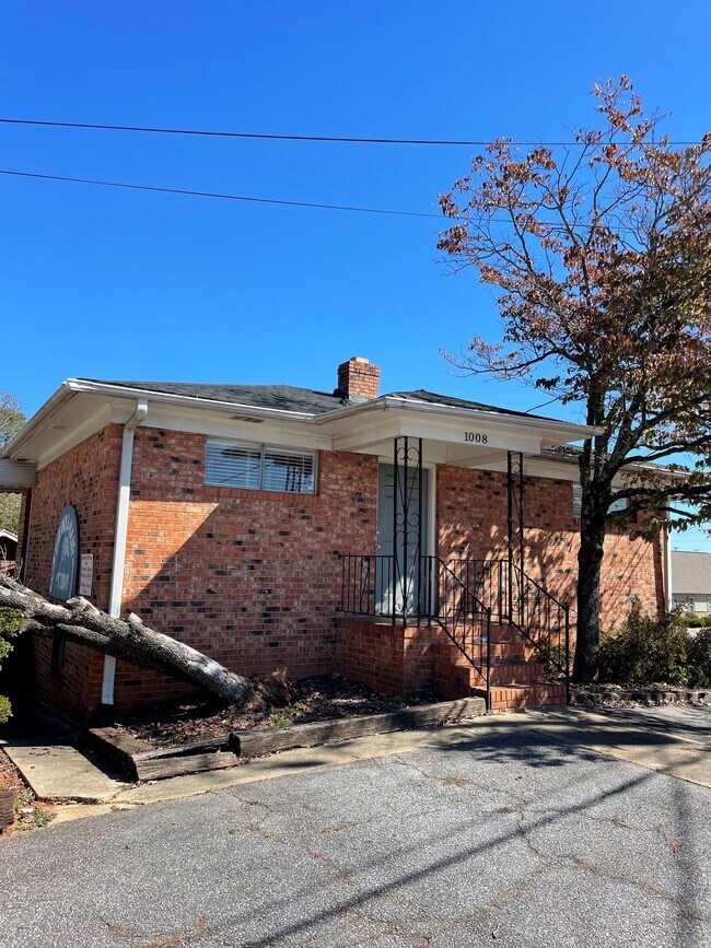
Property Record
1009 E Perry Rd, Greenville, SC 29609


NEARBY LISTINGS FOR SALE OR LEASE
Property Detail
1009 E Perry Rd
Greenville-Anderson-Mauldin, SC
Leawood Hills
0173.02-05-018.02
Greenville
Sfr
South Carolina
X
0.24 AC
45045C0319E
West Side Greenville
2,436 SF
Greenville/Spartanburg
DEMOGRAPHICS near 1009 E Perry Rd
1 Mile
3 Mile
5 Mile
2024 Total Population
7,458
64,091
159,071
2029 Population
8,260
71,119
176,202
Pop Growth 2024-2029
+ 10.75%
+ 10.97%
+ 10.77%
Average Age
37
38
39
2024 Total Households
3,206
25,969
66,678
HH Growth 2024-2029
+ 10.82%
+ 11.21%
+ 11.03%
Median Household Inc
$54,485
$49,819
$54,904
Avg Household Size
2.30
2.30
2.20
2024 Avg HH Vehicles
2.00
2.00
2.00
Median Home Value
$202,743
$227,257
$249,091
Median Year Built
1974
1977
1979
Nearby Places
Map Layers
Map Styles
 Street
 Aerial
- Restaurants
- Banks
- Shops
- Fitness
- Groceries
PUBLIC TRANSPORTATION
COMMUTER RAIL
Greenville Amtrak Station (Crescent - Amtrak)
DRIVE
WALK
Distance
Greenville Amtrak Station (Crescent - Amtrak)
6 min
2.7 mi
AIRPORT
Greenville Spartanburg International
DRIVE
WALK
Distance
Greenville Spartanburg International
27 min
16.0 mi
Freight Ports
North Charleston Terminal
DRIVE
WALK
Distance
North Charleston Terminal
234 min
206.7 mi
SALE & LEASE HISTORY
LISTING DATE
SALE/LEASE

Oct 21, 2024
For Sale
Nov 02, 2020
For Lease
Nearby Properties
Address
Land Use
TOTAL SIZE
Lot Size
Zoning
Address
Land Use
TOTAL SIZE
Lot Size
Zoning
22.97 AC
R12
Address
Land Use
TOTAL SIZE
Lot Size
Zoning
1.01 AC
C4
Address
Land Use
TOTAL SIZE
Lot Size
Zoning
0.39 AC
C4
Address
Land Use
TOTAL SIZE
Lot Size
Zoning
28.88 AC
RM
Address
Land Use
TOTAL SIZE
Lot Size
Zoning
14.41 AC
R15
Address
Land Use
TOTAL SIZE
Lot Size
Zoning
703.30 AC
RS
Address
Land Use
TOTAL SIZE
Lot Size
Zoning
0.53 AC
C4
Address
Land Use
TOTAL SIZE
Lot Size
Zoning
1.62 AC
C3
Address
Land Use
TOTAL SIZE
Lot Size
Zoning
11.13 AC
OD
Address
Land Use
TOTAL SIZE
Lot Size
Zoning
1.19 AC
C4
Address
Land Use
TOTAL SIZE
Lot Size
Zoning
9.57 AC
C3
Address
Land Use
TOTAL SIZE
Lot Size
Zoning
97.93 AC
OD
Address
Land Use
TOTAL SIZE
Lot Size
Zoning
4.18 AC
C2
Address
Land Use
TOTAL SIZE
Lot Size
Zoning
Address
Land Use
TOTAL SIZE
Lot Size
Zoning
5.07 AC
S1
Address
Land Use
TOTAL SIZE
Lot Size
Zoning
61.73 AC
OD
Address
Land Use
TOTAL SIZE
Lot Size
Zoning
954 SF
7.83 AC
S1
Address
Land Use
TOTAL SIZE
Lot Size
Zoning
2.71 AC
RM2
Address
Land Use
TOTAL SIZE
Lot Size
Zoning
1.53 AC
C4
Address
Land Use
TOTAL SIZE
Lot Size
Zoning
3.76 AC
CBD
Address
Land Use
TOTAL SIZE
Lot Size
Zoning
4.70 AC
C3
Address
Land Use
TOTAL SIZE
Lot Size
Zoning
26.30 AC
R20
Address
Land Use
TOTAL SIZE
Lot Size
Zoning
3.43 AC
CBD
Address
Land Use
TOTAL SIZE
Lot Size
Zoning
10.03 AC
R6
Address
Land Use
TOTAL SIZE
Lot Size
Zoning
85.24 AC
C2,R12
Address
Land Use
TOTAL SIZE
Lot Size
Zoning
2.21 AC
RMA
Address
Land Use
TOTAL SIZE
Lot Size
Zoning
1.90 AC
C3
Address
Land Use
TOTAL SIZE
Lot Size
Zoning
0.66 AC
C4
Address
Land Use
TOTAL SIZE
Lot Size
Zoning
3.07 AC
C3
Address
Land Use
TOTAL SIZE
Lot Size
Zoning
19.31 AC
R6
The World's #1 Commercial Real Estate Marketplace
Connect with us
© 2025 CoStar Group
The information above has been obtained from sources believed reliable. While we do not doubt its accuracy we have not verified it and make no guarantee, warranty or representation about it. It is your responsibility to independently confirm its accuracy and completeness. Any projections, opinions, assumptions, or estimates used are for example only and do not represent the current or future performance of the property. The value of this transaction to you depends on tax and other factors which should be evaluated by your tax, financial, and legal advisors. You and your advisors should conduct a careful, independent investigation of the property to determine to your satisfaction the suitability of the property for your needs.