Property Record
1009 Old Eastern Ave, Essex, MD 21221


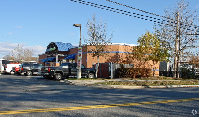
Property Detail
1009 Old Eastern Ave
15-1900007208
LT 17 PT 16 0.3030 A ESSEX
Storebuilding
Baltimore
BL
Maryland
B and X Area of moderate flood hazard, usually the area between the limits of the 100-year and 500-year floods.
17
2024
0.30 AC
2025
Baltimore County East
450503
Baltimore
2,960 SF
Baltimore-Columbia-Towson, MD
NEARBY LISTINGS FOR SALE OR LEASE
DEMOGRAPHICS near 1009 Old Eastern Ave
1 mile
3 mile
5 mile
2025 Total Population
16,357
87,531
230,370
2030 Population
16,376
87,783
229,877
Pop Growth 2025-2030
+ 0.12%
+ 0.29%
(0.21%)
Average Age
41
40
40
2025 Total Households
6,406
33,995
88,933
HH Growth 2025-2030
+ 0.09%
+ 0.36%
(0.21%)
Median Household Inc
$66,041
$67,586
$69,346
Avg Household Size
2.50
2.50
2.50
2025 Avg HH Vehicles
2.00
2.00
2.00
Median Home Value
$250,193
$263,436
$254,792
Median Year Built
1955
1966
1962
Nearby Places
Map Layers
Map Styles
 Street
 Aerial
Transit
 Traffic
 Biking
Places
Listings with unknown addresses are not visible on the map
- Restaurants
- Banks
- Shops
- Fitness
- Groceries
PUBLIC TRANSPORTATION
COMMUTER RAIL
Drive
Walk
Distance
7 min
3.1 mi
Penn Station (Penn Line - Maryland Area Regional Commuter Trains (The MARC))
Drive
Walk
Distance
Penn Station (Penn Line - Maryland Area Regional Commuter Trains (The MARC))
23 min
9.4 mi
AIRPORT
Baltimore/Washington International Thurgood Marshall
Drive
Walk
Distance
Baltimore/Washington International Thurgood Marshall
34 min
19.2 mi
Freight Ports
Port of Baltimore
Drive
Walk
Distance
Port of Baltimore
22 min
11.8 mi
Nearby Properties
Address
Land Use
TOTAL SIZE
Lot Size
Zoning
Address
Land Use
TOTAL SIZE
Lot Size
Zoning
159,728 SF
0.02 AC
MH
Address
Land Use
TOTAL SIZE
Lot Size
Zoning
119,200 SF
57.12 AC
Address
Land Use
TOTAL SIZE
Lot Size
Zoning
560,700 SF
25.77 AC
Address
Land Use
TOTAL SIZE
Lot Size
Zoning
85,474 SF
22.22 AC
Address
Land Use
TOTAL SIZE
Lot Size
Zoning
21.74 AC
DR16
Address
Land Use
TOTAL SIZE
Lot Size
Zoning
1,062,672 SF
70.27 AC
MHIM
Address
Land Use
TOTAL SIZE
Lot Size
Zoning
15.40 AC
DR16
Address
Land Use
TOTAL SIZE
Lot Size
Zoning
507,600 SF
21.36 AC
MHIM
Address
Land Use
TOTAL SIZE
Lot Size
Zoning
105,384 SF
15.41 AC
Address
Land Use
TOTAL SIZE
Lot Size
Zoning
718,098 SF
83.20 AC
MH-IM
Address
Land Use
TOTAL SIZE
Lot Size
Zoning
14.28 AC
DR16
Address
Land Use
TOTAL SIZE
Lot Size
Zoning
271,370 SF
20.11 AC
BM
Address
Land Use
TOTAL SIZE
Lot Size
Zoning
117,170 SF
7.84 AC
BM
Address
Land Use
TOTAL SIZE
Lot Size
Zoning
13.72 AC
DR16
Address
Land Use
TOTAL SIZE
Lot Size
Zoning
253,081 SF
42.21 AC
DR5.5
Address
Land Use
TOTAL SIZE
Lot Size
Zoning
300,400 SF
31.60 AC
ML-IM
Address
Land Use
TOTAL SIZE
Lot Size
Zoning
135,931 SF
21.65 AC
DR5.5
Address
Land Use
TOTAL SIZE
Lot Size
Zoning
192 SF
11.09 AC
Address
Land Use
TOTAL SIZE
Lot Size
Zoning
23.40 AC
DR16
Address
Land Use
TOTAL SIZE
Lot Size
Zoning
97,878 SF
12.45 AC
DR5.5
Address
Land Use
TOTAL SIZE
Lot Size
Zoning
158,131 SF
13.02 AC
BM
Address
Land Use
TOTAL SIZE
Lot Size
Zoning
20.13 AC
DR16
Address
Land Use
TOTAL SIZE
Lot Size
Zoning
14.30 AC
DR16
Address
Land Use
TOTAL SIZE
Lot Size
Zoning
28,963 SF
60.65 AC
BM-CT
Address
Land Use
TOTAL SIZE
Lot Size
Zoning
19 AC
DR16
Address
Land Use
TOTAL SIZE
Lot Size
Zoning
24.95 AC
DR16
Address
Land Use
TOTAL SIZE
Lot Size
Zoning
12.47 AC
DR16
Address
Land Use
TOTAL SIZE
Lot Size
Zoning
126,096 SF
14.68 AC
DR105
Address
Land Use
TOTAL SIZE
Lot Size
Zoning
10.27 AC
DR16
Address
Land Use
TOTAL SIZE
Lot Size
Zoning
81,300 SF
3.92 AC
The World's #1 Commercial Real Estate Marketplace
Connect with us
© 2026 CoStar Group
The information above has been obtained from sources believed reliable. While we do not doubt its accuracy we have not verified it and make no guarantee, warranty or representation about it. It is your responsibility to independently confirm its accuracy and completeness. Any projections, opinions, assumptions, or estimates used are for example only and do not represent the current or future performance of the property. The value of this transaction to you depends on tax and other factors which should be evaluated by your tax, financial, and legal advisors. You and your advisors should conduct a careful, independent investigation of the property to determine to your satisfaction the suitability of the property for your needs.