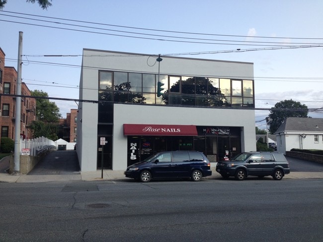
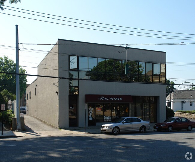
Property Record
1009 W Boston Post Rd, Mamaroneck, NY 10543

NEARBY LISTINGS FOR SALE OR LEASE
Property Detail
1009 W Boston Post Rd
Commercialofficeresidentialmixeduse
Westchester
X
New York
36119C0353F
0.24 AC
2025
Southeast
2024
Westchester/So Connecticut
007200
New York-Jersey City-White Plains, NY-NJ
9,282 SF
3203-009-000-00021-000-0158
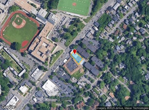
DEMOGRAPHICS near 1009 W Boston Post Rd
1 Mile
3 Mile
5 Mile
2024 Total Population
17,493
94,118
253,266
2029 Population
17,162
92,422
248,540
Pop Growth 2024-2029
(1.89%)
(1.80%)
(1.87%)
Average Age
41
41
41
2024 Total Households
6,474
33,232
91,243
HH Growth 2024-2029
(2.01%)
(1.79%)
(1.88%)
Median Household Inc
$148,104
$139,507
$136,177
Avg Household Size
2.60
2.70
2.70
2024 Avg HH Vehicles
2.00
2.00
2.00
Median Home Value
$843,637
$826,160
$777,814
Median Year Built
1951
1953
1951
Nearby Places
- Restaurants
- Banks
- Shops
- Fitness
- Groceries
PUBLIC TRANSPORTATION
COMMUTER RAIL
Mamaroneck Station (New Haven Line - Metro-North Commuter Railroad Company (Metro-North))
DRIVE
WALK
Distance
Mamaroneck Station (New Haven Line - Metro-North Commuter Railroad Company (Metro-North))
2 min
1.2 mi
Larchmont Station (New Haven Line - Metro-North Commuter Railroad Company (Metro-North))
DRIVE
WALK
Distance
Larchmont Station (New Haven Line - Metro-North Commuter Railroad Company (Metro-North))
4 min
1.5 mi
AIRPORT
Westchester County
DRIVE
WALK
Distance
Westchester County
21 min
12.5 mi
LaGuardia
DRIVE
WALK
Distance
LaGuardia
31 min
17.8 mi
John F Kennedy International
DRIVE
WALK
Distance
John F Kennedy International
40 min
25.3 mi
Freight Ports
NY - Red Hook Container Terminal
DRIVE
WALK
Distance
NY - Red Hook Container Terminal
47 min
28.3 mi
SALE & LEASE HISTORY
LISTING DATE
SALE/LEASE

Sep 23, 2016
For Sale
Oct 20, 2016
For Lease
Oct 20, 2016
For Sale
Jun 29, 2023
For Lease
Nearby Properties
Address
Land Use
TOTAL SIZE
Lot Size
Zoning
Address
Land Use
TOTAL SIZE
Lot Size
Zoning
413,946 SF
20.27 AC
Address
Land Use
TOTAL SIZE
Lot Size
Zoning
Address
Land Use
TOTAL SIZE
Lot Size
Zoning
Address
Land Use
TOTAL SIZE
Lot Size
Zoning
Address
Land Use
TOTAL SIZE
Lot Size
Zoning
125,010 SF
4.02 AC
Address
Land Use
TOTAL SIZE
Lot Size
Zoning
21.33 AC
Address
Land Use
TOTAL SIZE
Lot Size
Zoning
118,723 SF
3.45 AC
Address
Land Use
TOTAL SIZE
Lot Size
Zoning
82,895 SF
23.03 AC
A2
Address
Land Use
TOTAL SIZE
Lot Size
Zoning
188.31 AC
Address
Land Use
TOTAL SIZE
Lot Size
Zoning
67.51 AC
Address
Land Use
TOTAL SIZE
Lot Size
Zoning
1,056 SF
42.50 AC
PB
Address
Land Use
TOTAL SIZE
Lot Size
Zoning
5COMMUND
Address
Land Use
TOTAL SIZE
Lot Size
Zoning
11,951 SF
24.88 AC
Address
Land Use
TOTAL SIZE
Lot Size
Zoning
132,505 SF
5.53 AC
R6
Address
Land Use
TOTAL SIZE
Lot Size
Zoning
6.31 AC
R-5 SFR
Address
Land Use
TOTAL SIZE
Lot Size
Zoning
37,187 SF
2.62 AC
Address
Land Use
TOTAL SIZE
Lot Size
Zoning
Address
Land Use
TOTAL SIZE
Lot Size
Zoning
34,454 SF
216.47 AC
Address
Land Use
TOTAL SIZE
Lot Size
Zoning
99,502 SF
11.97 AC
Address
Land Use
TOTAL SIZE
Lot Size
Zoning
74,147 SF
2.76 AC
Address
Land Use
TOTAL SIZE
Lot Size
Zoning
48,240 SF
3.89 AC
Address
Land Use
TOTAL SIZE
Lot Size
Zoning
64,966 SF
4.92 AC
R20
Address
Land Use
TOTAL SIZE
Lot Size
Zoning
68,022 SF
4.31 AC
Address
Land Use
TOTAL SIZE
Lot Size
Zoning
76,258 SF
4.22 AC
R7.5
Address
Land Use
TOTAL SIZE
Lot Size
Zoning
92,960 SF
11.39 AC
Address
Land Use
TOTAL SIZE
Lot Size
Zoning
62,664 SF
3.50 AC
Address
Land Use
TOTAL SIZE
Lot Size
Zoning
93,226 SF
0.82 AC
RM2
Address
Land Use
TOTAL SIZE
Lot Size
Zoning
52,138 SF
3.24 AC
R6
Address
Land Use
TOTAL SIZE
Lot Size
Zoning
24,668 SF
11.17 AC
Address
Land Use
TOTAL SIZE
Lot Size
Zoning
28,500 SF
5.32 AC
R-20 SFR
The World's #1 Commercial Real Estate Marketplace
Connect with us
© 2025 CoStar Group
The information above has been obtained from sources believed reliable. While we do not doubt its accuracy we have not verified it and make no guarantee, warranty or representation about it. It is your responsibility to independently confirm its accuracy and completeness. Any projections, opinions, assumptions, or estimates used are for example only and do not represent the current or future performance of the property. The value of this transaction to you depends on tax and other factors which should be evaluated by your tax, financial, and legal advisors. You and your advisors should conduct a careful, independent investigation of the property to determine to your satisfaction the suitability of the property for your needs.