Property Record
10092 Belair Rd, Kingsville, MD 21087


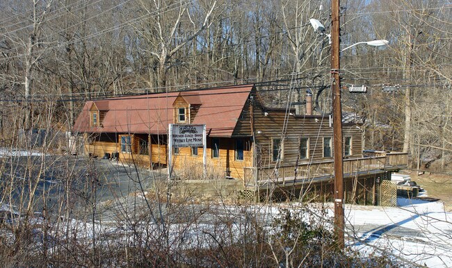
Property Detail
10092 Belair Rd
11-1102069310
1.818 AC
Bartavern
BALTIMORE
BL
Maryland
B and X Area of moderate flood hazard, usually the area between the limits of the 100-year and 500-year floods.
1.81 AC
2024
Baltimore County East
2025
Baltimore
411406
Baltimore-Columbia-Towson, MD
2,964 SF
NEARBY LISTINGS FOR SALE OR LEASE
DEMOGRAPHICS near 10092 Belair Rd
1 mile
3 mile
5 mile
2025 Total Population
2,558
40,745
106,435
2030 Population
2,620
41,031
106,930
Pop Growth 2025-2030
+ 2.42%
+ 0.70%
+ 0.47%
Average Age
45
43
42
2025 Total Households
946
15,002
41,321
HH Growth 2025-2030
+ 2.54%
+ 0.65%
+ 0.37%
Median Household Inc
$122,565
$118,841
$106,554
Avg Household Size
2.60
2.60
2.50
2025 Avg HH Vehicles
2.00
2.00
2.00
Median Home Value
$464,215
$406,463
$373,890
Median Year Built
1991
1987
1983
Nearby Places
Map Layers
Map Styles
 Street
 Aerial
Layers
 Traffic
 Biking
Places
Listings with unknown addresses are not visible on the map
- Restaurants
- Banks
- Shops
- Fitness
- Groceries
PUBLIC TRANSPORTATION
COMMUTER RAIL
Drive
Walk
Distance
18 min
9.4 mi
AIRPORT
Baltimore/Washington International Thurgood Marshall
Drive
Walk
Distance
Baltimore/Washington International Thurgood Marshall
42 min
26.7 mi
Freight Ports
Port of Baltimore
Drive
Walk
Distance
Port of Baltimore
32 min
20.2 mi
Nearby Properties
Address
Land Use
TOTAL SIZE
Lot Size
Zoning
Address
Land Use
TOTAL SIZE
Lot Size
Zoning
214,738 SF
5.92 AC
Address
Land Use
TOTAL SIZE
Lot Size
Zoning
240,121 SF
9.97 AC
Address
Land Use
TOTAL SIZE
Lot Size
Zoning
225,070 SF
20.65 AC
Address
Land Use
TOTAL SIZE
Lot Size
Zoning
239,798 SF
11.90 AC
Address
Land Use
TOTAL SIZE
Lot Size
Zoning
222,711 SF
39.21 AC
DR55
Address
Land Use
TOTAL SIZE
Lot Size
Zoning
7.72 AC
DR5.5
Address
Land Use
TOTAL SIZE
Lot Size
Zoning
64,480 SF
20.43 AC
Address
Land Use
TOTAL SIZE
Lot Size
Zoning
7.85 AC
DR5.5
Address
Land Use
TOTAL SIZE
Lot Size
Zoning
13,708 SF
15.67 AC
BLCCC
Address
Land Use
TOTAL SIZE
Lot Size
Zoning
100,725 SF
6.30 AC
BL
Address
Land Use
TOTAL SIZE
Lot Size
Zoning
10.88 AC
DR16
Address
Land Use
TOTAL SIZE
Lot Size
Zoning
69,744 SF
9.19 AC
BL-CS
Address
Land Use
TOTAL SIZE
Lot Size
Zoning
62,860 SF
26.96 AC
Address
Land Use
TOTAL SIZE
Lot Size
Zoning
60,145 SF
7.10 AC
BM
Address
Land Use
TOTAL SIZE
Lot Size
Zoning
35,170 SF
5.50 AC
BM
Address
Land Use
TOTAL SIZE
Lot Size
Zoning
49,704 SF
12.60 AC
Address
Land Use
TOTAL SIZE
Lot Size
Zoning
45,034 SF
17.95 AC
Address
Land Use
TOTAL SIZE
Lot Size
Zoning
5.47 AC
DR16
Address
Land Use
TOTAL SIZE
Lot Size
Zoning
44,297 SF
2.74 AC
Address
Land Use
TOTAL SIZE
Lot Size
Zoning
6.32 AC
DR16
Address
Land Use
TOTAL SIZE
Lot Size
Zoning
58,491 SF
5.65 AC
BL
Address
Land Use
TOTAL SIZE
Lot Size
Zoning
25,196 SF
4.20 AC
BM
Address
Land Use
TOTAL SIZE
Lot Size
Zoning
49,069 SF
6.29 AC
Address
Land Use
TOTAL SIZE
Lot Size
Zoning
59,132 SF
5.61 AC
BL
Address
Land Use
TOTAL SIZE
Lot Size
Zoning
55,669 SF
6.30 AC
DR5.5
Address
Land Use
TOTAL SIZE
Lot Size
Zoning
53,500 SF
13 AC
RC5
Address
Land Use
TOTAL SIZE
Lot Size
Zoning
1.38 AC
Address
Land Use
TOTAL SIZE
Lot Size
Zoning
114,969 SF
12.72 AC
Address
Land Use
TOTAL SIZE
Lot Size
Zoning
25,704 SF
6.77 AC
Address
Land Use
TOTAL SIZE
Lot Size
Zoning
52,484 SF
15.21 AC
ML
The World's #1 Commercial Real Estate Marketplace
Connect with us
© 2026 CoStar Group
The information above has been obtained from sources believed reliable. While we do not doubt its accuracy we have not verified it and make no guarantee, warranty or representation about it. It is your responsibility to independently confirm its accuracy and completeness. Any projections, opinions, assumptions, or estimates used are for example only and do not represent the current or future performance of the property. The value of this transaction to you depends on tax and other factors which should be evaluated by your tax, financial, and legal advisors. You and your advisors should conduct a careful, independent investigation of the property to determine to your satisfaction the suitability of the property for your needs.