Property Record
1322 Baldwin Hill Rd, Gales Ferry, CT 06335
NEARBY LISTINGS FOR SALE OR LEASE
Property Detail
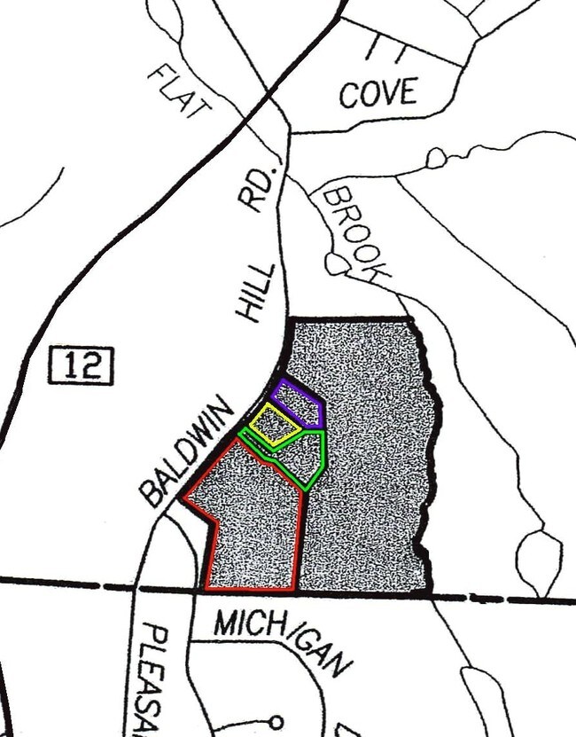
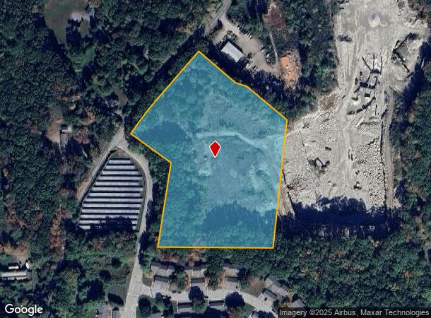
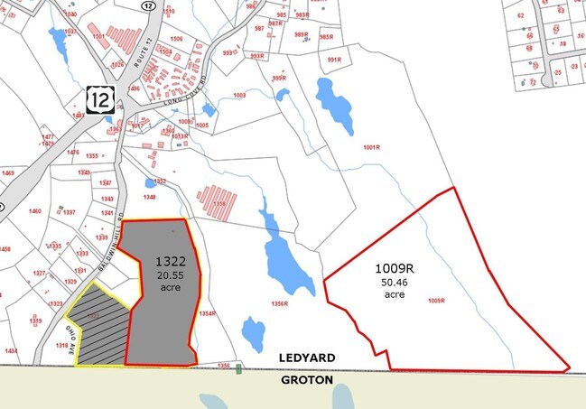
1322 Baldwin Hill Rd
LEDY-000134-000140-001322
New London
Industrialacreage
Connecticut
X
1322
09011C0364J
8.25 AC
2025
New London
2025
Hartford
701200
Norwich-New London, CT
DEMOGRAPHICS near 1322 Baldwin Hill Rd
1 Mile
3 Mile
5 Mile
2024 Total Population
1,869
21,798
74,506
2029 Population
1,889
21,762
74,149
Pop Growth 2024-2029
+ 1.07%
(0.17%)
(0.48%)
Average Age
36
35
39
2024 Total Households
733
7,325
29,093
HH Growth 2024-2029
+ 1.09%
(0.10%)
(0.53%)
Median Household Inc
$77,925
$78,364
$68,355
Avg Household Size
2.50
2.50
2.30
2024 Avg HH Vehicles
2.00
2.00
2.00
Median Home Value
$292,580
$258,054
$243,849
Median Year Built
1978
1973
1968
Nearby Places
Map Layers
Map Styles
 Street
 Aerial
- Restaurants
- Banks
- Shops
- Fitness
- Groceries
PUBLIC TRANSPORTATION
COMMUTER RAIL
New London (Shore Line East - Shore Line East)
DRIVE
WALK
Distance
New London (Shore Line East - Shore Line East)
11 min
6.0 mi
Mystic Amtrak (Northeast Regional - Amtrak)
DRIVE
WALK
Distance
Mystic Amtrak (Northeast Regional - Amtrak)
18 min
9.6 mi
Freight Ports
Port of Davisville, RI
DRIVE
WALK
Distance
Port of Davisville, RI
71 min
52.0 mi
SALE & LEASE HISTORY
LISTING DATE
SALE/LEASE

Sep 24, 2016
For Sale
Nearby Properties
Address
Land Use
TOTAL SIZE
Lot Size
Zoning
Address
Land Use
TOTAL SIZE
Lot Size
Zoning
8,712 SF
RU-20
Address
Land Use
TOTAL SIZE
Lot Size
Zoning
251.73 AC
RM40
Address
Land Use
TOTAL SIZE
Lot Size
Zoning
54.80 AC
INST
Address
Land Use
TOTAL SIZE
Lot Size
Zoning
13.68 AC
CR
Address
Land Use
TOTAL SIZE
Lot Size
Zoning
21.84 AC
C-2
Address
Land Use
TOTAL SIZE
Lot Size
Zoning
73,446 SF
69.87 AC
R-12
Address
Land Use
TOTAL SIZE
Lot Size
Zoning
69,658 SF
16.31 AC
VR-10
Address
Land Use
TOTAL SIZE
Lot Size
Zoning
204,329 SF
17.92 AC
CR
Address
Land Use
TOTAL SIZE
Lot Size
Zoning
33.50 AC
R-12
Address
Land Use
TOTAL SIZE
Lot Size
Zoning
52,065 SF
12.40 AC
CN
Address
Land Use
TOTAL SIZE
Lot Size
Zoning
18.76 AC
INST
Address
Land Use
TOTAL SIZE
Lot Size
Zoning
7,112 SF
R-12
Address
Land Use
TOTAL SIZE
Lot Size
Zoning
64,040 SF
4.57 AC
OS
Address
Land Use
TOTAL SIZE
Lot Size
Zoning
56,961 SF
3.43 AC
RM
Address
Land Use
TOTAL SIZE
Lot Size
Zoning
50,876 SF
57.34 AC
R-12
Address
Land Use
TOTAL SIZE
Lot Size
Zoning
7.31 AC
R-1
Address
Land Use
TOTAL SIZE
Lot Size
Zoning
83,470 SF
14.67 AC
CR
Address
Land Use
TOTAL SIZE
Lot Size
Zoning
5.92 AC
C-1
Address
Land Use
TOTAL SIZE
Lot Size
Zoning
90,170 SF
5.03 AC
CR
Address
Land Use
TOTAL SIZE
Lot Size
Zoning
2,980 SF
RU-20
Address
Land Use
TOTAL SIZE
Lot Size
Zoning
110,610 SF
18.42 AC
CR
Address
Land Use
TOTAL SIZE
Lot Size
Zoning
63,763 SF
1.97 AC
INST
Address
Land Use
TOTAL SIZE
Lot Size
Zoning
46,883 SF
7.82 AC
CR
Address
Land Use
TOTAL SIZE
Lot Size
Zoning
5,664 SF
20 AC
RM
Address
Land Use
TOTAL SIZE
Lot Size
Zoning
2.05 AC
RU-20
Address
Land Use
TOTAL SIZE
Lot Size
Zoning
2.32 AC
R-3
Address
Land Use
TOTAL SIZE
Lot Size
Zoning
4.52 AC
R-1
Address
Land Use
TOTAL SIZE
Lot Size
Zoning
2,400 SF
7.13 AC
CR
Address
Land Use
TOTAL SIZE
Lot Size
Zoning
6.54 AC
GOV
Address
Land Use
TOTAL SIZE
Lot Size
Zoning
34,436 SF
19.52 AC
IND
The World's #1 Commercial Real Estate Marketplace
Connect with us
© 2025 CoStar Group
The information above has been obtained from sources believed reliable. While we do not doubt its accuracy we have not verified it and make no guarantee, warranty or representation about it. It is your responsibility to independently confirm its accuracy and completeness. Any projections, opinions, assumptions, or estimates used are for example only and do not represent the current or future performance of the property. The value of this transaction to you depends on tax and other factors which should be evaluated by your tax, financial, and legal advisors. You and your advisors should conduct a careful, independent investigation of the property to determine to your satisfaction the suitability of the property for your needs.